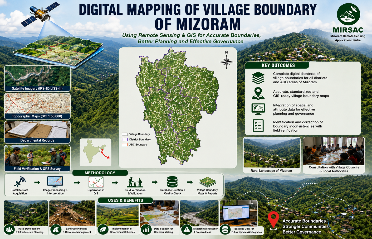
Digital Mapping of Village Boundary of Mizoram
The Digital Mapping of Village Boundary of Mizoram using Remote Sensing and GIS was undertaken as an in-house project by the Mizoram Remote Sensing Application Centre (MRSAC) under the Science & Technology, Planning Department, Government of Mizoram. The project was developed to address the need for accurate and standardized village boundaries for micro-level planning, administrative management and equitable implementation of development programmes across the State. The study covered the entire geographical area of Mizoram, including all eight districts and the village jurisdictions administered through the State Government and the Lai, Mara and Chakma Autonomous District Councils. The principal objective was to prepare a comprehensive digital village-boundary database that could be maintained, updated and used by MRSAC and other government departments for future planning and administrative purposes. The project integrated IRS-1D LISS-III satellite imagery, Survey of India topographic sheets at 1:50,000 scale, departmental land records, field observations and local administrative information. Satellite data were geometrically corrected and interpreted using ERDAS Imagine, while digitization, database preparation and spatial analysis were undertaken in ARC/INFO GIS. Field verification, handheld GPS observations and consultations with Village Councils and local communities were used to resolve doubtful or inaccessible boundary sections. Institutional collaboration formed an important component of the project. The Land Revenue & Settlement Department, Local Administration Department, local administrative offices and the three Autonomous District Councils provided preliminary records and jurisdictional information required for validation. Existing departmental maps were compared with satellite-derived information, enabling anomalies and inconsistencies in village boundaries to be identified and corrected. The resulting digital maps and associated spatial and non-spatial database provide a reliable reference for village-level administration and development planning. The outputs can support rural infrastructure development, land-use planning, resource allocation, census and socio-economic analysis, watershed and natural resource management, implementation of area-specific schemes and coordination among government departments. By presenting village locations, extents and administrative relationships in an accessible digital format, the project created an important baseline for decentralized planning in Mizoram. The maps and report remain valuable to planners, administrators, researchers, development agencies and user departments requiring accurate village-level spatial information for evidence-based decision-making. Summarize Metadata Mapping Scale: 1:50,000 Satellite data & Year: IRS 1D – LISS III (2006) Study area: Mizoram Collaborating/Funding Agency: Science, Technology & Environment Wing, Planning Department, Government of Mizoram No. of Report(s) published: 1 Project Period: 2006 - 2008