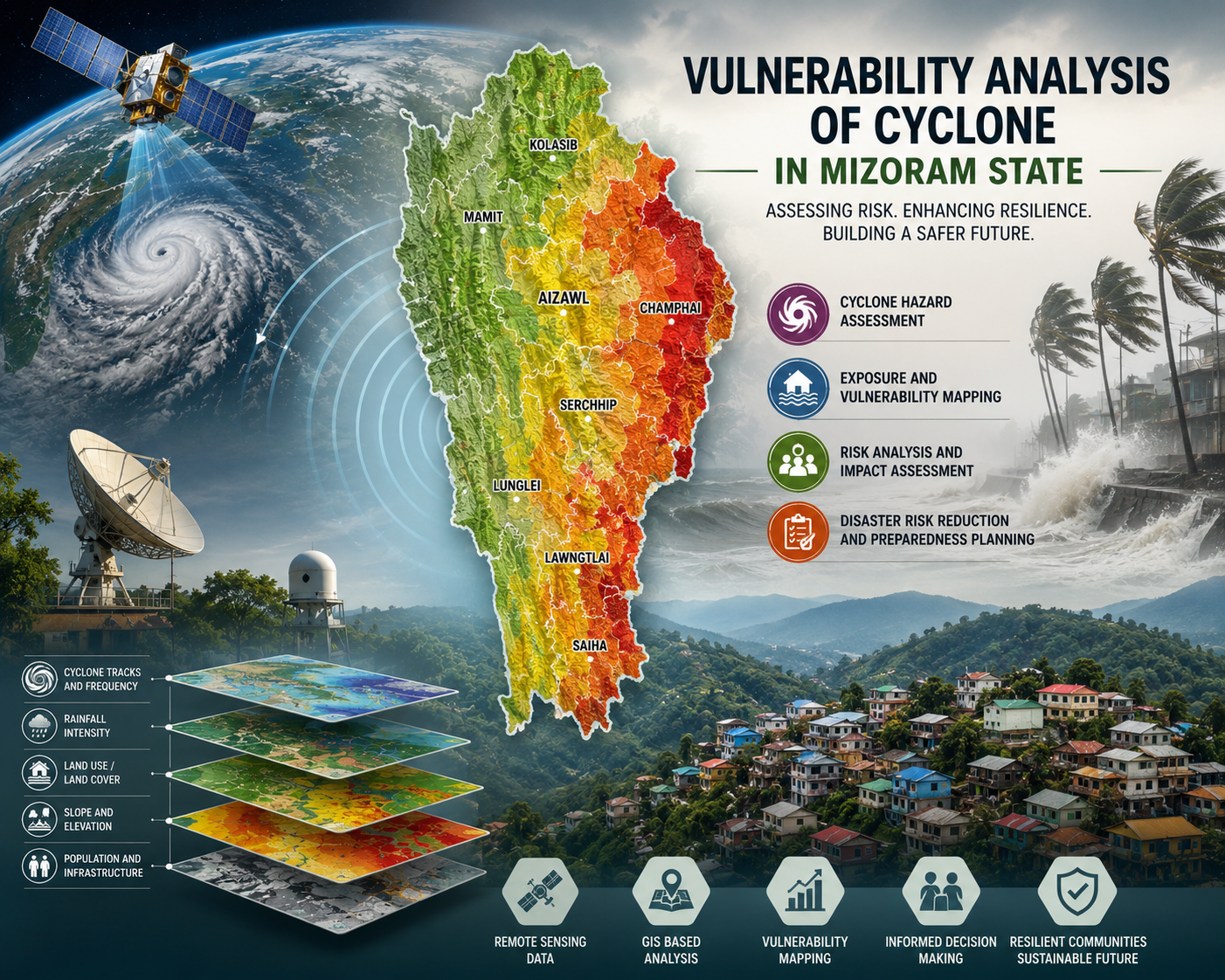
Vulnerability analysis of cyclone in Mizoram
The Vulnerability Analysis of Cyclone in Mizoram State is a key initiative by the State Remote Sensing Centre (SRSC), under the Science, Technology & ...
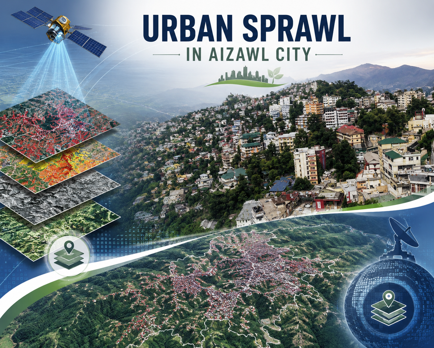
Urban sprawl study of Aizawl city
The Urban Sprawl Study of Aizawl City represents a pivotal collaboration between the North Eastern Space Applications Centre (NESAC), Department of Sp...

Wastelands of Mizoram
The “Wastelands of Mizoram” project was undertaken as part of a nationwide initiative of the Department of Space, Government of India, coordinated thr...
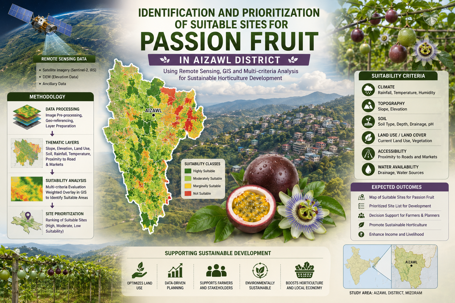
Identification and prioritization of suitable sites for passion fruit using Remote Sensing and GIS technique in Aizawl district, Mizoram state
The Identification and Prioritization of Suitable Sites for Passion Fruit using Remote Sensing and GIS Techniques in Aizawl District, Mizoram State wa...
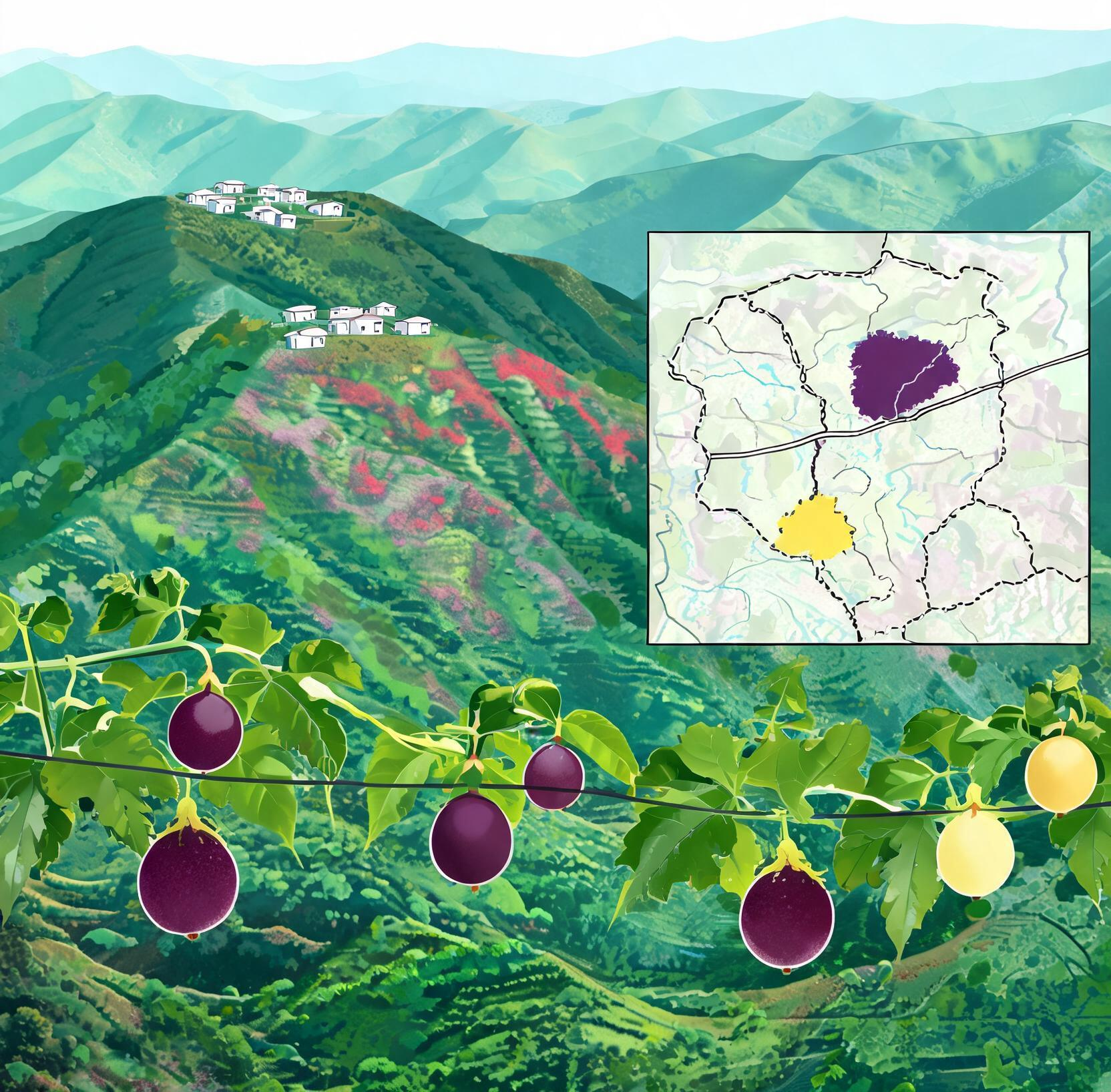
Village level passion fruit site suitability maps of Champhai and Kolasib horticultural circles, Mizoram state
The “Village Level Passion Fruit Site Suitability Maps of Champhai and Kolasib Horticultural Circles, Mizoram State” project is a collaborative effort...