Project Information
| Code | MIRSAC-PRJ-14 |
|---|---|
| Category | Infrastructure |
| Time Period | January 2003 |
| Funding Agency | Mizoram State Remote Sensing Application Centre (MSRSC) |
Road Network Mapping of Mizoram
Road
Infrastructure
Road Network
Project Description
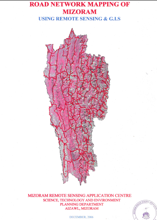
The Road Network Mapping of Mizoram using Remote Sensing and GIS was an in-house geospatial mapping project undertaken by the Mizoram Remote Sensing Application Centre (MSRSC) under the Science, Technology & Environment Wing, Planning Department, Government of Mizoram. Executed during 2003 and subsequently compiled into a comprehensive report, the project was initiated in recognition of the importance of an accurate and systematic inventory of the existing road infrastructure for transportation planning, infrastructure development, and the overall socio-economic growth of Mizoram. The study was undertaken at a time when reliable, spatially referenced information on the state's road network was essential for planning the improvement, expansion, and construction of roads across its challenging mountainous terrain.
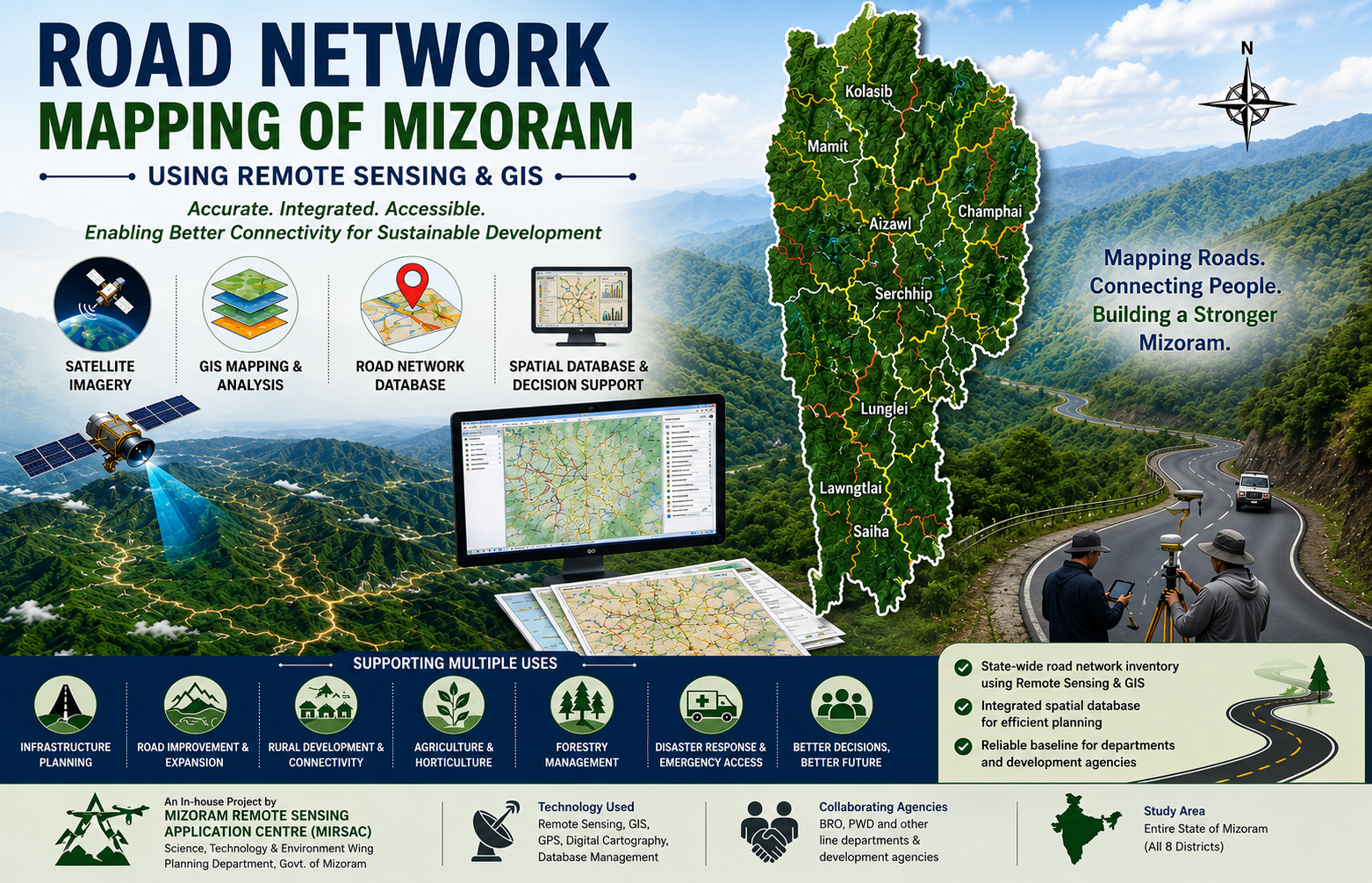
The principal objective of the project was to map and classify the existing road network of Mizoram, convert the mapped information into a digital GIS database, and make the resulting spatial information readily available to user departments. The project covered the entire geographical area of Mizoram, encompassing all eight districts—Kolasib, Mamit, Aizawl, Champhai, Serchhip, Lunglei, Lawngtlai, and Saiha. The state's rugged topography, narrow ridges, steep slopes, deeply dissected valleys, and international borders with Bangladesh and Myanmar make transportation infrastructure a particularly important component of regional development and connectivity planning.
The project employed IRS-1D LISS-III and Panchromatic satellite imagery acquired in 2003, procured from the NRSA Data Centre, Hyderabad, as the primary source for identifying and mapping the road network. Satellite-derived information was supplemented by Survey of India topographic sheets, Census data, administrative and other collateral information, as well as ground verification and field observations undertaken to assess the accuracy of mapped road features. Standard Remote Sensing and GIS techniques were applied to interpret satellite imagery, delineate and classify road categories, digitize the mapped features, and integrate them into a spatial database. This approach provided a systematic and consistent means of generating road network information for the state, complementing conventional ground-based mapping methods.
The project involved and provided information relevant to several agencies responsible for transportation and developmental infrastructure in Mizoram. These included the Border Roads Organisation (BRO), responsible for major strategic roads and National Highway infrastructure, the Public Works Department (PWD) for State Highways and district roads, and departments and agencies such as Rural Development, DRDA, Agriculture, Horticulture, and Forest, which are also involved in the development of minor roads and link roads. By providing a common spatial representation of the existing road network, the project helps establish a shared baseline for inter-departmental planning and coordination.
The resulting road network maps and GIS database provide valuable baseline information for road improvement, expansion, connectivity assessment, infrastructure planning, and identification of areas requiring better transportation access. The datasets can also support planning in agriculture, horticulture, forestry, rural development, emergency response, and other sectors where accessibility and transportation connectivity are critical. Overall, the project demonstrated the practical application of satellite remote sensing and GIS for infrastructure inventory and planning and established an important geospatial reference for understanding Mizoram's transportation network and supporting future road development initiatives.
Summarize Metadata
Mapping Scale: 1:50,000
Satellite data & Year: IRS 1D LISS III & PAN (2003)
Study area: Mizoram
Collaborating/Funding Agency: Mizoram Remote Sensing Application Centre
No. of Report(s) published: 1
Project Period: 2003 – 2006
The principal objective of the project was to map and classify the existing road network of Mizoram, convert the mapped information into a digital GIS database, and make the resulting spatial information readily available to user departments. The project covered the entire geographical area of Mizoram, encompassing all eight districts—Kolasib, Mamit, Aizawl, Champhai, Serchhip, Lunglei, Lawngtlai, and Saiha. The state's rugged topography, narrow ridges, steep slopes, deeply dissected valleys, and international borders with Bangladesh and Myanmar make transportation infrastructure a particularly important component of regional development and connectivity planning.
The project employed IRS-1D LISS-III and Panchromatic satellite imagery acquired in 2003, procured from the NRSA Data Centre, Hyderabad, as the primary source for identifying and mapping the road network. Satellite-derived information was supplemented by Survey of India topographic sheets, Census data, administrative and other collateral information, as well as ground verification and field observations undertaken to assess the accuracy of mapped road features. Standard Remote Sensing and GIS techniques were applied to interpret satellite imagery, delineate and classify road categories, digitize the mapped features, and integrate them into a spatial database. This approach provided a systematic and consistent means of generating road network information for the state, complementing conventional ground-based mapping methods.
The project involved and provided information relevant to several agencies responsible for transportation and developmental infrastructure in Mizoram. These included the Border Roads Organisation (BRO), responsible for major strategic roads and National Highway infrastructure, the Public Works Department (PWD) for State Highways and district roads, and departments and agencies such as Rural Development, DRDA, Agriculture, Horticulture, and Forest, which are also involved in the development of minor roads and link roads. By providing a common spatial representation of the existing road network, the project helps establish a shared baseline for inter-departmental planning and coordination.
The resulting road network maps and GIS database provide valuable baseline information for road improvement, expansion, connectivity assessment, infrastructure planning, and identification of areas requiring better transportation access. The datasets can also support planning in agriculture, horticulture, forestry, rural development, emergency response, and other sectors where accessibility and transportation connectivity are critical. Overall, the project demonstrated the practical application of satellite remote sensing and GIS for infrastructure inventory and planning and established an important geospatial reference for understanding Mizoram's transportation network and supporting future road development initiatives.
Summarize Metadata
Mapping Scale: 1:50,000
Satellite data & Year: IRS 1D LISS III & PAN (2003)
Study area: Mizoram
Collaborating/Funding Agency: Mizoram Remote Sensing Application Centre
No. of Report(s) published: 1
Project Period: 2003 – 2006
Related Publications
1