Project Information
| Code | MIRSAC-PRJ-19 |
|---|---|
| Category | Forestry & Environment |
| Time Period | March 2007 |
| Funding Agency | Environment & Forest Department, Government of Mizoram |
Mapping of Agriculture/Horticulture Potential areas within R.Tut Riverine Reserve Forest, Mamit District using Remote Sensing and GIS
Forests
Agriculture
Horticulture
Potential areas
RRF
Mamit district
R.Tut
Project Description
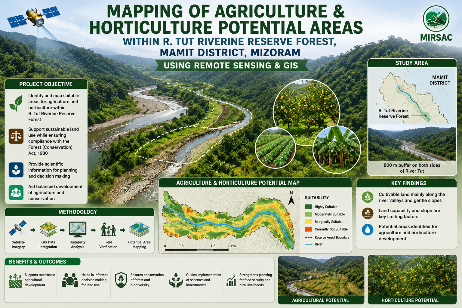
The project “Mapping of Agriculture and Horticulture Potential Areas within R. Tut Riverine Reserve Forest, Mamit District, Mizoram using Remote Sensing and GIS” was undertaken by the Mizoram Remote Sensing Application Centre (MRSAC) under the Science & Technology, Planning Department, Government of Mizoram, with sponsorship from the Environment and Forest Department, Government of Mizoram. The study was initiated following consultations with forest authorities to identify cultivable land within the legally protected riverine reserve while ensuring that any proposed diversion or utilization complies with the provisions of the Forest (Conservation) Act, 1980.
The study area covers the River Tut Riverine Reserve Forest in Mamit District, extending approximately 800 metres on both sides of the river. Mizoram’s rugged terrain offers limited scope for large-scale agriculture, making the low-lying valleys and riverbank areas especially important for crop development. The main objective was therefore to identify and spatially delineate land suitable for agriculture and horticulture and provide a scientific basis for evaluating future land-use proposals.
The project integrated satellite remote sensing, GIS analysis, Survey of India topographic maps, collateral information and field verification. Thematic datasets on land use and land cover, slope and land capability were generated and overlaid to identify potentially suitable areas. Inputs and field-level guidance were provided by the Environment and Forest Department, Mamit Forest Division and the district Agriculture authorities.
The resulting maps, sector-wise spatial database and accompanying report provide an important planning resource for forest administrators, agriculture and horticulture departments, district authorities and development agencies. They can support crop-development planning, land capability assessment, field verification, evaluation of forest-diversion proposals and identification of appropriate compensatory conservation measures. The project demonstrates how Remote Sensing and GIS can help balance agricultural development with forest protection by supplying objective, location-specific information for transparent and environmentally responsible decision-making.
Summarize Metadata
Mapping Scale: 1:50,000
Satellite data & Year: IRS 1D – LISS III (2006); Cartosat-1 (April & December, 2006)
Study area: Tut Riverine Reserve Forest, Mamit district
Collaborating/Funding Agency: Environment & Forest Department, Government of Mizoram
No. of Report(s) published: 1
Project Period: 2007 - 2008
The study area covers the River Tut Riverine Reserve Forest in Mamit District, extending approximately 800 metres on both sides of the river. Mizoram’s rugged terrain offers limited scope for large-scale agriculture, making the low-lying valleys and riverbank areas especially important for crop development. The main objective was therefore to identify and spatially delineate land suitable for agriculture and horticulture and provide a scientific basis for evaluating future land-use proposals.
The project integrated satellite remote sensing, GIS analysis, Survey of India topographic maps, collateral information and field verification. Thematic datasets on land use and land cover, slope and land capability were generated and overlaid to identify potentially suitable areas. Inputs and field-level guidance were provided by the Environment and Forest Department, Mamit Forest Division and the district Agriculture authorities.
The resulting maps, sector-wise spatial database and accompanying report provide an important planning resource for forest administrators, agriculture and horticulture departments, district authorities and development agencies. They can support crop-development planning, land capability assessment, field verification, evaluation of forest-diversion proposals and identification of appropriate compensatory conservation measures. The project demonstrates how Remote Sensing and GIS can help balance agricultural development with forest protection by supplying objective, location-specific information for transparent and environmentally responsible decision-making.
Summarize Metadata
Mapping Scale: 1:50,000
Satellite data & Year: IRS 1D – LISS III (2006); Cartosat-1 (April & December, 2006)
Study area: Tut Riverine Reserve Forest, Mamit district
Collaborating/Funding Agency: Environment & Forest Department, Government of Mizoram
No. of Report(s) published: 1
Project Period: 2007 - 2008