Project Information
| Code | MIRSAC-PRJ-23 |
|---|---|
| Category | Forestry & Environment |
| Time Period | November 2006 |
| Funding Agency | Environment & Forest Department, Government of Mizoram |
Mapping and Growing Stock Assessment of Bamboo in Mizoram
Bamboo
Growing stock
Mizoram
Bamboo flowering
Forests
Project Description
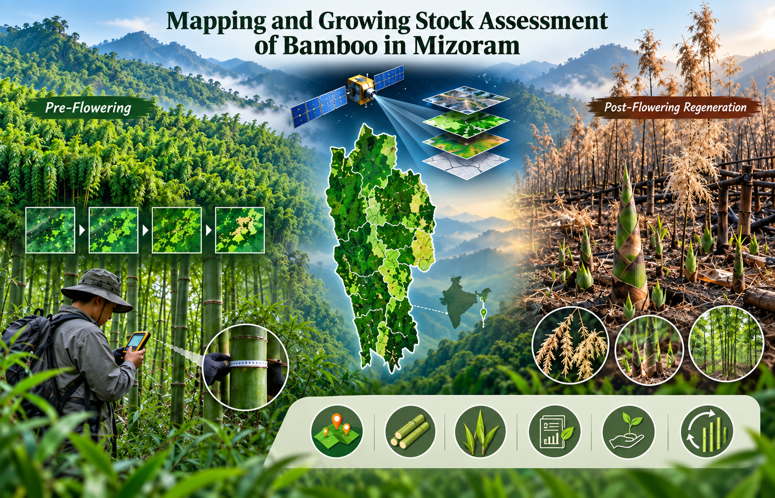
The Mapping and Growing Stock Assessment of Bamboo in Mizoram was undertaken by the Mizoram Remote Sensing Application Centre (MIRSAC) in collaboration with and under the sponsorship of the Environment & Forest Department, Government of Mizoram. The project was conceived to generate a reliable, spatially referenced assessment of Mizoram’s extensive bamboo resources and to support their sustainable management, particularly in the context of the State’s cyclical gregarious bamboo flowering, which reached its peak during 2006–2007.
The project was executed in two complementary phases. The first phase represented the pre-flowering period assessment, using a three-date satellite time series of IRS-1D LISS-III imagery from 2003, 2005 and 2006, together with PAN data, Survey of India topographic maps, existing forest-resource information and intensive field sampling. Remote Sensing and GIS techniques were used to delineate bamboo cover, classify it into Pure, Mixed and Young bamboo, and develop district-, watershed- and forest-division-wise information on area, culm density and growing stock.
The second phase, undertaken after the major flowering event, focused on post-flowering regeneration and future growing-stock assessment using 2008 IRS-1D LISS-III satellite imagery acquired from NRSC, Hyderabad. Regenerating bamboo areas were mapped and verified through systematic field sampling of young bamboo stands, and the observations were used to estimate the likely growing stock as the regenerated bamboo reaches maturity.
Together, the two phases provide an important temporal record of bamboo resources before and after the flowering cycle. The resulting bamboo maps, spatial databases, regeneration information and growing-stock estimates are valuable for the Environment & Forest Department, Bamboo Development agencies, planners, researchers, industries and rural development institutions. They support bamboo conservation, plantation planning, sustainable harvesting, raw-material assessment, forest management, industrial development and future monitoring of regeneration across Mizoram.
Summarize Metadata
Mapping Scale: 1:50,000
Satellite data & Year: IRS 1D LISS III (2003, 2005, 2006, 2008), IRS 1D PAN (2003).
Study area: Mizoram
Collaborating/Funding Agency: Environment & Forest Department, Government of Mizoram.
No. of Report(s) published: 2
Project Period: 2007 – 2009
The project was executed in two complementary phases. The first phase represented the pre-flowering period assessment, using a three-date satellite time series of IRS-1D LISS-III imagery from 2003, 2005 and 2006, together with PAN data, Survey of India topographic maps, existing forest-resource information and intensive field sampling. Remote Sensing and GIS techniques were used to delineate bamboo cover, classify it into Pure, Mixed and Young bamboo, and develop district-, watershed- and forest-division-wise information on area, culm density and growing stock.
The second phase, undertaken after the major flowering event, focused on post-flowering regeneration and future growing-stock assessment using 2008 IRS-1D LISS-III satellite imagery acquired from NRSC, Hyderabad. Regenerating bamboo areas were mapped and verified through systematic field sampling of young bamboo stands, and the observations were used to estimate the likely growing stock as the regenerated bamboo reaches maturity.
Together, the two phases provide an important temporal record of bamboo resources before and after the flowering cycle. The resulting bamboo maps, spatial databases, regeneration information and growing-stock estimates are valuable for the Environment & Forest Department, Bamboo Development agencies, planners, researchers, industries and rural development institutions. They support bamboo conservation, plantation planning, sustainable harvesting, raw-material assessment, forest management, industrial development and future monitoring of regeneration across Mizoram.
Summarize Metadata
Mapping Scale: 1:50,000
Satellite data & Year: IRS 1D LISS III (2003, 2005, 2006, 2008), IRS 1D PAN (2003).
Study area: Mizoram
Collaborating/Funding Agency: Environment & Forest Department, Government of Mizoram.
No. of Report(s) published: 2
Project Period: 2007 – 2009
.png)
.png)