Project Information
| Code | MIRSAC-PRJ-25 |
|---|---|
| Category | Geosciences & Disaster Management |
| Time Period | February 2007 |
| Funding Agency | Science, Technology & Environment Wing, Planning Department, Government of Mizoram |
Micro Landslide Hazard Zonation Mapping of Lunglei Town
Disaster management
Landslide
Hazard Zonation
Lunglei
Geology
Micro level
Project Description
The Micro Landslide Hazard Zonation Mapping of Lunglei Town was undertaken as an in-house project of the Mizoram Remote Sensing Application Centre (MIRSAC), Science & Technology, Planning Department, Government of Mizoram. The study was initiated in response to the recurrent landslide problems affecting Lunglei, where rapid urban expansion, road cutting, slope modification and construction activities interact with steep terrain, fragile geology and heavy monsoon rainfall. The project was intended to provide planners, government agencies, non-governmental organisations and the public with a scientifically derived basis for landslide-risk mitigation and safer future development.
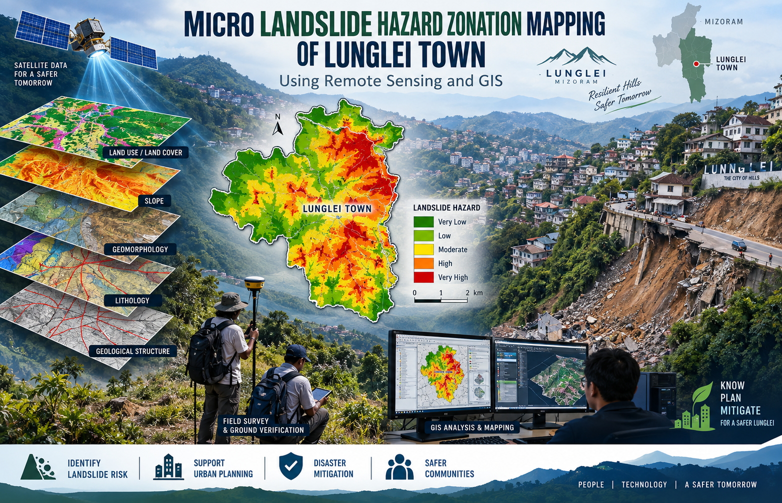
The study covered the 55.08 sq. km notified area of Lunglei Town, the second-largest settlement in Mizoram. Its principal objective was to prepare a micro-level landslide hazard zonation map by integrating key terrain and environmental parameters, including land use/land cover, slope, geomorphology, lithology and geological structure.
The project employed high-resolution QuickBird satellite imagery (0.8 m) as the primary spatial dataset, supplemented by IRS-P5 Cartosat-I stereo data (2.5 m), Survey of India topographic maps, ancillary information and field observations. Remote Sensing and GIS techniques were used to derive thematic layers, while Cartosat stereo data supported contour and slope generation. The hazard assessment followed a qualitative, expert-based approach adapted from NRSA methodology, with individual terrain parameters weighted according to their influence on landslide susceptibility.
The resulting thematic maps, landslide hazard zonation map and grid-wise outputs provide an important geospatial reference for disaster management, infrastructure planning, road development, building-site assessment, slope management and prioritization of mitigation measures. The report is particularly valuable for planning and engineering departments, local authorities, disaster-management agencies, researchers and development organisations seeking to identify relatively vulnerable terrain and incorporate landslide considerations into urban planning. It also establishes a useful baseline for more detailed field investigations and future monitoring of slope instability in Lunglei.
Summarize Metadata
Mapping Scale: 1:5,000
Satellite data & Year: Quickbird & Cartosat-1 (2007)
Study area: Lunglei Town
Collaborating/Funding Agency: Science, Technology & Environment Wing, Planning Department, Government of Mizoram
No. of Report(s) published: 1
Project Period: 2007 – 2009
Related Publications
1