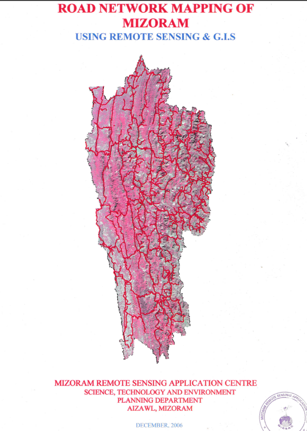
Road Network Mapping of Mizoram
The Road Network Mapping of Mizoram using Remote Sensing and GIS was an in-house geospatial mapping project undertaken by the Mizoram Remote Sensing Application Centre (MSRSC) under the Science, Technology & Environment Wing, Planning Department, Government of Mizoram, with funding support from the State Government. The project was initiated to establish a systematic, spatially referenced inventory of Mizoram's road infrastructure and to demonstrate the application of satellite remote sensing and Geographic Information System (GIS) technologies for transportation and developmental planning. The project covered the entire State of Mizoram, encompassing all eight districts and its extensive network of inter-state, inter-district, district, village, agricultural, horticultural, and other link roads. The final report was compiled and published in December 2006, based primarily on satellite data acquired during 2003.The principal objective was to map and classify different categories of roads using satellite data, digitize the mapped information, and prepare a comprehensive road network map and GIS database for use by government departments. The study employed IRS-1D LISS-III and Panchromatic satellite imagery, procured from the NRSA Data Centre, Hyderabad, supported by Survey of India topographic sheets, Census data, administrative information, departmental reports, and ground verification of major roads. The GIS database was structured to incorporate road types along with associated information on settlements and drainage, providing a spatial framework for analysing road connectivity in relation to other geographical features.The project mapped the road infrastructure within a State covering approximately 21,087 sq. km, extending between 21°58′20″ N and 24°35′00″ N latitude and 92°15′–93°20′ E longitude. Mizoram's challenging mountainous landscape and its 585-km international boundary with Bangladesh and Myanmar make road connectivity particularly important from economic, social, administrative, and strategic perspectives. The resulting maps provide a detailed spatial representation of the State's transportation infrastructure. The project mapped the principal inter-state corridors, including National Highway 54, National Highway 44A, National Highway 150, and National Highway 54B, which connect Mizoram with neighbouring states and form important routes for trade, administration, and movement of people and goods.The study recognizes the important roles of multiple agencies in developing Mizoram's road infrastructure. The Border Roads Organisation (BRO) is primarily responsible for major strategic and National Highway corridors, while the Public Works Department (PWD) undertakes State Highways and district roads. Other departments and agencies, including Rural Development, DRDA, Agriculture, Horticulture, and Forest, contribute to the development of minor, agricultural, horticultural, and village link roads. The mapping therefore provides a common spatial reference that can facilitate coordination among these institutions and support more integrated infrastructure planning.A key observation emerging from the mapping is the importance of agricultural and horticultural link roads, which provide connectivity between interior production areas and markets. However, the report also identifies areas where villages remain dependent on footpaths, unmetalled jeepable roads, or seasonally functional routes, with poor maintenance limiting accessibility during the rainy season. These findings highlight the value of the mapped database for identifying connectivity gaps and prioritizing road improvement and expansion.The resulting maps, digital spatial information, and report provide valuable baseline resources for transportation planning, road construction and maintenance, infrastructure prioritization, rural connectivity, agricultural and horticultural development, emergency response, disaster management, and regional planning. The road network data can also be integrated with other GIS layers such as settlements, terrain, land use, forests, and natural resources to support multi-sectoral decision-making. Overall, the project represents an important early application of Remote Sensing and GIS for statewide infrastructure inventory, establishing a standardized geospatial reference that can assist government departments, planners, researchers, and development agencies in understanding and improving road connectivity across Mizoram. Summarized MetadataMapping Scale: 1:50,000 Satellite data & Year: IRS 1D LISS III & PAN (2003) Thematic sub-category: Infrastructure, RoadCollaborating/Funding Agency: Mizoram Remote Sensing Application CentreReport Publication Month/Year: December, 2006