Project Information
| Code | MIRSAC-PRJ-13 |
|---|---|
| Category | Multi-Thematic |
| Time Period | January 1998 |
| Funding Agency | National Remote Sensing Centre (NRSA), Hyderabad |
National Natural Resources Information System (NRIS)
Natural resources
Spatial planning
NRIS
Decision Support System
Project Description
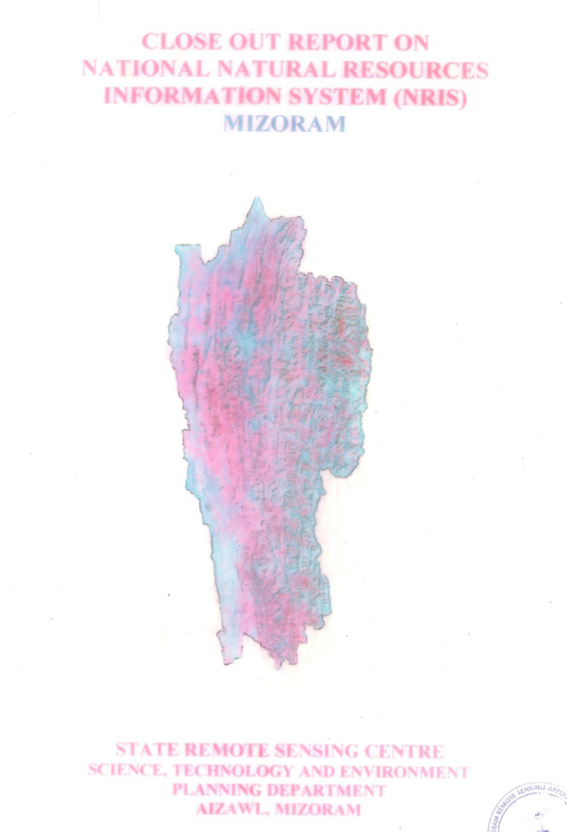
The National (Natural) Resources Information System (NRIS) for Mizoram was established as a strategic geospatial information initiative under the National Natural Resources Management System (NNRMS) of the Department of Space (DoS), Government of India, with implementation carried out by the Mizoram State Remote Sensing Centre (MSRSC) in collaboration with the State Planning Department and other resource management agencies. Initiated during 1996, it was conceived as part of India's national effort to integrate Remote Sensing, Geographic Information System (GIS), and spatial databases into the planning process, the project aimed to create a standardized and interoperable digital information system that supports evidence-based decision-making for sustainable natural resource management and regional development across Mizoram.
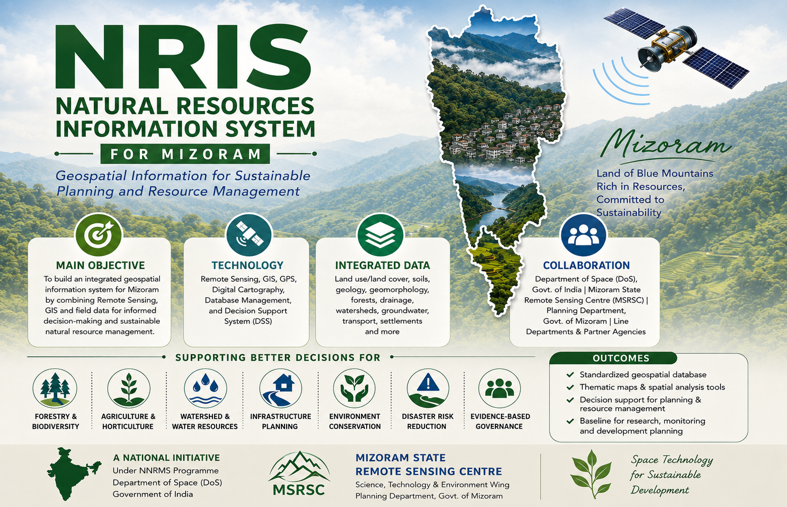
The principal objective of the project was to develop an integrated Natural Resources Information System (NRIS) capable of storing, managing, analysing, and disseminating geospatial information on the state's natural resources within a unified GIS framework. Building upon the extensive resource (Eg: IMSD), the project consolidated diverse thematic datasets into a structured spatial database that could be readily accessed and utilized by planners, administrators, researchers, and technical users. The system was designed not merely as a repository of maps, but as a comprehensive Decision Support System (DSS) that enables users to visualize, query, analyse, and integrate spatial information for planning and resource management.
The project encompasses the entire state of Mizoram, covering its varied physiographic regions, forests, agricultural landscapes, watersheds, river systems, and human settlements. Using satellite remote sensing, GIS, GPS-assisted field surveys, digital cartography, database management systems, and network-based information architecture, the project integrated thematic information on land use and land cover, forests, soils, geology, geomorphology, drainage, watersheds, groundwater potential, transportation, settlements, administrative boundaries, and other natural resource domains into a standardized geospatial database. The adoption of common data standards, digital map specifications, metadata protocols, and GIS-based analytical tools ensured compatibility between datasets while facilitating seamless information sharing across different government departments and planning agencies.
One of the distinguishing features of NRIS is its emphasis on integrated spatial decision support rather than conventional map production. The system enables users to perform spatial queries, overlay analysis, resource evaluation, thematic visualization, and customized modelling to address a wide range of planning requirements. By linking geospatial information with administrative and developmental databases, NRIS supports applications in land-use planning, watershed management, agriculture and horticulture development, forestry, groundwater exploration, infrastructure planning, disaster management, environmental conservation, urban planning, and rural development. The standardized spatial framework also facilitates inter-departmental coordination, minimizes duplication of mapping efforts, and promotes the use of a common geospatial reference for planning activities.
As one of the pioneering geospatial information infrastructures developed for Mizoram, the project has significantly strengthened the adoption of GIS-based planning within the State. The digital databases, thematic maps, and analytical capabilities generated under NRIS continue to serve as valuable baseline resources for government departments, academic institutions, researchers, consultants, and development agencies. By transforming large volumes of spatial data into an accessible and user-oriented information system, NRIS has laid the foundation for informed decision-making, multidisciplinary research, and sustainable natural resource management. The project remains an important milestone in the evolution of geospatial technologies in Mizoram and continues to support evidence-based governance through the effective integration of space technology with developmental planning.
Summarize Metadata
Mapping Scale: 1:50,000 (District level); 1:250,000 (State/Regional level)
Satellite data & Year: IRS 1D LISS III (1999) & available reference data from previous projects
Study area: Mizoram
Collaborating/Funding Agency: Department of Space, Government of India
No. of Report(s) published: 1
Project Period: 1998 – 2005
The principal objective of the project was to develop an integrated Natural Resources Information System (NRIS) capable of storing, managing, analysing, and disseminating geospatial information on the state's natural resources within a unified GIS framework. Building upon the extensive resource (Eg: IMSD), the project consolidated diverse thematic datasets into a structured spatial database that could be readily accessed and utilized by planners, administrators, researchers, and technical users. The system was designed not merely as a repository of maps, but as a comprehensive Decision Support System (DSS) that enables users to visualize, query, analyse, and integrate spatial information for planning and resource management.
The project encompasses the entire state of Mizoram, covering its varied physiographic regions, forests, agricultural landscapes, watersheds, river systems, and human settlements. Using satellite remote sensing, GIS, GPS-assisted field surveys, digital cartography, database management systems, and network-based information architecture, the project integrated thematic information on land use and land cover, forests, soils, geology, geomorphology, drainage, watersheds, groundwater potential, transportation, settlements, administrative boundaries, and other natural resource domains into a standardized geospatial database. The adoption of common data standards, digital map specifications, metadata protocols, and GIS-based analytical tools ensured compatibility between datasets while facilitating seamless information sharing across different government departments and planning agencies.
One of the distinguishing features of NRIS is its emphasis on integrated spatial decision support rather than conventional map production. The system enables users to perform spatial queries, overlay analysis, resource evaluation, thematic visualization, and customized modelling to address a wide range of planning requirements. By linking geospatial information with administrative and developmental databases, NRIS supports applications in land-use planning, watershed management, agriculture and horticulture development, forestry, groundwater exploration, infrastructure planning, disaster management, environmental conservation, urban planning, and rural development. The standardized spatial framework also facilitates inter-departmental coordination, minimizes duplication of mapping efforts, and promotes the use of a common geospatial reference for planning activities.
As one of the pioneering geospatial information infrastructures developed for Mizoram, the project has significantly strengthened the adoption of GIS-based planning within the State. The digital databases, thematic maps, and analytical capabilities generated under NRIS continue to serve as valuable baseline resources for government departments, academic institutions, researchers, consultants, and development agencies. By transforming large volumes of spatial data into an accessible and user-oriented information system, NRIS has laid the foundation for informed decision-making, multidisciplinary research, and sustainable natural resource management. The project remains an important milestone in the evolution of geospatial technologies in Mizoram and continues to support evidence-based governance through the effective integration of space technology with developmental planning.
Summarize Metadata
Mapping Scale: 1:50,000 (District level); 1:250,000 (State/Regional level)
Satellite data & Year: IRS 1D LISS III (1999) & available reference data from previous projects
Study area: Mizoram
Collaborating/Funding Agency: Department of Space, Government of India
No. of Report(s) published: 1
Project Period: 1998 – 2005
Related Publications
1