Project Information
| Code | MIRSAC-PRJ-22 |
|---|---|
| Category | Forestry & Environment |
| Time Period | February 2005 |
| Funding Agency | North Eastern Space Applications Centre (NESAC) |
Tiger Habitat Analysis in Dampa Tiger Reserve, Mizoram
Dampa Tiger Reserve
Forestry
Forests
Wildlife
Habitat analysis
Project Description
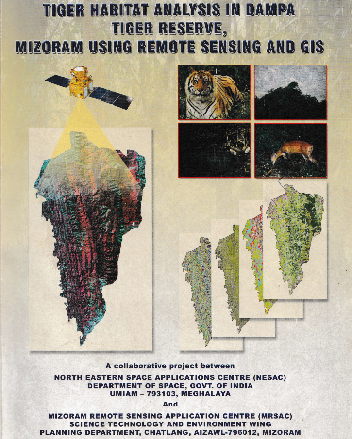
The project “Tiger Habitat Analysis in Dampa Tiger Reserve, Mizoram using Remote Sensing and GIS” was undertaken to evaluate the condition and suitability of tiger habitat within Dampa Tiger Reserve and its surrounding landscape, and to support scientific conservation and management planning through geospatial technologies. The study was carried out in close association with Northeastern Space Application Centre (NESAC) and Environment & Forest Department, Government of Mizoram, which provided reserve boundaries, wildlife census information and other field-level data required for analysis.
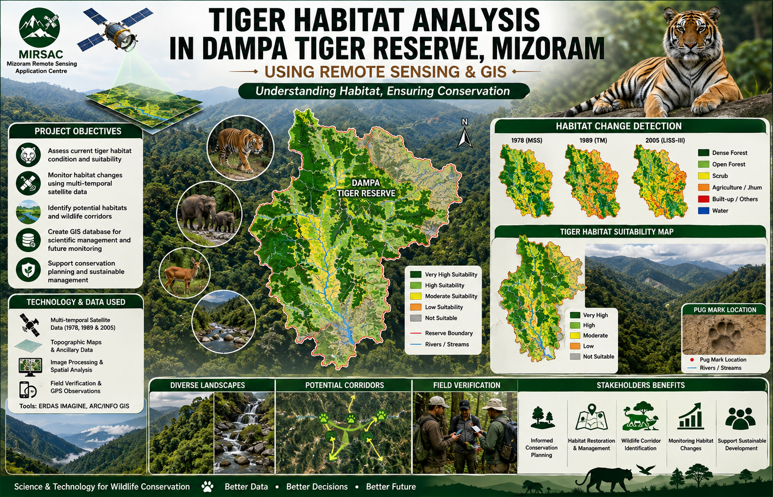
The main objectives were to prepare an inventory of vegetation types, forest density and water bodies, assess long-term habitat changes, characterize suitable tiger habitat, identify possible habitat and corridor areas outside the reserve, and create a digital database for future management. The project employed a multi-temporal Remote Sensing and GIS approach using Landsat MSS data from 1978, Landsat TM data from 1989, IRS-1D LISS-III and PAN data, and IRS-P6 LISS-III imagery from 2005, supported by topographic information, socio-economic data from surrounding villages and field verification.
GIS-based spatial modelling integrated vegetation type, forest density, slope, aspect, elevation, proximity to water and observed tiger pug-mark locations to develop a tiger habitat suitability model and map. The surrounding buffer area was also examined to evaluate habitat continuity and potential corridors beyond the reserve boundary.
The importance of the study lies in its ability to link wildlife observations with measurable landscape characteristics and long-term vegetation change. The report identifies degradation and fragmentation of closed evergreen and semi-evergreen forests, largely associated with shifting cultivation and other biotic pressures, as important threats to tiger habitat quality.
The resulting habitat suitability maps, vegetation and forest-density datasets, change-analysis outputs and digital GIS database provide valuable baseline information for the Forest Department, wildlife managers, conservation planners and researchers. These outputs can support habitat restoration, monitoring of forest degradation, management of buffer zones, identification of wildlife corridors, prioritization of conservation interventions and periodic assessment of habitat change, thereby strengthening long-term conservation planning for Dampa Tiger Reserve and its surrounding landscape.
Summarize Metadata
Mapping Scale: 1:50,000
Satellite data & Year: Landsat MSS (1978), Landsat TM (1989), IRS 1D LISS III (1999), IRS 1D PAN (2003), IRS P6 LISS-III (2005).
Study area: Dampa Tiger Reserve
Collaborating/Funding Agency: North Eastern Space Applications Centre (NESAC) & Environment & Forest Department, Government of Mizoram.
No. of Report(s) published: 1
Project Period: 2005 – 2008
The main objectives were to prepare an inventory of vegetation types, forest density and water bodies, assess long-term habitat changes, characterize suitable tiger habitat, identify possible habitat and corridor areas outside the reserve, and create a digital database for future management. The project employed a multi-temporal Remote Sensing and GIS approach using Landsat MSS data from 1978, Landsat TM data from 1989, IRS-1D LISS-III and PAN data, and IRS-P6 LISS-III imagery from 2005, supported by topographic information, socio-economic data from surrounding villages and field verification.
GIS-based spatial modelling integrated vegetation type, forest density, slope, aspect, elevation, proximity to water and observed tiger pug-mark locations to develop a tiger habitat suitability model and map. The surrounding buffer area was also examined to evaluate habitat continuity and potential corridors beyond the reserve boundary.
The importance of the study lies in its ability to link wildlife observations with measurable landscape characteristics and long-term vegetation change. The report identifies degradation and fragmentation of closed evergreen and semi-evergreen forests, largely associated with shifting cultivation and other biotic pressures, as important threats to tiger habitat quality.
The resulting habitat suitability maps, vegetation and forest-density datasets, change-analysis outputs and digital GIS database provide valuable baseline information for the Forest Department, wildlife managers, conservation planners and researchers. These outputs can support habitat restoration, monitoring of forest degradation, management of buffer zones, identification of wildlife corridors, prioritization of conservation interventions and periodic assessment of habitat change, thereby strengthening long-term conservation planning for Dampa Tiger Reserve and its surrounding landscape.
Summarize Metadata
Mapping Scale: 1:50,000
Satellite data & Year: Landsat MSS (1978), Landsat TM (1989), IRS 1D LISS III (1999), IRS 1D PAN (2003), IRS P6 LISS-III (2005).
Study area: Dampa Tiger Reserve
Collaborating/Funding Agency: North Eastern Space Applications Centre (NESAC) & Environment & Forest Department, Government of Mizoram.
No. of Report(s) published: 1
Project Period: 2005 – 2008
Related Publications
1