Project Information
| Code | MIRSAC-PRJ-33 |
|---|---|
| Category | Water Resources |
| Time Period | October 2009 |
| Funding Agency | PHED, Government of Mizoram |
Groundwater Potential Zonation & Surface Water Inventory Mapping of Mizoram
Groundwater
Surface water
Inventory
Potential areas
PHED
Drainage
Water bodies
Project Description
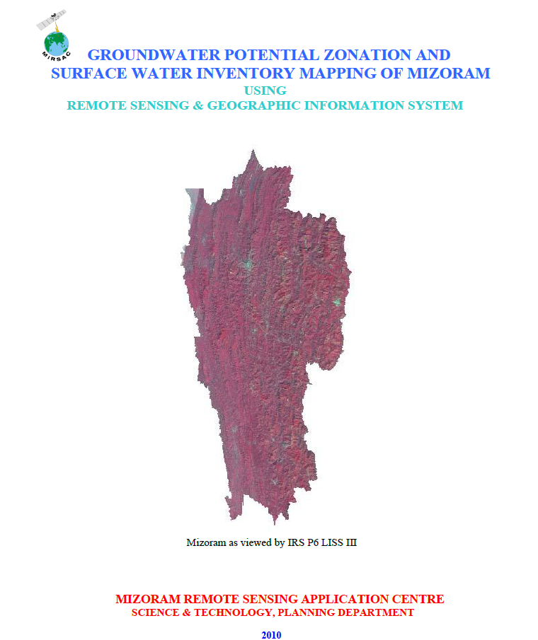
The “Groundwater Potential Zonation and Surface Water Inventory Mapping of Mizoram” project was undertaken by the Mizoram Remote Sensing Application Centre (MIRSAC), Science & Technology, Planning Department, Government of Mizoram, with funding support from the Public Health Engineering Department (PHED), Government of Mizoram. The study was conceived to provide a scientific, State-wide assessment of groundwater prospects and surface-water resources in response to the growing demand for reliable water supply arising from population growth, urbanization and development.
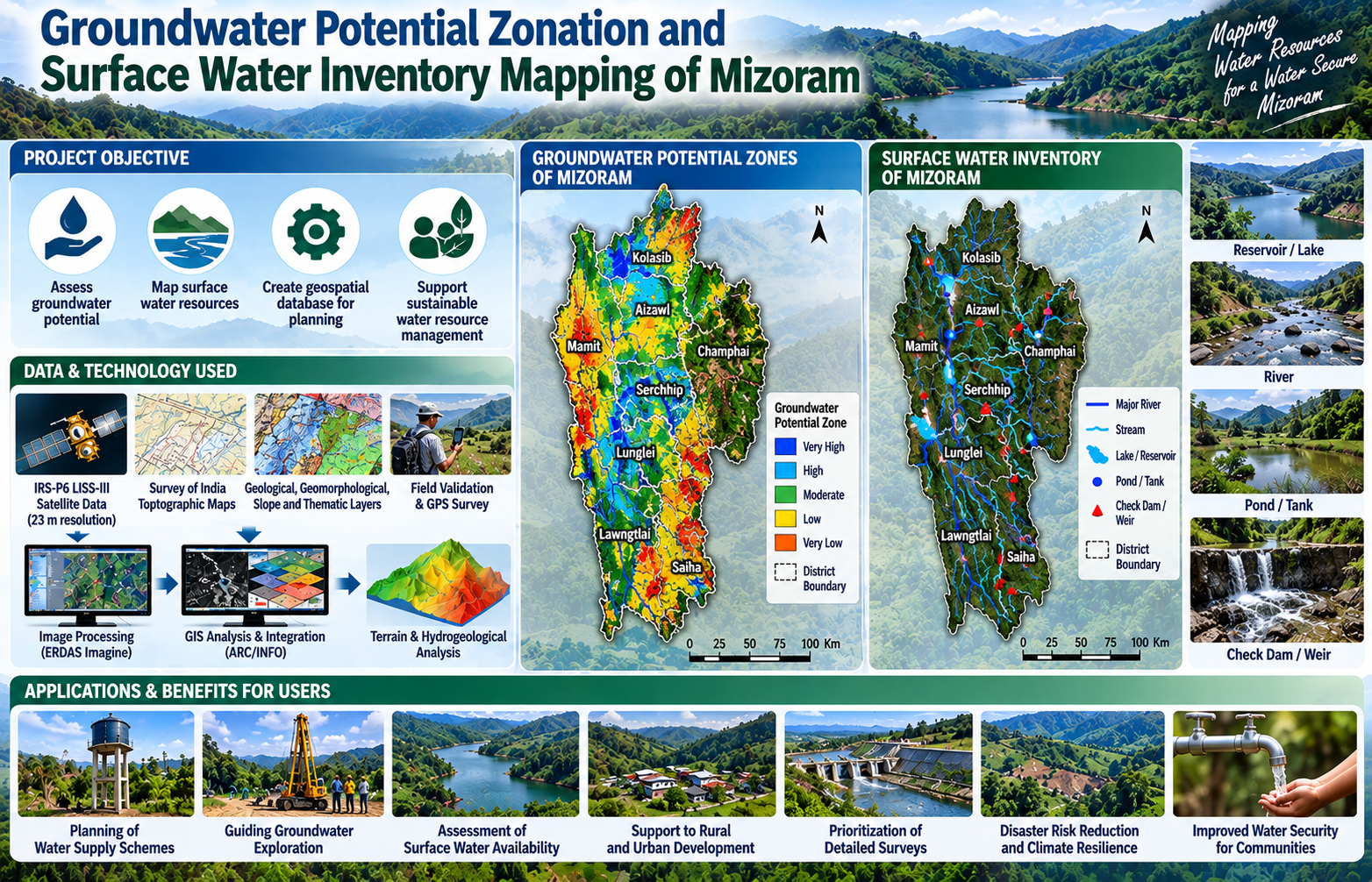
The project covered the entire State of Mizoram and applied Remote Sensing and Geographic Information System (GIS) techniques to integrate hydrogeological and terrain-related information. IRS-P6 LISS-III satellite imagery with 23 m spatial resolution was used together with Survey of India topographic maps, geological and geomorphological information, slope data, administrative boundaries and field-based ground verification. GIS-based integration of lithology, geomorphology, geological structures, slope and available groundwater indicators was used to delineate groundwater potential zones, while surface-water bodies such as rivers, streams, lakes, ponds and reservoirs were mapped directly from satellite imagery.
The main objective was to prepare a comprehensive spatial database and maps showing areas of varying groundwater potential together with an inventory of important surface-water resources. Such information is particularly important in Mizoram because its rugged terrain, complex geology and strongly dissected drainage system make conventional water-resource assessment and infrastructure planning challenging.
The resulting district-wise and State-level maps and databases provide valuable decision-support information for PHED, district administrations, planners, engineers, researchers and other development departments. They can assist in preliminary identification of areas suitable for groundwater exploration, planning of water-supply schemes, assessment of surface-water availability, prioritization of detailed hydrogeological and geophysical surveys, and long-term water-resource management. The project therefore provides an important geospatial baseline for improving water-security planning and sustainable utilization of Mizoram’s groundwater and surface-water resources.
Summarize Metadata
Mapping Scale: 1:50,000
Satellite data & Year: IRS P6 LISS IV (2009)
Study area: Mizoram
Collaborating/Funding Agency: PHED, Government of Mizoram
No. of Report(s) published: 1
Project Period: 2010
The project covered the entire State of Mizoram and applied Remote Sensing and Geographic Information System (GIS) techniques to integrate hydrogeological and terrain-related information. IRS-P6 LISS-III satellite imagery with 23 m spatial resolution was used together with Survey of India topographic maps, geological and geomorphological information, slope data, administrative boundaries and field-based ground verification. GIS-based integration of lithology, geomorphology, geological structures, slope and available groundwater indicators was used to delineate groundwater potential zones, while surface-water bodies such as rivers, streams, lakes, ponds and reservoirs were mapped directly from satellite imagery.
The main objective was to prepare a comprehensive spatial database and maps showing areas of varying groundwater potential together with an inventory of important surface-water resources. Such information is particularly important in Mizoram because its rugged terrain, complex geology and strongly dissected drainage system make conventional water-resource assessment and infrastructure planning challenging.
The resulting district-wise and State-level maps and databases provide valuable decision-support information for PHED, district administrations, planners, engineers, researchers and other development departments. They can assist in preliminary identification of areas suitable for groundwater exploration, planning of water-supply schemes, assessment of surface-water availability, prioritization of detailed hydrogeological and geophysical surveys, and long-term water-resource management. The project therefore provides an important geospatial baseline for improving water-security planning and sustainable utilization of Mizoram’s groundwater and surface-water resources.
Summarize Metadata
Mapping Scale: 1:50,000
Satellite data & Year: IRS P6 LISS IV (2009)
Study area: Mizoram
Collaborating/Funding Agency: PHED, Government of Mizoram
No. of Report(s) published: 1
Project Period: 2010