Access Options
Member Only Content
Please log in to view availability or download this document.
| Published | January 06, 1998 |
|---|---|
| Type | Project Report |
| Thematic Category | Multi-Thematic |
| Project | Integrated Mission for Sustainable Development (IMSD) |
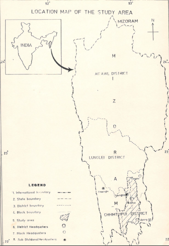
Integrated Mission for Sustainable Development (IMSD) – Part of Chhimtuipui District, Mizoram
Abstract / Description
The report “Integrated Mission for Sustainable Development (IMSD) – Part of Chhimtuipui District” presents a comprehensive geospatial assessment of natural resources and land-use conditions within selected watershed areas of Chhimtuipui District, Mizoram, with the objective of developing integrated action plans for sustainable development using remote sensing and GIS techniques. Undertaken as part of the nationwide IMSD programme initiated by the Department of Space, Government of India, the study aims to demonstrate how multi-thematic spatial datasets derived from satellite imagery and field surveys can support systematic planning of natural resources and guide development interventions in ecologically fragile hill environments. The project was implemented in Mizoram by the Mizoram State Remote Sensing Application Centre (MIRSAC) with technical guidance from ISRO and the National Remote Sensing Centre, following standardised methodologies developed under the IMSD framework.
The principal objective of the study was to generate detailed thematic information on land resources and environmental conditions of the study area and to integrate these datasets to produce location-specific development strategies. The project utilised satellite imagery interpretation, GIS-based spatial analysis, and ground verification surveys to prepare a series of thematic layers including land use / land cover, slope categories, soil characteristics, hydrogeomorphology, drainage network, groundwater potential zones, transportation network, and settlement distribution. These spatial datasets were further integrated with available socio-economic and meteorological information to evaluate land capability and identify areas suitable for targeted resource management and development activities.
Analysis of land use and land cover patterns reveals that a major portion of the study area remains under forest vegetation and secondary regrowth associated with shifting cultivation practices, which dominate the traditional agricultural system in the district. However, the study also identifies significant areas of degraded forest and fallow land resulting from repeated jhum cycles and shortened fallow periods. Agricultural lands occupy comparatively limited areas and are generally confined to valley bottoms and gentle slopes where soil fertility and moisture availability are more favourable. The slope analysis indicates that a large proportion of the terrain falls within moderately steep to steep categories, highlighting the susceptibility of the region to soil erosion and land degradation, particularly where vegetation cover has been disturbed.
Hydrogeomorphological interpretation suggests that groundwater potential across much of the study area is moderate to poor due to the rugged terrain and rapid surface runoff typical of the region. Nevertheless, certain geomorphic features such as valley fills, fractured zones, and weathered rock formations were identified as favourable locations for groundwater recharge and small-scale water development. The integration of slope, soil, drainage, and land-use data enabled the delineation of priority zones requiring soil and water conservation interventions, particularly in erosion-prone hill slopes and cultivated areas.
Based on the integrated spatial analysis, the project developed a set of sectoral action plans aimed at improving land productivity and environmental sustainability within the watershed. Recommended interventions include afforestation and regeneration of degraded forest areas, promotion of horticulture and agroforestry in suitable upland zones, soil conservation measures such as contour trenching and vegetative barriers on steep slopes, development of fodder resources, and construction of water harvesting structures to enhance groundwater recharge and support small-scale irrigation. These recommendations were prioritised according to resource capability, slope stability, and proximity to settlements to ensure practical implementation and maximum socio-economic benefits.
Overall, the IMSD study for Chhimtuipui District demonstrates the effectiveness of integrating satellite remote sensing, GIS analysis, and field surveys in developing scientifically informed action plans for watershed-based development in mountainous regions. The project provides a comprehensive spatial database and planning framework that can guide sustainable management of land, water, and forest resources while supporting rural development initiatives in the district.
Summarized Metadata
Mapping Scale: 1:50,000
Satellite data & Year: IRS 1D, 1994-1995
Thematic sub-category: Land & Water, Geology, Spatial Planning
Collaborating/Funding Agency: NRSC Hyderabad, RRSC Kharagpur & Department of Space
Report Publication Month/Year: June, 1998