Access Options
Member Only Content
Please log in to view availability or download this document.
| Published | October 01, 2004 |
|---|---|
| Type | Project Report |
| Thematic Category | Land Resources |
| Project | Urban sprawl study of Aizawl city |
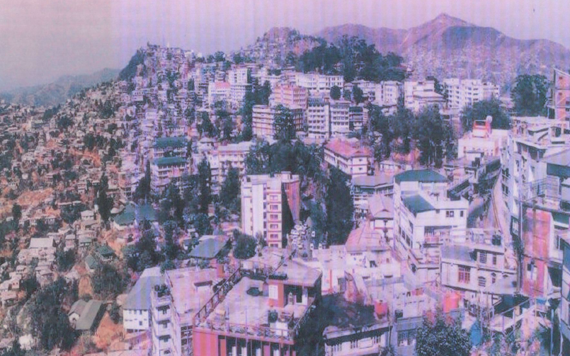
Urban sprawl study of Aizawl city
Abstract / Description
The Urban Sprawl Study of Aizawl City was undertaken by the North Eastern Space Applications Centre (NESAC), Department of Space, Government of India, Umiam, Meghalaya, in collaboration with Mizoram Remote Sensing Application Centre (MIRSAC), Aizawl, and completed in October 2004.
The primary objective was to analyze temporal urban expansion (1975–2003), map land use/land cover, assess growth patterns against the Aizawl Master Plan (2002), and identify site suitability zones for future planned development amid topographic constraints (steep slopes 20°–40°+, elevation 950–1155 m, young sedimentary terrain). Covering 128.98 sq km (23°39'–24°50'N, 92°39'–92°47'E), the study employed visual/digital interpretation of multi-temporal satellite data: Landsat MSS (1981), IRS-1C LISS-III/PAN merged (1998, 2002), and Resourcesat-1 LISS-III (2003), registered to 1:25,000 scale topographic sheets (84A/9–14) with ground truth verification.
Built-up area expanded from 649.53 ha (1975) to 2,051.55 ha (2003): +667.27 ha (1975–1981; +102.77%), +615.52 ha (1981–1998; +31.85%), +119.23 ha (1998–2003; +5.8%). Growth trended ribbon-like along NH-54, state highways (north, south, east, west directions), incorporating fringes like Durtlang Leitan, Vaivakawn, Tanhril; population surged from 31,740 (1971) to 235,138 (2001), outpacing areal growth and indicating vertical intensification. Dominant land covers include built-up (urban/rural residential/mixed), agriculture (permanent crops, current/abandoned jhum), forest (evergreen/deciduous/bamboo), wasteland (scrub/barren/degraded/quarry), water bodies (streams/springs, e.g., Chite River).
GIS database integrated spatial (DEM-derived slope, transport, water bodies) and non-spatial data (ward-wise census 1981–2001, household surveys on amenities: 70% spring-dependent water, variable school/medical access).
Site suitability zoned via weighted overlay (slope <20°/elev. <400 m prioritized; road buffer <200 m; wasteland proximity; water <50 m): Zone I (highly suitable: low slope/elev., near roads/water/wasteland), Zone II (moderately: 20°–40°/400–800 m), Zone III (unfavorable: >40°/>800 m). Suggests decongesting core via fringe development, aligning partially with Master Plan but revising northern high-slope areas for water scarcity/erosion risks.
Findings envisages to aid planners in mitigating congestion, water scarcity, erosion; emphasize road-aligned, low-slope growth with infrastructure (vertical limits, springs harnessing) for sustainable expansion.
Summarized Metadata
Mapping Scale: 1:25,000
Satellite data & Year: Landsat MSS (1981), IRS-1C (1998-2022), Resourcesat-1 (2003)
Thematic sub-category: Land Resources (Urban)
Collaborating/Funding Agency: North Eastern Space Applications Centre (NESAC), Umiam
Report Publication Month/Year: October, 2004