Access Options
Member Only Content
Please log in to view availability or download this document.
| Published | December 16, 2004 |
|---|---|
| Type | Project Report |
| Thematic Category | Land Resources |
| Project | Wasteland Mapping of Mizoram |
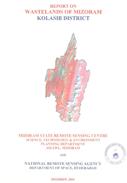
Wastelands of Mizoram - Kolasib district
Abstract / Description
The Wasteland Mapping of Kolasib District, Mizoram was carried out by the Mizoram State Remote Sensing Centre (MSRSC) under the National Wasteland Mapping Project sponsored by the National Remote Sensing Agency (NRSA), Department of Space, Government of India. The primary objective of the study was to identify, classify, quantify and spatially map wastelands of Kolasib district using satellite remote sensing and Geographic Information System (GIS) techniques. The resulting spatial database provides a scientific basis for sustainable land-use planning, watershed development, afforestation programmes, and reclamation of degraded lands.
Kolasib district occupies the north-western part of Mizoram and serves as the gateway to the state, sharing its northern boundary with Assam. The district is characterized by rugged hill ranges interspersed with narrow valleys and low-lying plains. Elevation varies from the alluvial plains adjoining Assam to moderately high hill ranges in the southern part of the district. Compared with the central and southern districts of Mizoram, Kolasib possesses relatively gentler terrain and larger areas suitable for agriculture and settlements.
The district experiences a humid tropical monsoon climate with abundant rainfall concentrated during the southwest monsoon season. The annual rainfall exceeds 2,000 mm, supporting luxuriant vegetation and rich biodiversity. Numerous perennial and seasonal streams drain the district, eventually joining the Barak River system. While the heavy rainfall sustains dense forest cover, it also accelerates soil erosion on exposed slopes affected by deforestation and shifting cultivation.
Geologically, Kolasib district is composed predominantly of sedimentary rocks belonging to the Surma Group, consisting mainly of sandstone, shale and siltstone. These formations have undergone folding and faulting, producing the characteristic north–south trending hill ranges of Mizoram. The soils are generally acidic, moderately deep on hill slopes, and comparatively deeper in valley bottoms. Although rich in organic matter under forest cover, the soils become highly vulnerable to erosion when protective vegetation is removed.
The natural vegetation consists mainly of tropical evergreen and semi-evergreen forests with extensive bamboo brakes. Economically important species include Michelia champaca, Schima wallichii, Gmelina arborea, Castanopsis spp., Terminalia spp., Albizia spp., Duabanga grandiflora, Macaranga denticulata, Trema orientalis, and several bamboo species. However, repeated anthropogenic disturbances, particularly shifting cultivation (jhum), extraction of forest resources and localized encroachments, have contributed to forest degradation and the formation of wastelands in several parts of the district.
The study follows the standardized wasteland classification adopted under the National Wasteland Mapping Programme. Based on satellite image interpretation supported by extensive field verification, three major wasteland categories were identified in Kolasib district:
- Shifting Cultivation Areas – This represents the dominant wasteland category in the district. These lands comprise hill slopes subjected to the traditional slash-and-burn cultivation system. Vegetation is cleared and burned before cultivation, followed by abandonment to allow natural regeneration. However, the shortening of fallow periods due to increasing population pressure has reduced forest recovery, resulting in soil degradation, declining productivity and expansion of degraded landscapes. The report identifies shifting cultivation as the principal driver of wasteland formation in Kolasib district.
- Current Jhum Areas (Current Shifting Cultivation) – These include areas actively under cultivation during the period of satellite image acquisition. They are characterized by freshly cleared vegetation, exposed soil surfaces, seasonal agricultural crops and sparse regenerating vegetation. The report notes that current jhum areas are concentrated on moderate hill slopes surrounding rural settlements where traditional agricultural practices continue to dominate.
- Degraded Notified Forest Land – This category includes reserved and protected forest areas where the original forest vegetation has deteriorated due to repeated burning, fuelwood extraction, illicit felling, grazing and other anthropogenic disturbances. Although legally designated as forest land, these areas have experienced significant reduction in canopy density and ecological quality, necessitating restoration measures.
The assessment reveals that shifting cultivation constitutes the largest proportion of wastelands in Kolasib district, while degraded notified forest occupies a comparatively smaller area. The report further indicates that the overall extent of wasteland has declined compared with the previous mapping cycle, reflecting positive impacts of natural forest regeneration, plantation programmes, watershed development initiatives and increasing adoption of horticulture and permanent agricultural practices. Large areas of abandoned jhum have gradually regenerated into secondary forests dominated by pioneer tree species and bamboo, demonstrating the ecological resilience of the landscape when adequate fallow periods are maintained.
The report documents several successful examples of land restoration where abandoned jhum lands have been converted into orchards, plantations and agroforestry systems. Expansion of horticultural crops, soil conservation measures and community participation in resource management have contributed to improved land productivity and reduced land degradation in several localities. These examples illustrate the potential for sustainable land-use transformation while maintaining ecological stability.
The study emphasizes that long-term management of Kolasib's wastelands requires an integrated strategy combining scientific watershed management, contour-based soil and water conservation, afforestation with indigenous species, promotion of agroforestry, regulated shifting cultivation practices, and expansion of sustainable horticultural development. Strengthening community participation through village institutions is considered essential for the successful implementation of conservation programmes because land-use decisions in Mizoram are closely linked to customary land tenure systems.
Overall, the report demonstrates the effectiveness of remote sensing and GIS as powerful tools for systematic inventory and monitoring of wastelands in mountainous regions. The spatial database generated through the study provides valuable baseline information for government agencies, planners, forest managers and watershed development authorities involved in natural resource management. The findings indicate that although shifting cultivation continues to be the principal factor responsible for land degradation in Kolasib district, ongoing conservation initiatives and improved land management practices have resulted in measurable reduction of wastelands and enhanced prospects for sustainable landscape restoration.
Summarized Metadata
Mapping Scale: 1:50,000
Satellite data & Year: IRS 1D LISS III, February 2003
Thematic sub-category: Wasteland, Spatial Planning
Collaborating/Funding Agency: National Remote Sensing Centre (NRSC), Hyderabad
Report Publication Month/Year: December, 2004