Access Options
Member Only Content
Please log in to view availability or download this document.
| Published | March 28, 2005 |
|---|---|
| Type | Project Report |
| Thematic Category | Multi-Thematic |
| Project | Environmental Studies of Aizawl City |
Environmental Studies of Aizawl City using Remote Sensing and GIS
Abstract / Description
The project "Environmental Studies of Aizawl City using Remote Sensing and GIS" was undertaken by the Mizoram State Remote Sensing Centre (MSRSC), and Science, Technology & Environment Wing, Planning Department, Government of Mizoram in March 2005. The study was initiated in response to the rapid and largely unplanned expansion of Aizawl city, which has resulted in increasing environmental degradation, pressure on natural resources, and growing urban management challenges. The project employs Remote Sensing (RS) and Geographical Information System (GIS) technologies to generate an integrated environmental database that can support scientific urban planning, infrastructure development, hazard mitigation, and sustainable environmental management.
Aizawl, the capital city of Mizoram, has experienced unprecedented urban growth over the past few decades due to administrative expansion, population increase, and rural-to-urban migration. The city is situated along narrow ridge tops and steep hill slopes within the rugged hill terrain of the state. This unique topographic setting severely limits the availability of developable land while simultaneously increasing the susceptibility of the city to environmental hazards such as landslides, slope failures, soil erosion, water scarcity, and environmental pollution. Recognizing these challenges, the project sought to establish a comprehensive environmental information system covering both the natural and anthropogenic components of the urban landscape.
The study area encompasses the entire municipal limits of Aizawl City covering approximately 12,898 hectares, located between 23°39'–23°50' N latitude and 92°39'–92°47' E longitude. The city occupies a series of elongated hill ridges with elevations ranging from approximately 700 m to over 1,100 m above mean sea level, separated by deeply incised valleys. The complex physiography has strongly influenced urban expansion patterns, transportation networks, drainage systems, and infrastructure development.
The principal objective of the project was to develop a comprehensive environmental database through the integration of satellite imagery, topographic information, field surveys, and GIS analysis. Specifically, the study aimed to:
- Prepare an updated land use/land cover database;
- Assess surface and groundwater resources;
- Evaluate water quality and water supply systems;
- Study geology, geomorphology and structural characteristics;
- Delineate landslide hazard zones;
- Generate terrain information including slope, aspect and elevation;
- Assess soil characteristics and land capability;
- Analyze existing urban growth patterns;
- Formulate recommendations for environmentally sustainable urban planning and resource management.
The project integrates multiple thematic layers generated from satellite imagery, Survey of India topographic maps, geological maps, field investigations, laboratory analyses, and GPS observations. These datasets were compiled within a GIS environment to facilitate spatial analysis and decision-making.
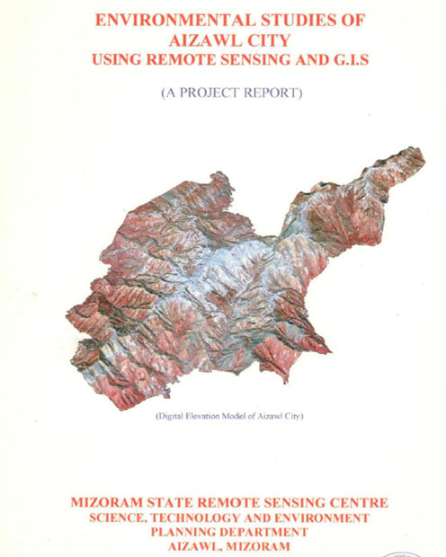
One of the major components of the study involves terrain analysis, which demonstrates that Aizawl is predominantly developed along steep ridge tops with side slopes frequently exceeding 35–45%. Such terrain conditions significantly restrict construction activities and increase the risk of slope instability. Digital elevation models, slope maps, aspect maps and terrain profiles were generated to identify suitable areas for future urban expansion and infrastructure development.
The geological and geomorphological investigations reveal that the city is underlain predominantly by folded sedimentary rocks belonging to the Surma Group, consisting mainly of sandstone, shale and siltstone. Numerous joints, fractures and bedding planes weaken the rock mass, making many hill slopes vulnerable to failure during prolonged rainfall. The geomorphological assessment identifies ridge tops, structural hills, denudational slopes, escarpments and narrow valleys as the principal landforms controlling urban development.
A comprehensive climatological assessment was undertaken using long-term meteorological records. The study analyses rainfall, temperature, humidity, wind characteristics and seasonal climatic variations. Aizawl experiences a humid tropical monsoon climate with annual rainfall exceeding 2,000 mm, most of which occurs during the southwest monsoon season. High rainfall intensity combined with steep terrain contributes significantly to soil erosion, slope instability and frequent landslide occurrences. The climatic analysis also highlights the influence of monsoon winds, seasonal humidity and temperature regimes on vegetation growth and urban environmental conditions.
The project includes an extensive evaluation of the water resources of Aizawl city. Surface water sources, perennial streams, reservoirs and groundwater occurrences were inventoried and analysed. The report documents the historical evolution of the city's water supply system and identifies increasing pressure on available water resources due to rapid population growth. Groundwater investigations indicate generally limited groundwater potential because of the hard sedimentary formations and steep terrain. Nevertheless, localized aquifers associated with fractured sandstone formations provide opportunities for supplementary groundwater development. Water quality analyses indicate that although most water sources remain suitable for domestic use after treatment, increasing urbanization has begun to affect the quality of several streams through domestic sewage discharge and solid waste disposal.
One of the most significant components of the study is the landslide hazard zonation. Using an integrated approach combining slope, geology, land use, drainage, structural discontinuities and field observations, the project identifies areas of varying landslide susceptibility throughout the city. Numerous unstable slopes were documented where inappropriate hill cutting, road construction, deforestation and uncontrolled urban development have destabilized natural hill slopes. The hazard zonation maps provide an important planning tool for regulating future construction and reducing disaster risks.
The soil survey forms another major component of the project. Representative soil profiles were studied across different physiographic units and analysed for both physical and chemical properties. The soils are generally acidic, moderately deep on ridge tops, deeper on gentle slopes and valley floors, and rich in organic matter under forest vegetation. However, removal of vegetation cover significantly accelerates erosion and nutrient loss. Laboratory analyses of soil texture, bulk density, moisture content, pH, organic carbon, cation exchange capacity and nutrient status were carried out to assess soil fertility and land capability. Based on these characteristics, land capability classifications were developed to guide suitable land utilization and conservation practices.
The land use/land cover analysis demonstrates the rapid transformation of the urban landscape. Built-up areas have expanded considerably along ridge tops and major transportation corridors, often replacing forest cover and agricultural lands. The study classifies land use into categories including dense forest, open forest, scrub, agricultural land, settlements, institutional areas, roads, water bodies and barren lands. GIS analysis reveals increasing fragmentation of forest patches, reduction in natural vegetation, and expansion of residential areas into environmentally sensitive slopes.
The report emphasizes that many of these problems are interconnected and require integrated planning rather than isolated engineering interventions. Based on the environmental assessment, the study recommends a comprehensive urban environmental management strategy. Major recommendations include strict regulation of construction activities on steep slopes, scientific land-use zoning based on terrain suitability, implementation of landslide mitigation measures, watershed conservation, afforestation using indigenous species, improved drainage systems, scientific solid waste management, protection of water sources, groundwater recharge, strengthening of environmental monitoring programmes, and establishment of a GIS-based Urban Environmental Information System for continuous planning support.
The project demonstrates that Remote Sensing and GIS provide powerful tools for integrated urban environmental assessment, enabling the simultaneous evaluation of topography, geology, land use, hydrology, soils, hazards and infrastructure within a single spatial framework. The generated environmental database constitutes one of the earliest comprehensive GIS-based urban environmental information systems for Aizawl city and provides a valuable baseline for future urban planning, disaster risk reduction, infrastructure development and sustainable natural resource management.
Overall, the study concludes that while Aizawl's unique mountainous setting presents significant constraints to urban expansion, scientifically informed planning supported by geospatial technologies can substantially reduce environmental degradation and improve the long-term sustainability of urban development. The report therefore serves as an important reference document for planners, engineers, environmental managers, disaster management authorities and policymakers involved in guiding the future growth of Aizawl city.
Summarized Metadata
Mapping Scale: 1:12,500
Satellite data & Year: IRS 1D PAN (February 2001) & LISS III (May 2002)
Thematic sub-category: Land Use/Land Cover, Geology, Water resource, Climate, Spatial Planning
Collaborating/Funding Agency: Science, Technology & Environment Wing, Planning Department, Government of Mizoram
Report Publication Month/Year: March, 2005