Access Options
Member Only Content
Please log in to view availability or download this document.
| Published | September 27, 2005 |
|---|---|
| Type | Project Report |
| Thematic Category | Multi-Thematic |
| Project | Natural Resources Mapping of Mizoram |
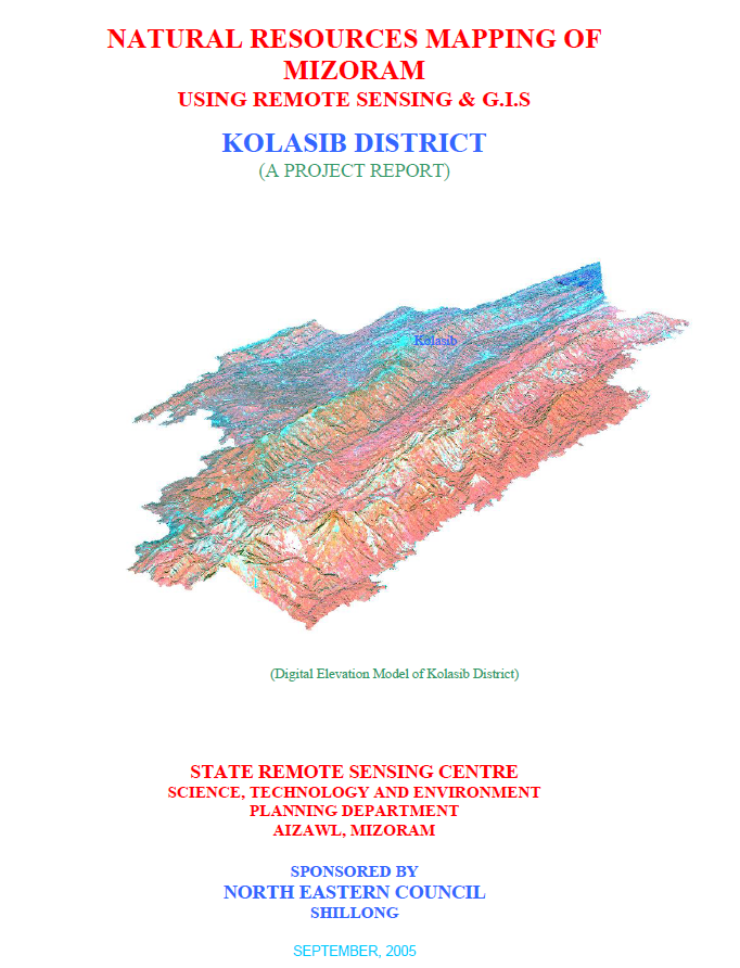
Natural Resources Mapping of Kolasib District using Remote Sensing and GIS
Abstract / Description
The Natural Resources Mapping of Kolasib District using Remote Sensing and GIS was undertaken by the Mizoram State Remote Sensing Centre (MSRSC), Science, Technology & Environment Wing, Planning Department, Government of Mizoram, under the Natural Resources Mapping of Mizoram project sponsored by the North Eastern Council (NEC), Shillong. The study forms part of a state-wide initiative launched in 2004 to develop a comprehensive geospatial database of Mizoram's natural resources through the integration of satellite remote sensing, Geographic Information System (GIS), GPS surveys, and field investigations. The primary objective was to generate accurate thematic maps and digital spatial datasets that would support sustainable land and water resource management, environmental planning, and informed decision-making at district and state levels.
The project covers the entire Kolasib District, the northernmost district of Mizoram, extending over 1,382.51 sq. km, representing approximately 6.56% of the state's geographical area. IRS-1D LISS-III and Panchromatic satellite imagery acquired during 2003–2004 formed the primary data source, supplemented by Survey of India topographic sheets, geological and meteorological records, soil investigations, and extensive ground verification. A standardized workflow comprising pre-field image interpretation, GPS-assisted field validation, laboratory analysis, and GIS integration was adopted to generate thematic layers on transport network and settlements, drainage, watershed boundaries, geology, geomorphology, slope, aspect, groundwater potential, soils, and land use/land cover, culminating in district-level land and water resource development plans.
The study reveals that Kolasib is predominantly a hilly district, with low structural hills occupying about 91.94% of the total area, while valley fills and flood plains together account for less than 5%, indicating limited terrain suitable for intensive agriculture. Geologically, the district is dominated by siltstone and shale formations (77.99%), followed by sandstone (19.32%), with recent alluvial deposits occurring mainly along major river systems such as the Tlawng, Tuirial, and Serlui.
Land use analysis demonstrates that forest remains the dominant land cover, with bamboo forests alone covering 657.40 sq. km (47.55%), while medium and dense forests together account for over 23% of the district. Current and abandoned shifting cultivation (jhum) occupy approximately 200.44 sq. km (14.50%), highlighting the continued influence of traditional agricultural practices on the landscape. The assessment also documents the growing importance of horticulture, including arecanut, citrus, coffee, banana, pineapple, and black pepper plantations, which represent a gradual transition towards more sustainable land-use systems.
Groundwater potential mapping indicates that 33.07% of the district possesses moderate groundwater potential, whereas 37.24% falls within the poor potential category because of steep topography and rapid surface runoff. Soil investigations identified predominantly acidic red and yellow loamy soils belonging to the Entisols, Inceptisols, and Ultisols orders, characterized by high organic carbon and nitrogen content but comparatively low phosphorus and potassium availability. The report further classified land irrigability and hydrosoil characteristics, providing a scientific basis for selecting suitable agricultural practices and water management strategies.
A major outcome of the project is the preparation of integrated land and water resource development plans based on GIS analysis of multiple thematic layers. The study identifies opportunities for watershed development, rainwater harvesting, groundwater exploration, soil conservation, afforestation, agroforestry, horticultural expansion, and scientific land capability planning. By combining satellite-derived information with field observations and spatial modelling, the project establishes a comprehensive natural resource information system for Kolasib District. The generated maps, datasets, and development plans provide a valuable reference for government agencies, researchers, planners, and development organizations, enabling evidence-based planning and promoting the sustainable management of natural resources in one of Mizoram's most strategically important districts.
Summarized Metadata
Mapping Scale: 1:50,000
Satellite data & Year: IRS 1D PAN & LISS III (2003 & 2004) – Digital & Photo print
Thematic sub-category: Land Use/Land Cover, Geology, Water resource, Climate, Action Plan
Collaborating/Funding Agency: North Eastern Council (NEC), Shillong
Report Publication Month/Year: September, 2005