Access Options
Member Only Content
Please log in to view availability or download this document.
| Published | July 26, 2006 |
|---|---|
| Type | Project Report |
| Thematic Category | Multi-Thematic |
| Project | Natural Resources Mapping of Mizoram |
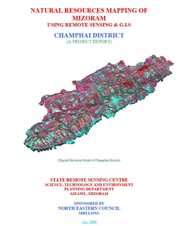
Natural Resources Mapping of Champhai District using Remote Sensing and GIS
Abstract / Description
The Natural Resources Mapping of Champhai District using Remote Sensing and GIS was undertaken by the Mizoram State Remote Sensing Centre (MSRSC), Science, Technology & Environment Wing, Planning Department, Government of Mizoram, under the Natural Resources Mapping of Mizoram programme sponsored by the North Eastern Council (NEC), Shillong. The study forms part of a three-year state-wide initiative to develop an integrated geospatial database of Mizoram's natural resources using Remote Sensing (RS), Geographic Information System (GIS), GPS-assisted field surveys, and conventional resource mapping techniques. The primary objective was to generate standardized thematic maps and digital spatial datasets for sustainable management of land, water, forests, and other natural resources while supporting scientific planning and policy formulation.
The study covers the entire Champhai District, extending over 3,185.83 sq. km, accounting for approximately 15.11% of the geographical area of Mizoram. The project utilized IRS-1D LISS-III and Panchromatic satellite imagery (2003–2004), Survey of India topographic maps, meteorological records, geological information, and extensive field verification to prepare thematic layers on land use/land cover, geology, geomorphology, soils, drainage, watershed boundaries, groundwater potential, slope, aspect, elevation, settlements, and transportation networks. These datasets were integrated within a GIS environment to facilitate resource assessment and formulate district-specific action plans.
The analysis reveals that Champhai District is characterized by rugged hill ranges interspersed with broad intermontane valleys, particularly the fertile Champhai Valley, making it one of Mizoram's most important agricultural regions. Terrain analysis indicates that the district is predominantly mountainous, with land capability and agricultural suitability closely controlled by slope and elevation. Geological mapping identifies sedimentary formations of the Surma Group as the dominant lithology, while geomorphological analysis highlights structural hills, valleys, flood plains, and denudational features that govern drainage and land-use patterns.
Land use and land cover assessment indicates that forest and bamboo forest remain the dominant land cover, reflecting the district's rich ecological resources. However, current shifting cultivation (jhum) occupies approximately 164.48 sq. km (5.16%), while young abandoned jhum lands cover about 561.44 sq. km (17.62%), emphasizing the continued influence of traditional shifting cultivation on the landscape. The report also documents the expansion of horticultural plantations, wet rice cultivation in valley floors, and permanent agriculture, indicating a gradual transition towards more sustainable land-use systems in suitable areas.
The study further evaluates soil characteristics, groundwater prospects, and watershed conditions to identify areas suitable for agricultural intensification and water resource development. Soil investigations reveal predominantly acidic hill soils with moderate fertility and high susceptibility to erosion on steep slopes, underscoring the need for integrated soil and water conservation measures. Watershed-based analysis provides a scientific framework for rainwater harvesting, groundwater recharge, and sustainable watershed management.
A major outcome of the project is the development of a comprehensive natural resources information for Champhai District, integrating multiple thematic datasets into a GIS platform for resource planning and spatial decision-making. Based on the integrated assessment, the report recommends watershed development, afforestation, agroforestry, horticultural expansion, sustainable agricultural practices, groundwater development, and land capability-based planning to optimize resource utilization while conserving the district's fragile mountain ecosystem.
Overall, the project demonstrates the effectiveness of integrating Remote Sensing, GIS, GPS, and field investigations for comprehensive natural resource assessment in mountainous regions. The thematic maps, digital databases, and development plans generated under the study provide an invaluable reference for planners, researchers, government agencies, and development organizations, supporting evidence-based planning and the sustainable management of Champhai District's natural resources.
Summarized Metadata
Mapping Scale: 1:50,000
Satellite data & Year: IRS 1D PAN & LISS III (2003 & 2004) – Digital & Photo print
Thematic sub-category: Land Use/Land Cover, Geology, Water resource, Climate, Action Plan
Collaborating/Funding Agency: North Eastern Council (NEC), Shillong
Report Publication Month/Year: July, 2006