Access Options
Member Only Content
Please log in to view availability or download this document.
| Published | June 12, 2007 |
|---|---|
| Type | Project Report |
| Thematic Category | Multi-Thematic |
| Project | Natural Resources Mapping of Mizoram |
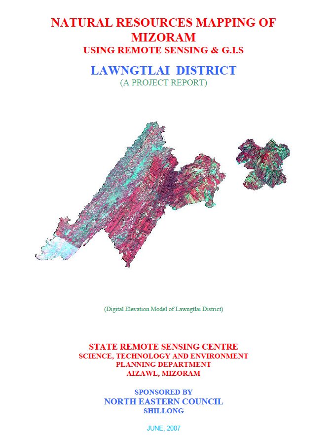
Natural Resources Mapping of Lawngtlai District using Remote Sensing and GIS
Abstract / Description
The Natural Resources Mapping of Lawngtlai District using Remote Sensing and GIS was undertaken by the Mizoram State Remote Sensing Centre (MSRSC), Science, Technology & Environment Wing, Planning Department, Government of Mizoram, under the Natural Resources Mapping of Mizoram programme sponsored by the North Eastern Council (NEC), Shillong. Executed as part of a three-year state-wide geospatial resource inventory, the project aimed to develop a comprehensive spatial database of Lawngtlai District by integrating Remote Sensing (RS), Geographic Information System (GIS), GPS-based field surveys, and conventional resource investigations. The principal objective was to generate standardized thematic information on the district's land, water, forest, and terrain resources to support scientific planning, sustainable development, and evidence-based natural resource management.
The study covers the entire Lawngtlai District, encompassing approximately 2,557.10 sq. km in the southernmost part of Mizoram. The district is characterized by rugged north-south trending hill ranges, deeply dissected valleys, high rainfall, and extensive forest cover, making it one of the state's ecologically significant landscapes. The project utilized IRS-1D LISS-III and Panchromatic satellite imagery, Survey of India topographic maps, geological and meteorological records, soil surveys, and extensive field verification to prepare detailed thematic layers on land use/land cover, geology, geomorphology, drainage, watershed boundaries, groundwater potential, soils, slope, aspect, settlements, and transportation networks. These datasets were integrated within a GIS environment to create a district-level Natural Resources Information System (NRIS).
The assessment indicates that the district is dominated by structural hills and steep slopes, which largely determine land capability, settlement patterns, and agricultural practices. Forest and bamboo forest constitute the predominant land-use categories, reflecting the district's rich biodiversity and relatively intact natural ecosystems. Nevertheless, current and abandoned shifting cultivation (jhum) continue to occupy substantial portions of the landscape, demonstrating the continued dependence of rural communities on traditional farming systems. The report also highlights the gradual expansion of horticultural plantations, wet rice cultivation, and permanent agriculture in suitable valleys and gentle slopes, indicating an ongoing transition towards more sustainable and diversified land-use practices.
Groundwater investigations reveal that groundwater occurrence is primarily associated with fractured sandstone formations, valley fills, and gentle slopes, while the extensive hilly terrain generally exhibits poor to moderate groundwater potential because of steep gradients and rapid runoff. Soil investigations identify predominantly acidic hill soils with moderate organic carbon content and varying fertility, emphasizing the need for appropriate soil conservation and watershed management measures. The study also delineates watershed boundaries and drainage characteristics, providing valuable information for integrated water resource planning and rainwater harvesting initiatives.
One of the major outcomes of the project is the development of an integrated natural resources information that combines multiple thematic datasets into a GIS platform for resource evaluation and spatial decision-making. Based on the integrated assessment, the report recommends watershed development, afforestation, agroforestry, bamboo resource management, groundwater development, horticultural expansion, soil and water conservation, and land capability-based planning to ensure sustainable utilization of natural resources while minimizing environmental degradation.
Overall, the project demonstrates the effectiveness of integrating Remote Sensing, GIS, GPS, and field investigations for comprehensive natural resource assessment in mountainous environments. The thematic maps, digital databases, and resource development plans generated under the study provide a valuable baseline for government departments, planners, researchers, and development agencies, supporting sustainable land and water resource management, environmental conservation, infrastructure planning, and long-term regional development in Lawngtlai District.
Summarized Metadata
Mapping Scale: 1:50,000
Satellite data & Year: IRS 1D PAN & LISS III (2003 & 2004) – Digital & Photo print
Thematic sub-category: Land Use/Land Cover, Geology, Water resource, Climate, Action Plan
Collaborating/Funding Agency: North Eastern Council (NEC), Shillong
Report Publication Month/Year: June, 2007