Access Options
Member Only Content
Please log in to view availability or download this document.
| Published | October 07, 2009 |
|---|---|
| Type | Project Report |
| Thematic Category | Forestry & Environment |
| Project | Wetland Inventory & Assessment of Mizoram |
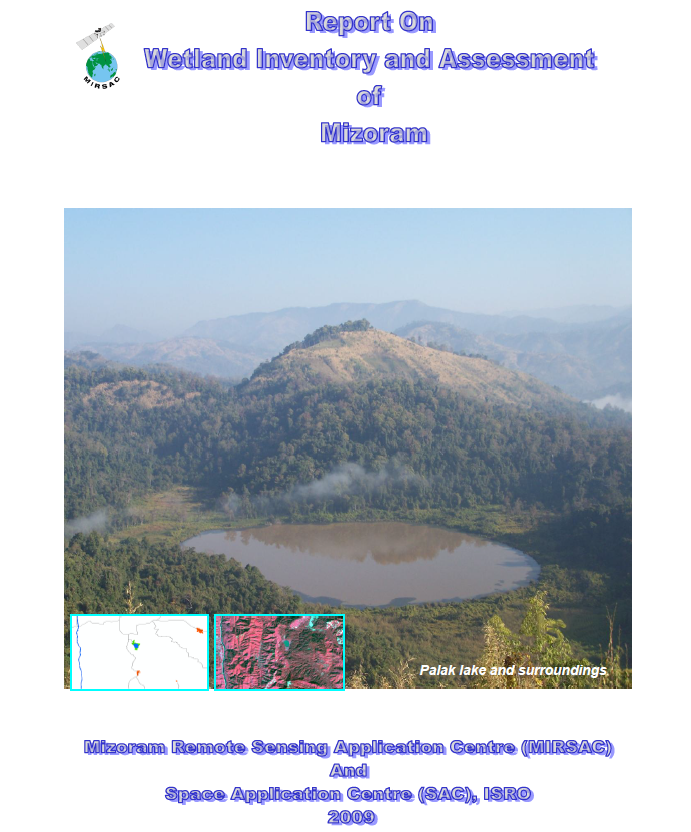
Wetland Inventory & Assessment of Mizoram
Abstract / Description
The “Wetland Inventory and Assessment of Mizoram” was undertaken as the State component of the National Wetland Inventory and Assessment (NWIA) Project, formulated by the Space Applications Centre (SAC), ISRO, Ahmedabad and funded by the Ministry of Environment & Forests, Government of India. For Mizoram, the project was implemented by the Mizoram Remote Sensing Application Centre (MIRSAC) with technical guidance and support from SAC and NESAC. The principal objective was to prepare a scientifically standardized inventory of wetlands at 1:50,000 scale, generate a seamless GIS database, integrate ancillary spatial layers, and contribute to the National Wetland Atlas.
The study utilized IRS-P6 LISS-III satellite imagery from both post-monsoon (December 2006) and pre-monsoon (March 2007) periods, supplemented by Survey of India topographic maps, administrative boundaries, ground-truth observations and other ancillary datasets. Wetlands were delineated through digital classification and on-screen interpretation using ERDAS Imagine, ARC/INFO and ArcGIS. Spectral indices including NDWI, MNDWI, NDVI, NDPI and NDTI were applied to characterize wetland extent, open-water spread, aquatic vegetation and turbidity. The project followed the NWIA classification and database standards to ensure compatibility with the national geospatial framework.
The inventory identified 41 wetlands larger than the minimum mapping unit, excluding rivers and streams, together with 148 wetlands smaller than 2.25 ha. Total wetland area was estimated at 13,989.28 ha. Rivers and streams overwhelmingly dominated the wetland resource, accounting for approximately 13,496.19 ha, while lakes and ponds occupied 185.49 ha, waterlogged areas 132.87 ha, and reservoirs/barrages 26.74 ha. Seasonal open-water extent was estimated at 13,835.89 ha during the post-monsoon period and 13,817.61 ha during the pre-monsoon period, indicating relatively limited seasonal variation at State scale. Aquatic vegetation covered about 55.62 ha post-monsoon and 61.29 ha pre-monsoon. Most mapped water bodies exhibited low turbidity, with no areas categorized under the high-turbidity class.
District-wise analysis showed that Lunglei contained the largest share of mapped wetland area, about 22.91% of the State total, followed by Mamit and Lawngtlai; Kolasib and Serchhip contained comparatively smaller proportions. Major wetland types included rivers, lakes and ponds, with representative field validation carried out using GPS and standardized ground-truth procedures.
Overall, the project established a standardized and spatially explicit baseline of Mizoram’s wetland resources. The resulting maps, seasonal water-spread information, wetland classification layers and GIS database provide an important foundation for wetland conservation, biodiversity assessment, water-resource planning, environmental monitoring and future change detection, while also integrating Mizoram’s wetland information into the broader National Wetland Inventory framework.
Summarized Metadata
Mapping Scale: 1:50,000
Satellite data & Year: IRS LISS III (2006 & 2007)
Thematic sub-category: Forestry & Environment, Water resources
Collaborating/Funding Agency: Ministry of Environment & Forest, Govt. of India & Space Application Centre, Ahmedabad
Report Publication Month/Year: October, 2009