Access Options
Member Only Content
Please log in to view availability or download this document.
| Published | December 21, 1995 |
|---|---|
| Type | Project Report |
| Thematic Category | Multi-Thematic |
| Project | Integrated Mission for Sustainable Development (IMSD) |
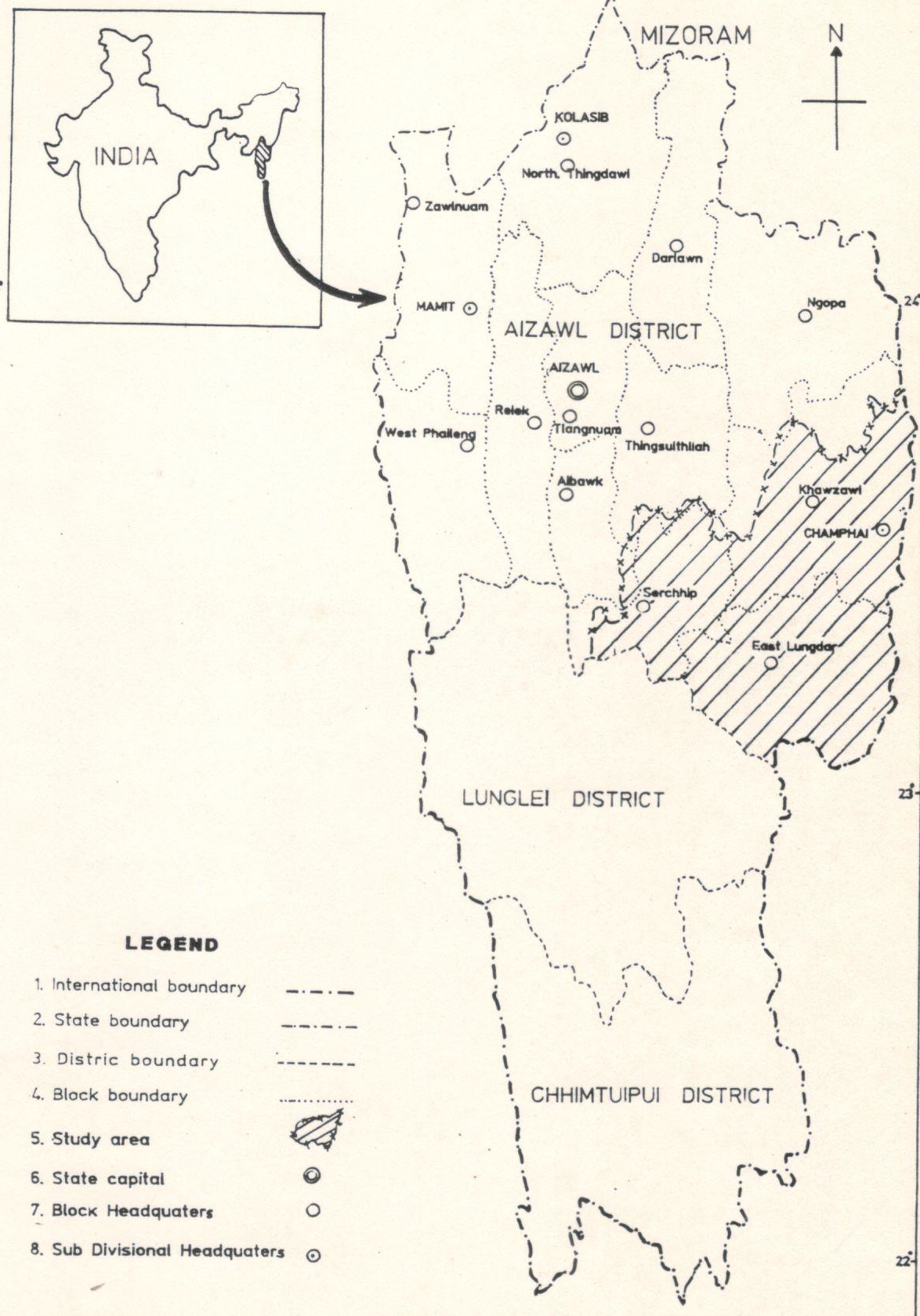
Integrated Mission for Sustainable Development (IMSD) Tuipui Watershed, Aizawl District, Mizoram.
Abstract / Description
This report presents the Integrated Mission for Sustainable Development (IMSD) pilot implementation for the Tuipui watershed (Aizawl District, Mizoram), executed as a district-scale, multi-thematic, remote-sensing and GIS-based assessment to generate implementable, location-specific action plans for sustainable resource management. The principal objective was to demonstrate how satellite-derived thematic layers integrated with field surveys and socio-economic data can be used to diagnose land-resource status, prioritise interventions, and guide sectoral actions in forestry, agriculture, soil and water conservation, and livelihood enhancement within a watershed planning framework. The study was implemented as a phased, district-focused IMSD activity under technical guidance from NRSC/ISRO and with state collaboration through MIRSAC. It emphasized replicable methods, institutional capacity building, and production of GIS-ready datasets for operational planning.
The methodology combined multi-temporal satellite image interpretation, thematic classification, and GIS overlay analysis with stratified ground surveys and stakeholder consultations. Core thematic maps produced included land use / land cover, slope and erosion susceptibility, soil types, hydrogeomorphology and drainage, groundwater potential zones, transport and settlement networks, and existing land-based infrastructure. These were integrated with socio-economic indicators and local needs assessments gathered through field visits to generate a set of area-specific recommendations. Standardized field-validation and mapping protocols were followed to ensure thematic consistency and to calibrate remotely sensed signatures against on-site observations.
Key outcomes demonstrate the operational value of the IMSD approach for watershed planning. The project produced detailed, map-based diagnostics of resource distribution and degradation hotspots within the Tuipui catchment covering a pilot implementation area of 940 sqkm, enabling spatial prioritization of interventions such as priority afforestation/regeneration sites, slope stabilization and soil-conservation measures, targeted fodder and livelihood development zones, and water-harvesting and groundwater recharge locations. The integrated analysis identified areas with high erosion risk and soil vulnerability, delineated zones of limited versus moderate groundwater potential, and highlighted settlement patterns and transport constraints that influence service delivery and intervention feasibility. The maps and GIS layers were packaged as decision-support products intended for direct use by the Planning Department , forest and watershed agencies, and local implementing units within the Khawzawl & East Lungdar Rural development block administrative jurisdiction.
From a methodological standpoint the pilot study confirmed that remote sensing, when combined with systematic field validation, provides robust spatial coverage and repeatable workflows suited to district/watershed planning. The study highlighted several practical lessons: the need for high-resolution imagery or finer temporal sampling to resolve smallholder mosaic plots; the importance of stratified field sampling for accurate soil and hydrogeomorphic classification; and the benefit of close coordination with local stakeholders to align technical recommendations with ground realities. The report also presents a set of prioritized, site-specific action plans (forestry regeneration targets, soil-and-water conservation measures, fodder development and agricultural/horticultural interventions), together with implementation notes and institutional responsibilities to support follow-through.
In conclusion, the Tuipui watershed pilot under IMSD delivered an integrated geospatial baseline and practical action plans that translate multi-thematic remote-sensing products into operational interventions for sustainable watershed development. Detailed quantitative results, including mapped area statistics by theme, priority site lists, and field-derived metrics that underpin the recommendations, are provided in the report and should be consulted for operational planning and monitoring purposes.
Summarized Metadata
Mapping Scale: 1:50,000
Satellite data & Year: IRS 1D, 1994-1995
Thematic sub-category: Land & Water, Geology, Spatial Planning
Collaborating/Funding Agency: NRSC Hyderabad, RRSC Kharagpur & Department of Space
Report Publication Month/Year: December, 1995