Micro Landslide Hazard Zonation Mapping of Aizawl City
The project “Micro Landslide Hazard Zonation Mapping of Aizawl City using Remote Sensing and GIS” was undertaken by the Mizoram Remote Sensing Application Centre to produce a detailed spatial assessment of landslide susceptibility within Aizawl City. The study was initiated in response to recurrent slope failures, rapid urban expansion and increasing development pressure on the city’s narrow ridges and steep hill slopes. Its principal objective was to identify areas of varying landslide hazard, analyse the major causative factors influencing slope instability and provide a scientific basis for safer land-use planning, infrastructure development and disaster-risk mitigation.The study covered the entire Aizawl urban area of 128.98 sq. km. High-resolution QuickBird imagery with 0.8 m spatial resolution was used as the primary dataset, supplemented by IRS-P5 Cartosat-I stereo data at 2.5 m resolution, Survey of India topographic maps, field observations and GPS-based ground verification. Five principal thematic parameters—land use/land cover, slope, geomorphology, lithology and geological structure—were generated and integrated in ARC/INFO GIS using a weighted heuristic approach. Additional consideration was given to active and old landslides, fault proximity, road cutting, drainage conditions and dip-slope relationships. The final hazard maps were prepared at 1:5,000 scale, with grid-wise reference maps also produced at 1:20,000.The results demonstrate the inherent fragility of Aizawl’s terrain. About 64.22% of the city lies on slopes exceeding 40°, including 63.95% within the 40–60° class, indicating that steep terrain is the dominant physical constraint. Scrubland forms the largest land-use category, occupying 52.51 sq. km or 40.71%, while built-up areas already cover 18.23 sq. km or 14.13%. Geomorphologically, medium and low structural hills together account for more than 96% of the study area, whereas valley fills occupy only 0.28%, confirming the scarcity of naturally stable flat land. Lithological analysis shows that sandstone covers 39.41%, while crumpled shale and shale-sandstone units together occupy over 45%, creating extensive zones of relatively weak and weathering-prone material.The hazard zonation classified the city into five categories. Very High and High Hazard Zones together cover 37.77 sq. km, or 29.28% of the city, representing areas where construction and major development require avoidance or stringent geotechnical scrutiny. The Moderate Hazard Zone is the largest class at 56.66 sq. km (43.93%), while Low and Very Low Hazard Zones account for 20.61% and 6.18%, respectively. High-risk locations were associated with active landslides, faults, crumpled shale, steep road cuts, quarrying, poor drainage and dense settlement.The project’s principal outcome is a detailed GIS-based hazard database for Aizawl City. It provides planners, engineers, municipal authorities and disaster-management agencies with an operational tool for site selection, building regulation, road and drainage design, slope stabilization, emergency planning and hazard-sensitive urban development. Summarized MetadataMapping Scale: 1:5,000 Satellite data & Year: IRS P5 Cartosat-I & Quickbird (2006)Thematic sub-category: Forestry, Administrative boundaryCollaborating/Funding Agency: Science, Technology & Environment Wing, Planning Department, Government of MizoramReport Publication Month/Year: March, 2008

Report on Landslides in Mizoram
The Report on Landslides in Mizoram, prepared by the Mizoram Remote Sensing Application Centre (MRSAC) under the Science and Technology Wing, Planning Department, Government of Mizoram, was compiled in 2007 in response to the increasing incidence of landslides and associated disruptions across the State's mountainous terrain. The study was undertaken to document recent landslide occurrences, assess their geographical distribution and impacts, and provide an initial scientific understanding of landslide susceptibility across Mizoram, particularly following intense monsoon rainfall during September 2007.The project employed Remote Sensing and Geographic Information System (GIS) techniques to prepare a generalized Landslide Hazard Zonation (LHZ) map for the State. IRS-1D LISS-III satellite imagery acquired in February 2003, together with Survey of India topographic maps at 1:50,000 scale and available ancillary spatial datasets, was used to analyse terrain and geo-environmental conditions. Key causative parameters—including lithology, geological structure, geomorphology, slope, and land use/land cover—were integrated using ARC/INFO GIS software to classify Mizoram into five relative landslide hazard categories. The analysis provided a statewide framework for identifying areas of varying susceptibility and understanding the influence of both natural terrain conditions and human interventions such as road cutting and quarrying.The report also compiled field and administrative information on landslide impacts from across all eight districts of Mizoram, documenting damage to houses, roads, bridges, public utilities, and communication networks. The assessment highlights the vulnerability of settlements and infrastructure during periods of intense rainfall and demonstrates the widespread nature of landslide-related hazards in the State.A key outcome of the project was the preparation of a generalized Landslide Hazard Zonation Map of Mizoram, providing an important baseline for disaster preparedness and mitigation. The report emphasizes that although landslides cannot be completely prevented, their impacts can be reduced through appropriate land-use planning, slope stabilization, safer infrastructure development, and avoidance of highly susceptible areas.The resulting landslide inventory, hazard zonation map, spatial information, and documented observations provide valuable reference material for government departments, disaster management authorities, planners, engineers, researchers, and local administrations. The information can support road and infrastructure planning, hazard monitoring, emergency preparedness, environmental management, and prioritization of mitigation measures, while also providing a foundation for more detailed, site-specific landslide susceptibility and risk assessments in the future.Summarized MetadataMapping Scale: 1:50,000 Satellite data & Year: IRS 1D LISS III (2003)Thematic sub-category: Landslide, Disaster ManagementCollaborating/Funding Agency: Mizoram Remote Sensing Application CentreReport Publication Month/Year: September, 2007
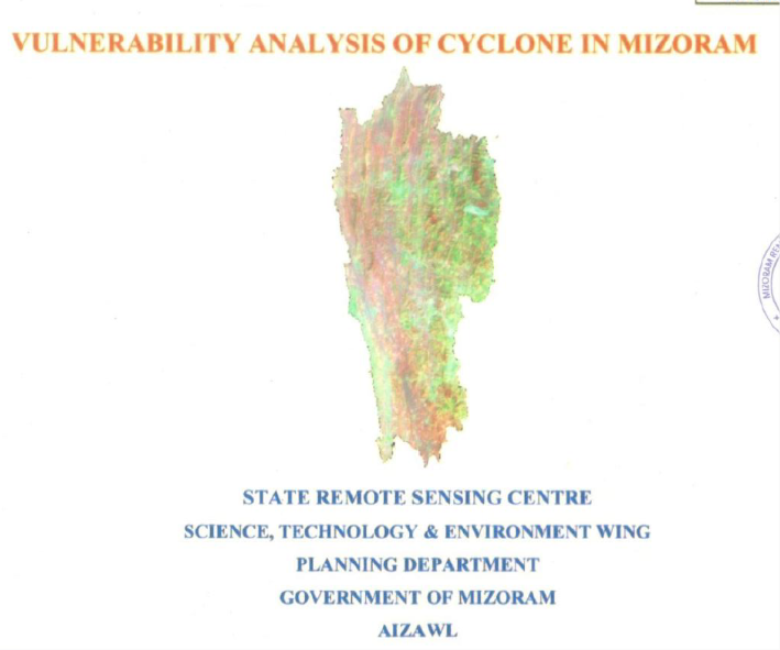
Vulnerability analysis of cyclone in Mizoram
The Vulnerability Analysis of Cyclone in Mizoram State was executed by the State Remote Sensing Centre (SRSC), Science, Technology & Environment Wing, Planning Department, Government of Mizoram, Aizawl. Stemming from a Hazard Mapping meeting on April 13, 2004, chaired by the Secretary, Relief & Rehabilitation, the project was funded by the Relief & Rehabilitation Department., Government of Mizoram.Covering Mizoram (21,087 sq km) strategically bordered by Bangladesh (west) and Myanmar (east/south), featuring NNW-SSE trending ridges with humid tropical climate (250–350 cm annual rainfall and temparatures ranging from 11–31°C, the study analyzed cyclone impacts using 20-year records (1985–2004) from eight districts (Mamit, Kolasib, Aizawl, Champhai, Serchhip, Lunglei, Lawngtlai, Saiha) and 2001 Census data.The methodology integrated IRS LISS-III FCC visual interpretation, SOI topographical maps for physiographic parameters (location: ridge/hill-top/slope/valley; aspect: N/NE/E/SE/S/SW/W/NW; altitude: 0–500/501–1,000/>1,001 m), and ArcInfo GIS for vulnerability zoning: low (0–3 events), medium (4–6), high (≥7). Of 828 villages/towns/wards, 450 (54.4%) were low vulnerability, 243 (29.3%) medium, and 135 (16.3%) high.District-wise observation and analysis showed that Saiha topped high vulnerability (23/77 wards; 29.87%), followed by Lunglei (52/185; 28.11%), Lawngtlai (16/139; 11.51%), Champhai (12/85; 14.12%), Aizawl (15/160; 9.38%), Kolasib (11/52; 21.15%), Mamit (4/87; 4.6%), Serchhip (2/43; 4.65%). Locationally, ridge/hill-tops dominated high vulnerability (e.g., 82.69% in Lunglei; 93.33% in Aizawl), vs. slopes (20.17% overall) and valleys (18.24%). Altitude-wise, high vulnerability peaked at 501–1,000 m (56/135; 41.5%) and >1,001 m (45; 33.3%). Aspect vulnerabilities varied throughout the locations e.g., NW highest in Lunglei (23.07%), E in Kolasib (54.55%). Cyclones (post/pre-monsoon tails from Bay of Bengal; est. Saffir-Simpson scale 2–3: 43–58 m/s) caused house/powerline/road/crop/livestock damage, exacerbated by Assam-type/thatched/tin-roof structures on exposed saddles/ridges.The project produced thematic maps, tables (village/ward/district/aspect/altitude-wise), and a cyclone database, marking SRSC's first disaster management effort. Outputs enable risk-based planning: prioritize retrofitting high-vulnerability ridge-tops (>501 m), enforce cyclone-resistant designs (sloping roofs at 33:10, J-bolts/anchors/bracing/bands, leeward sites, windbreaks like tree belts), avoid saddles/protrusions, and integrate into mitigation cycles (preparedness/response/recovery).Recommendations from the project outputs emphasize wind-loading standards, RCC slabs, reinforced walls/frames, minimal projections, and firm foundations against torrential rains, fostering resilient infrastructure amid Mizoram's frequent moderate cyclones.Summarized MetadataMapping Scale: 1:50,000Satellite data & Year: IRS LISS III (2003)Thematic sub-category: Disaster managementCollaborating/Funding Agency: Relief & Rehabilitation Department, Govt. of MizoramReport Publication Month/Year: December, 2004