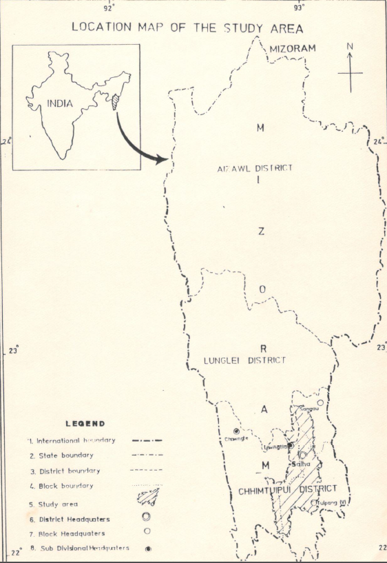
Integrated Mission for Sustainable Development (IMSD) – Part of Chhimtuipui District, Mizoram
The report “Integrated Mission for Sustainable Development (IMSD) – Part of Chhimtuipui District” presents a comprehensive geospatial assessment of natural resources and land-use conditions within selected watershed areas of Chhimtuipui District, Mizoram, with the objective of developing integrated action plans for sustainable development using remote sensing and GIS techniques. Undertaken as part of the nationwide IMSD programme initiated by the Department of Space, Government of India, the study aims to demonstrate how multi-thematic spatial datasets derived from satellite imagery and field surveys can support systematic planning of natural resources and guide development interventions in ecologically fragile hill environments. The project was implemented in Mizoram by the Mizoram State Remote Sensing Application Centre (MIRSAC) with technical guidance from ISRO and the National Remote Sensing Centre, following standardised methodologies developed under the IMSD framework. The principal objective of the study was to generate detailed thematic information on land resources and environmental conditions of the study area and to integrate these datasets to produce location-specific development strategies. The project utilised satellite imagery interpretation, GIS-based spatial analysis, and ground verification surveys to prepare a series of thematic layers including land use / land cover, slope categories, soil characteristics, hydrogeomorphology, drainage network, groundwater potential zones, transportation network, and settlement distribution. These spatial datasets were further integrated with available socio-economic and meteorological information to evaluate land capability and identify areas suitable for targeted resource management and development activities.Analysis of land use and land cover patterns reveals that a major portion of the study area remains under forest vegetation and secondary regrowth associated with shifting cultivation practices, which dominate the traditional agricultural system in the district. However, the study also identifies significant areas of degraded forest and fallow land resulting from repeated jhum cycles and shortened fallow periods. Agricultural lands occupy comparatively limited areas and are generally confined to valley bottoms and gentle slopes where soil fertility and moisture availability are more favourable. The slope analysis indicates that a large proportion of the terrain falls within moderately steep to steep categories, highlighting the susceptibility of the region to soil erosion and land degradation, particularly where vegetation cover has been disturbed.Hydrogeomorphological interpretation suggests that groundwater potential across much of the study area is moderate to poor due to the rugged terrain and rapid surface runoff typical of the region. Nevertheless, certain geomorphic features such as valley fills, fractured zones, and weathered rock formations were identified as favourable locations for groundwater recharge and small-scale water development. The integration of slope, soil, drainage, and land-use data enabled the delineation of priority zones requiring soil and water conservation interventions, particularly in erosion-prone hill slopes and cultivated areas.Based on the integrated spatial analysis, the project developed a set of sectoral action plans aimed at improving land productivity and environmental sustainability within the watershed. Recommended interventions include afforestation and regeneration of degraded forest areas, promotion of horticulture and agroforestry in suitable upland zones, soil conservation measures such as contour trenching and vegetative barriers on steep slopes, development of fodder resources, and construction of water harvesting structures to enhance groundwater recharge and support small-scale irrigation. These recommendations were prioritised according to resource capability, slope stability, and proximity to settlements to ensure practical implementation and maximum socio-economic benefits.Overall, the IMSD study for Chhimtuipui District demonstrates the effectiveness of integrating satellite remote sensing, GIS analysis, and field surveys in developing scientifically informed action plans for watershed-based development in mountainous regions. The project provides a comprehensive spatial database and planning framework that can guide sustainable management of land, water, and forest resources while supporting rural development initiatives in the district.Summarized MetadataMapping Scale: 1:50,000Satellite data & Year: IRS 1D, 1994-1995Thematic sub-category: Land & Water, Geology, Spatial PlanningCollaborating/Funding Agency: NRSC Hyderabad, RRSC Kharagpur & Department of SpaceReport Publication Month/Year: June, 1998
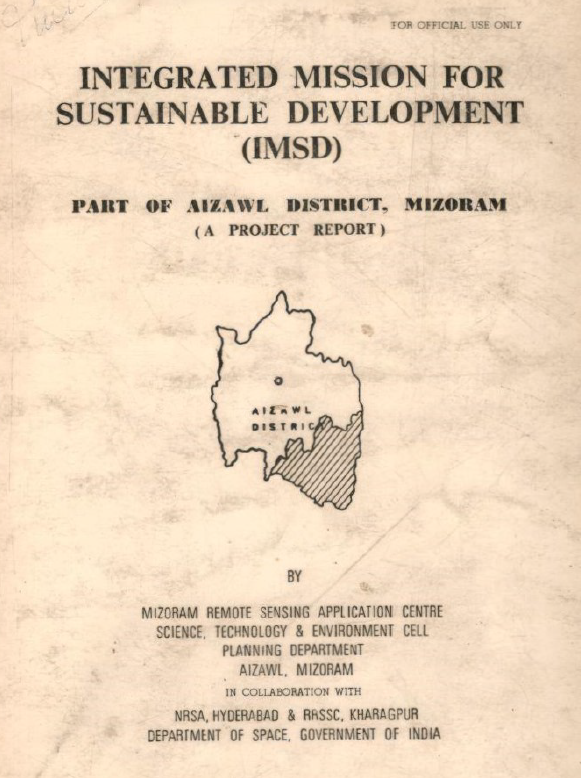
Integrated Mission for Sustainable Development (IMSD) – Part of Aizawl District, Mizoram
The report “Integrated Mission for Sustainable Development (IMSD) – Part of Aizawl District” presents a comprehensive geospatial assessment of natural resources within the selected watershed areas (Mat, Tuichang, Tiau & Tuipui) and RD block areas (Part of Khawzawl, Thingsulthliah, Aibawk, Serchhip & whole of East Lungdar) of Aizawl District using satellite remote sensing, GIS analysis, and field-based surveys to support integrated and sustainable land-use planning. The primary objective of the study was to generate spatially explicit thematic information on natural resources and socio-economic conditions and to translate these datasets into location-specific action plans aimed at improving land productivity, conserving fragile hill ecosystems, and strengthening rural livelihoods. The project forms part of the nationwide IMSD programme initiated by the Department of Space, Government of India, and implemented in Mizoram by the Mizoram State Remote Sensing Application Centre (MIRSAC) with technical guidance from ISRO and NRSC. The study adopted a multidisciplinary methodology combining satellite image interpretation, GIS-based spatial analysis, and extensive ground verification. Key thematic layers generated for the watershed included land use / land cover, slope, soil characteristics, hydrogeomorphology, drainage patterns, groundwater prospects, settlement distribution, and transport networks. These layers were subsequently integrated with socio-economic and meteorological data to evaluate the natural resource potential of the area and identify constraints affecting agricultural productivity, soil stability, and water availability. The integrated database enabled the delineation of land capability classes and the identification of priority zones for developmental interventions.Analysis of the land use and land cover data indicates that a significant proportion of the study area is under forest vegetation and secondary growth associated with shifting cultivation cycles, reflecting the dominant land-use system practiced in the region. However, the spatial distribution of land cover also highlights the presence of degraded forest patches and fallow areas resulting from shortened jhum cycles. Agricultural land occupies a relatively smaller share of the total area and is largely confined to valley bottoms and gentle slopes where soil depth and moisture conditions are more favourable. The slope analysis reveals that a large portion of the landscape falls within moderate to steep slope categories, underscoring the susceptibility of the terrain to soil erosion and land degradation if appropriate conservation measures are not implemented. Hydrogeomorphological analysis further indicates that groundwater prospects in the watershed are generally moderate to low due to the steep terrain and rapid surface runoff characteristics typical of Mizoram’s hill ecosystems. Nevertheless, specific valley fills, structural depressions, and weathered zones were identified as potential sites for groundwater development and water harvesting structures. The integration of slope, soil, drainage, and land-use information enabled the delineation of erosion-prone areas where soil conservation interventions such as contour bunding, vegetative barriers, and afforestation would be most effective.The project outcomes include a comprehensive set of thematic maps, GIS databases, and an integrated action plan proposing sector-specific interventions. Recommended strategies include afforestation and forest regeneration in degraded hill slopes, horticultural development in suitable upland areas, soil and water conservation measures in erosion-prone zones, fodder resource development to support livestock, and the construction of water harvesting and small irrigation structures to improve water availability. These recommendations were prioritised based on resource capability, slope stability, and proximity to settlements to maximise socio-economic benefits for local communities.Overall, the IMSD study demonstrates the effectiveness of integrating remote sensing and GIS technologies with field-level information to generate scientifically informed development plans for fragile hill environments. The project establishes a spatial baseline for natural resource management in the study area and provides actionable recommendations that can guide sustainable watershed development and rural planning initiatives in Aizawl District.Summarized MetadataMapping Scale: 1:50,000Satellite data & Year: IRS 1D, 1994-1995Thematic sub-category: Land & Water, Geology, Spatial Planning Collaborating/Funding Agency: NRSC Hyderabad, RRSC Kharagpur & Department of SpaceReport Publication Month/Year: August, 1996
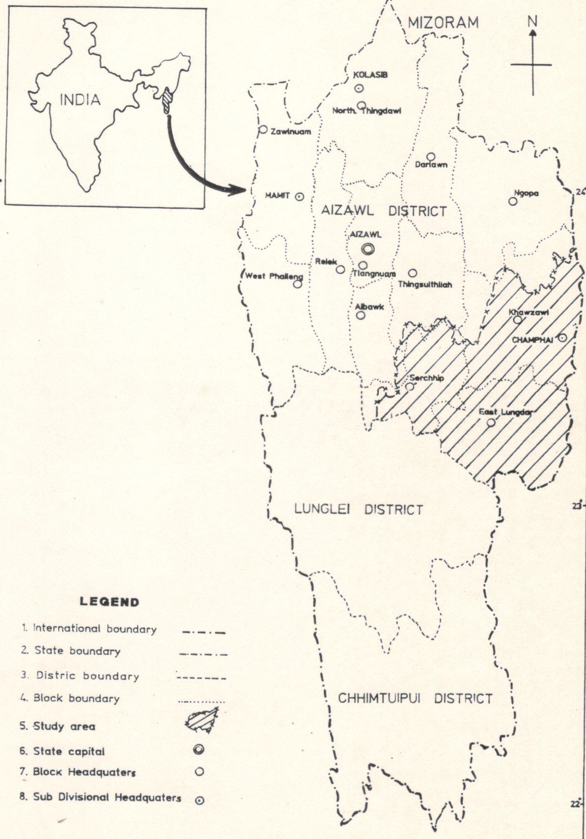
Integrated Mission for Sustainable Development (IMSD) Tuipui Watershed, Aizawl District, Mizoram.
This report presents the Integrated Mission for Sustainable Development (IMSD) pilot implementation for the Tuipui watershed (Aizawl District, Mizoram), executed as a district-scale, multi-thematic, remote-sensing and GIS-based assessment to generate implementable, location-specific action plans for sustainable resource management. The principal objective was to demonstrate how satellite-derived thematic layers integrated with field surveys and socio-economic data can be used to diagnose land-resource status, prioritise interventions, and guide sectoral actions in forestry, agriculture, soil and water conservation, and livelihood enhancement within a watershed planning framework. The study was implemented as a phased, district-focused IMSD activity under technical guidance from NRSC/ISRO and with state collaboration through MIRSAC. It emphasized replicable methods, institutional capacity building, and production of GIS-ready datasets for operational planning. The methodology combined multi-temporal satellite image interpretation, thematic classification, and GIS overlay analysis with stratified ground surveys and stakeholder consultations. Core thematic maps produced included land use / land cover, slope and erosion susceptibility, soil types, hydrogeomorphology and drainage, groundwater potential zones, transport and settlement networks, and existing land-based infrastructure. These were integrated with socio-economic indicators and local needs assessments gathered through field visits to generate a set of area-specific recommendations. Standardized field-validation and mapping protocols were followed to ensure thematic consistency and to calibrate remotely sensed signatures against on-site observations. Key outcomes demonstrate the operational value of the IMSD approach for watershed planning. The project produced detailed, map-based diagnostics of resource distribution and degradation hotspots within the Tuipui catchment covering a pilot implementation area of 940 sqkm, enabling spatial prioritization of interventions such as priority afforestation/regeneration sites, slope stabilization and soil-conservation measures, targeted fodder and livelihood development zones, and water-harvesting and groundwater recharge locations. The integrated analysis identified areas with high erosion risk and soil vulnerability, delineated zones of limited versus moderate groundwater potential, and highlighted settlement patterns and transport constraints that influence service delivery and intervention feasibility. The maps and GIS layers were packaged as decision-support products intended for direct use by the Planning Department , forest and watershed agencies, and local implementing units within the Khawzawl & East Lungdar Rural development block administrative jurisdiction. From a methodological standpoint the pilot study confirmed that remote sensing, when combined with systematic field validation, provides robust spatial coverage and repeatable workflows suited to district/watershed planning. The study highlighted several practical lessons: the need for high-resolution imagery or finer temporal sampling to resolve smallholder mosaic plots; the importance of stratified field sampling for accurate soil and hydrogeomorphic classification; and the benefit of close coordination with local stakeholders to align technical recommendations with ground realities. The report also presents a set of prioritized, site-specific action plans (forestry regeneration targets, soil-and-water conservation measures, fodder development and agricultural/horticultural interventions), together with implementation notes and institutional responsibilities to support follow-through.In conclusion, the Tuipui watershed pilot under IMSD delivered an integrated geospatial baseline and practical action plans that translate multi-thematic remote-sensing products into operational interventions for sustainable watershed development. Detailed quantitative results, including mapped area statistics by theme, priority site lists, and field-derived metrics that underpin the recommendations, are provided in the report and should be consulted for operational planning and monitoring purposes.Summarized MetadataMapping Scale: 1:50,000Satellite data & Year: IRS 1D, 1994-1995Thematic sub-category: Land & Water, Geology, Spatial PlanningCollaborating/Funding Agency: NRSC Hyderabad, RRSC Kharagpur & Department of SpaceReport Publication Month/Year: December, 1995