Environmental Studies of Lunglei town
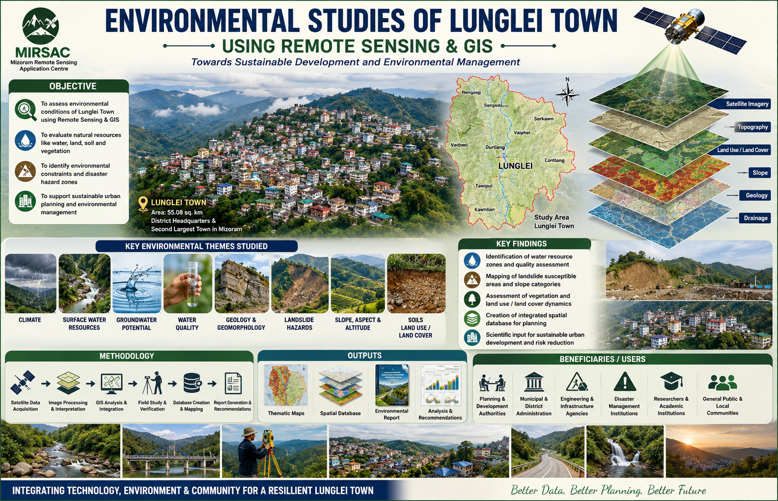
The Environmental Studies of Lunglei Town project was undertaken by the Mizoram Remote Sensing Application Centre (MIRSAC) under the Science, Technology & Environment Wing, Planning Department, Government of Mizoram, and completed in 2008. The study was initiated in response to increasing developmental pressure and environmental concerns in Lunglei, including heavy rainfall, unstable slopes and rock formations, seasonal water scarcity, vegetation degradation and uncontrolled human activities. The project recognized the need for a reliable environmental database to support more scientific and sustainable urban development. The study covered Lunglei Town, the headquarters of Lunglei District and the second-largest settlement in Mizoram, with an area of about 55.08 sq. km. The project applied Remote Sensing and Geographic Information System (GIS) technologies, supported by field investigations and other environmental datasets, to analyse the interrelationships between natural conditions and human activities. The major themes examined included climate, surface-water resources, groundwater potential, water quality, geology, geomorphology, landslide hazards, slope, aspect, altitude, soils and land use/land cover. The study also aimed to formulate recommendations for environmental management and future development planning. The project provides an integrated environmental framework for understanding the physical constraints and resource potential of Lunglei Town. Its thematic maps, spatial database, field observations and accompanying report are valuable for urban and infrastructure planning, water-resource management, landslide-risk reduction, land-use regulation, environmental conservation and identification of suitable areas for future development. The generated information is particularly useful to the Planning Department, municipal and district authorities, engineering and development agencies, disaster-management institutions, researchers and other government departments requiring reliable environmental baseline data. By bringing multiple environmental parameters into a common geospatial framework, the project provides an important reference for monitoring environmental change and promoting safer, better informed and more sustainable development of Lunglei Town. Summarize Metadata Mapping Scale: 1:10,000 Satellite data & Year: ResourceSat – LISS IV (2007) & Cartosat-1 (2006) Study area: Lunglei town Collaborating/Funding Agency: Science & Technology wing, Planning Department No. of Report(s) published: 1 Project Period: 2007 – 2008
Natural Resources Mapping of Mizoram
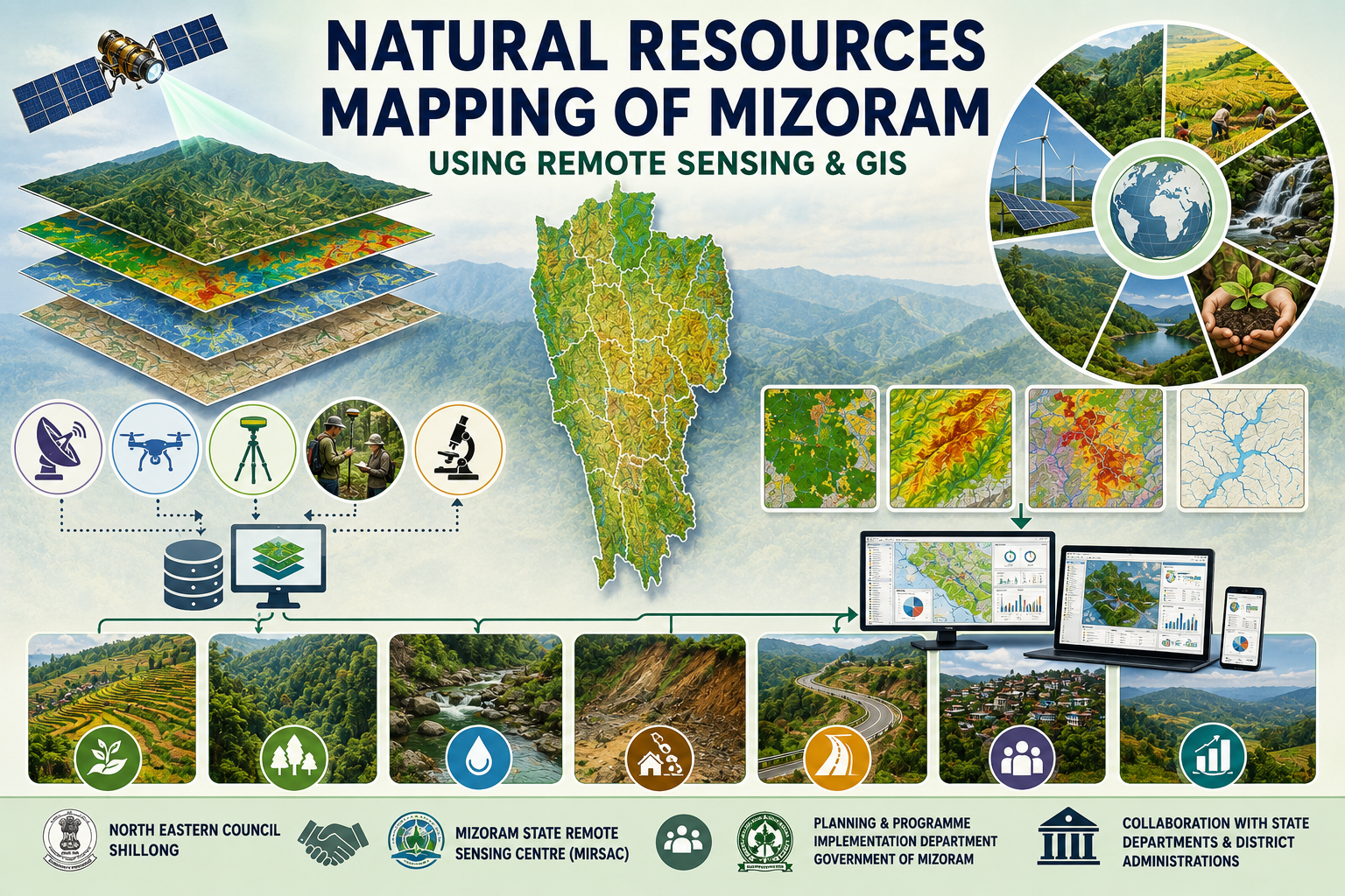
The Natural Resources Mapping of Mizoram using Remote Sensing and GIS is a flagship geospatial resource inventory project undertaken by the Mizoram State Remote Sensing Centre (MSRSC) under the Science, Technology & Environment Wing, Planning Department, Government of Mizoram, with financial support from the North Eastern Council (NEC), Shillong. Initiated in 2004 as a three-year programme, the project was implemented in a district-wise phased manner to systematically cover the entire state and develop a comprehensive geospatial database of Mizoram's natural resources. It represents one of the earliest large-scale initiatives in the state to integrate satellite Remote sensing and Geographic Information System (GIS) technologies for natural resource assessment and development planning. The primary objective of the project was to create standardized thematic maps and digital spatial databases covering the state's major natural resources, thereby providing reliable scientific information for sustainable planning and management. Using high-resolution Indian Remote Sensing (IRS-1D LISS-III and Panchromatic) satellite imagery, supported by Survey of India topographic maps, field verification, GPS and GIS-based spatial analysis, the project generated a comprehensive inventory of natural resources across Mizoram. Major thematic layers include land use/land cover, geology, geomorphology, soils, drainage, watershed boundaries, groundwater potential, slope, aspect, transport network, and settlements. These thematic datasets were digitized and integrated within a GIS environment to enable spatial analysis and preparation of resource-based action plans. The project covered the entire geographical extent of Mizoram, encompassing its diverse physiographic regions, mountainous terrain, river basins, forests, agricultural landscapes, and rural settlements. By adopting a uniform methodology across all districts, the project established a consistent and scientifically validated geospatial database capable of supporting planning at district, watershed, and state levels. The integrated assessment provides a holistic understanding of the interrelationships between land, water, terrain, and other natural resources, facilitating informed decision-making for sustainable development. One of the most significant outcomes of the project is the creation of statewide natural resources information that serves as a valuable reference for government departments, researchers, planners, academic institutions, and development agencies. The thematic maps and digital databases provide critical baseline information for watershed management, agriculture and horticulture development, forestry, groundwater exploration, infrastructure planning, disaster risk reduction, environmental conservation, and land capability assessment. The project also enables resource monitoring, identification of development potential, and formulation of scientifically based action plans tailored to local conditions. By demonstrating the effective integration of Remote Sensing, GIS, GPS, and field observations, the project established a modern framework for geospatial planning in Mizoram. Even today, the datasets and reports generated under this initiative remain an important repository of baseline information for multidisciplinary research, policy formulation, environmental assessment, and evidence-based planning. As one of the pioneering state-wide geospatial mapping programmes supported by the North Eastern Council, the project has significantly strengthened the application of space technology in natural resource management and continues to provide lasting value for the sustainable development of Mizoram. Summarize Metadata Mapping Scale: 1:50,000 Satellite data & Year: IRS 1D PAN & LISS III (2003 & 2004) – Digital & Photo print Study area: Mizoram Collaborating/Funding Agency: North Eastern Council (NEC), Shillong No. of Report(s) published: 8 Project Period: 2004 – 2007
Environmental Studies of Aizawl City
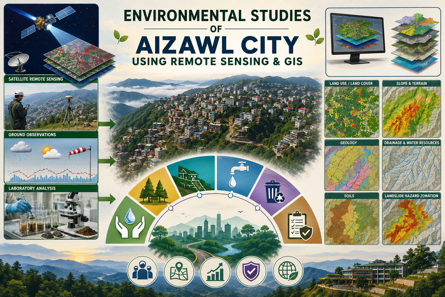
The project "Environmental Studies of Aizawl City Using Remote Sensing and GIS", undertaken by the Mizoram State Remote Sensing Centre (MSRSC), was designed to develop a comprehensive geospatial database for assessing the environmental status of Aizawl city and to provide scientific inputs for sustainable urban planning. Rapid population growth, unplanned expansion, and increasing developmental activities on the city's fragile hill slopes have intensified environmental problems, including landslides, soil erosion, water scarcity, degradation of natural vegetation, and inadequate urban infrastructure. The study demonstrates the application of Remote Sensing (RS) and Geographic Information System (GIS) technologies as effective tools for integrated environmental assessment and decision support. The study covers the entire Aizawl Municipal Area (approximately 12,900 ha) situated between 23°39'–23°50' N latitude and 92°39'–92°47' E longitude. Multi-source satellite imagery, Survey of India topographic maps, geological and meteorological data, field investigations, GPS observations, and laboratory analyses were integrated within a GIS environment to generate a series of thematic layers. These include land use/land cover, geology, geomorphology, soils, drainage, water resources, terrain characteristics (slope, aspect and elevation), infrastructure, and landslide hazard zonation. The investigation revealed that urban development has largely occurred along narrow ridge tops and steep hill slopes, many exceeding 35–45% slope, significantly increasing the city's vulnerability to slope failures. Geological analysis showed that the folded sedimentary formations of the Surma Group, together with intense monsoonal rainfall exceeding 2,000 mm annually, constitute the primary natural factors responsible for frequent landslides and severe soil erosion. Updated land use mapping indicated rapid expansion of built-up areas at the expense of forests and open spaces, reflecting the city's continued urban sprawl. Water resource assessment identified increasing pressure on both surface and groundwater supplies due to rising population and urban demand, while soil investigations highlighted the prevalence of acidic, erosion-prone soils whose productivity declines rapidly following vegetation removal. An important outcome of the project was the preparation of a GIS-based land capability and water resources plan, landslide hazard zonation, drainage, slope, soil and land use information to identify areas of varying instability which could aid in natural resource based and scientific development of the city. The study also established a comprehensive environmental database that supports resource inventory, hazard assessment and long-term urban monitoring. Based on the findings, the project recommends scientific land-use zoning, regulation of construction on unstable slopes, watershed conservation, afforestation, improved drainage and solid waste management, protection of water sources, and continuous environmental monitoring using GIS. Overall, the study demonstrates that the integration of Remote Sensing and GIS provides a robust scientific framework for urban environmental management, enabling planners and policymakers to balance future urban growth with environmental conservation and disaster risk reduction in Aizawl city. Summarize Metadata Mapping Scale: 1:12,500 Satellite data & Year: IRS 1D PAN (February 2001) & LISS III (May 2002) Study area: Aizawl City Collaborating/Funding Agency: Science, Technology & Environment Wing, Planning Department, Government of Mizoram No. of Report(s) published: 1 Project Period: 2001 - 2005
National Natural Resources Information System (NRIS)
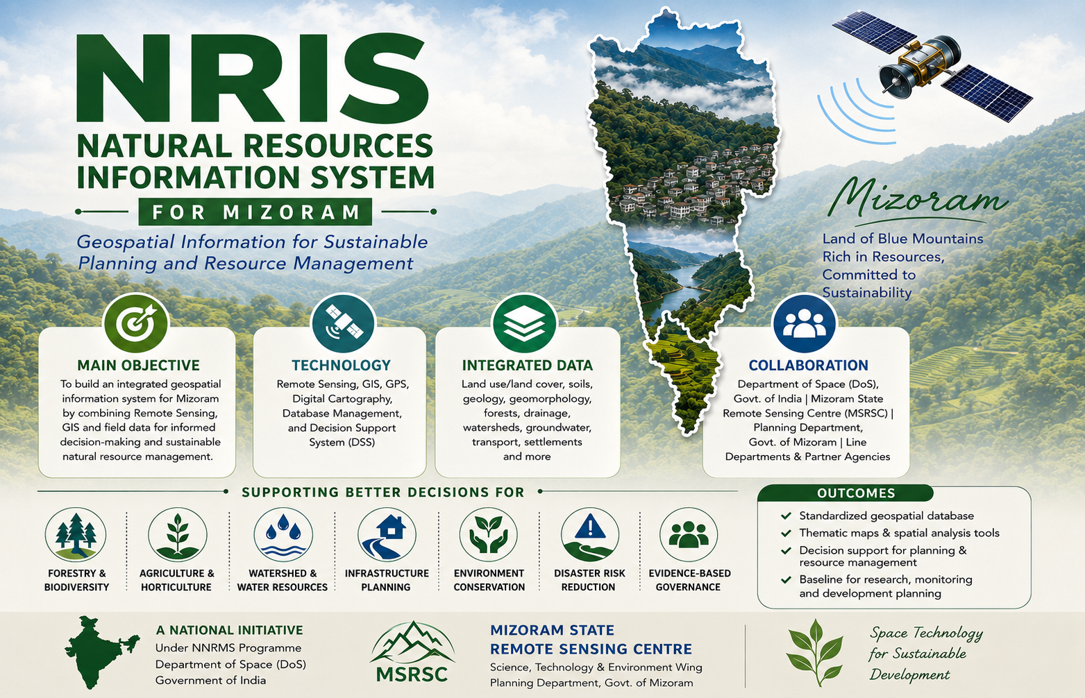
The National (Natural) Resources Information System (NRIS) for Mizoram was established as a strategic geospatial information initiative under the National Natural Resources Management System (NNRMS) of the Department of Space (DoS), Government of India, with implementation carried out by the Mizoram State Remote Sensing Centre (MSRSC) in collaboration with the State Planning Department and other resource management agencies. Initiated during 1996, it was conceived as part of India's national effort to integrate Remote Sensing, Geographic Information System (GIS), and spatial databases into the planning process, the project aimed to create a standardized and interoperable digital information system that supports evidence-based decision-making for sustainable natural resource management and regional development across Mizoram. The principal objective of the project was to develop an integrated Natural Resources Information System (NRIS) capable of storing, managing, analysing, and disseminating geospatial information on the state's natural resources within a unified GIS framework. Building upon the extensive resource (Eg: IMSD), the project consolidated diverse thematic datasets into a structured spatial database that could be readily accessed and utilized by planners, administrators, researchers, and technical users. The system was designed not merely as a repository of maps, but as a comprehensive Decision Support System (DSS) that enables users to visualize, query, analyse, and integrate spatial information for planning and resource management. The project encompasses the entire state of Mizoram, covering its varied physiographic regions, forests, agricultural landscapes, watersheds, river systems, and human settlements. Using satellite remote sensing, GIS, GPS-assisted field surveys, digital cartography, database management systems, and network-based information architecture, the project integrated thematic information on land use and land cover, forests, soils, geology, geomorphology, drainage, watersheds, groundwater potential, transportation, settlements, administrative boundaries, and other natural resource domains into a standardized geospatial database. The adoption of common data standards, digital map specifications, metadata protocols, and GIS-based analytical tools ensured compatibility between datasets while facilitating seamless information sharing across different government departments and planning agencies. One of the distinguishing features of NRIS is its emphasis on integrated spatial decision support rather than conventional map production. The system enables users to perform spatial queries, overlay analysis, resource evaluation, thematic visualization, and customized modelling to address a wide range of planning requirements. By linking geospatial information with administrative and developmental databases, NRIS supports applications in land-use planning, watershed management, agriculture and horticulture development, forestry, groundwater exploration, infrastructure planning, disaster management, environmental conservation, urban planning, and rural development. The standardized spatial framework also facilitates inter-departmental coordination, minimizes duplication of mapping efforts, and promotes the use of a common geospatial reference for planning activities. As one of the pioneering geospatial information infrastructures developed for Mizoram, the project has significantly strengthened the adoption of GIS-based planning within the State. The digital databases, thematic maps, and analytical capabilities generated under NRIS continue to serve as valuable baseline resources for government departments, academic institutions, researchers, consultants, and development agencies. By transforming large volumes of spatial data into an accessible and user-oriented information system, NRIS has laid the foundation for informed decision-making, multidisciplinary research, and sustainable natural resource management. The project remains an important milestone in the evolution of geospatial technologies in Mizoram and continues to support evidence-based governance through the effective integration of space technology with developmental planning. Summarize Metadata Mapping Scale: 1:50,000 (District level); 1:250,000 (State/Regional level) Satellite data & Year: IRS 1D LISS III (1999) & available reference data from previous projects Study area: Mizoram Collaborating/Funding Agency: Department of Space, Government of India No. of Report(s) published: 1 Project Period: 1998 – 2005
Integrated Mission for Sustainable Development (IMSD)
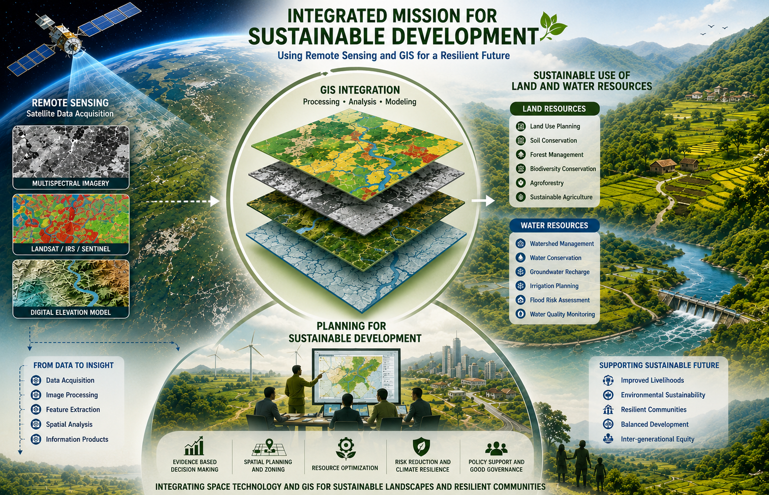
The Integrated Mission for Sustainable Development (IMSD) is a nation-wide remote-sensing application initiative launched under the Department of Space, Government of India, to provide spatially explicit natural-resource information and decision support for integrated, area-based planning and sustainable development. Originally developed with technical guidance and standardized field and mapping procedures captured in NRSC/IMSD technical guidelines, the mission established a replicable framework for producing multi-thematic geo-databases (land use/land cover, soils, slope, hydrogeomorphology, drainage and transport networks, settlements and related layers) which can be combined with socio-economic and meteorological data to produce localized action plans. In recognition of its practical value for district and regional planning, the approach has been accepted as a suitable methodology for integrated planning by central planning bodies and used widely across states to inform sectoral interventions. In Mizoram, the project was co-sponsored by the Government of Mizoram and entrusted to the Mizoram State Remote Sensing Application Centre (MIRSAC, formerly MSRSC) for implementation, with technical oversight and inputs from ISRO Headquarters, National Remote Sensing Centre (NRSC), Hyderabad, and RRSC, Kharagpur. The state-level execution followed a phased, district-wise rollout so that each district could receive tailored mapping, field survey support and an action plan prepared from integrated thematic maps and ground surveys. Field reconnaissance and stratified ground truthing were combined with satellite image interpretation and GIS processing to ensure thematic consistency and to calibrate remote-sensing signatures for local conditions. The project emphasized institutional collaboration, capacity building of state technical staff, and the creation of GIS-ready spatial databases that could be maintained and updated by state agencies for iterative planning and monitoring. The principal objective was to generate local-specific, implementable action plans by synthesizing natural-resource thematic maps with socio-economic needs assessments gathered through on-site surveys. These action plans are designed to translate map-based diagnostics into sectoral interventions: forest management and regeneration (including identification of degraded and priority regeneration sites), fodder resource development, targeted agricultural and horticultural development, soil and slope conservation measures, water-resource management (catchment and groundwater interventions), rural infrastructure and settlement planning, and livelihood enhancement activities. The resulting outputs comprise thematic maps, area statistics, land-use change indicators, GIS layers for decision support, and a set of prioritized, site-specific recommendations and implementation steps intended for departmental, village council and programme managers. Operationally, IMSD products serve three linked purposes: (1) to provide an evidence base for integrated, cross-sectoral planning at district and sub-district scales; (2) to identify spatial priorities for conservation and development interventions; and (3) to build state capacity for ongoing monitoring and periodic updating of resource inventories. Lessons from the Mizoram implementation emphasize the need for systematic field validation, periodic updating of imagery, and close coordination between technical agencies and local stakeholders to translate spatial plans into effective on-ground actions. The IMSD framework therefore remains a practical template for scaling remote-sensing-based planning across administrative units and for embedding geospatial information into sustainable development practice. Summarize Metadata Mapping Scale: 1:50,000 Satellite data & Year: IRS 1A/1B (1995-1996) & IRS 1C/1D (1998-2002) Study area: Tuipui watershed, Part of Aizawl district, Part of Chhimtuipui district, Part of Lunglei district, Lunglei district, Saiha & Lawngtlai district. Collaborating/Funding Agency: Mizoram State Remote Sensing Application Centre (MSRSC) No. of Reports published: 6 Project Period: 1995 - 2002