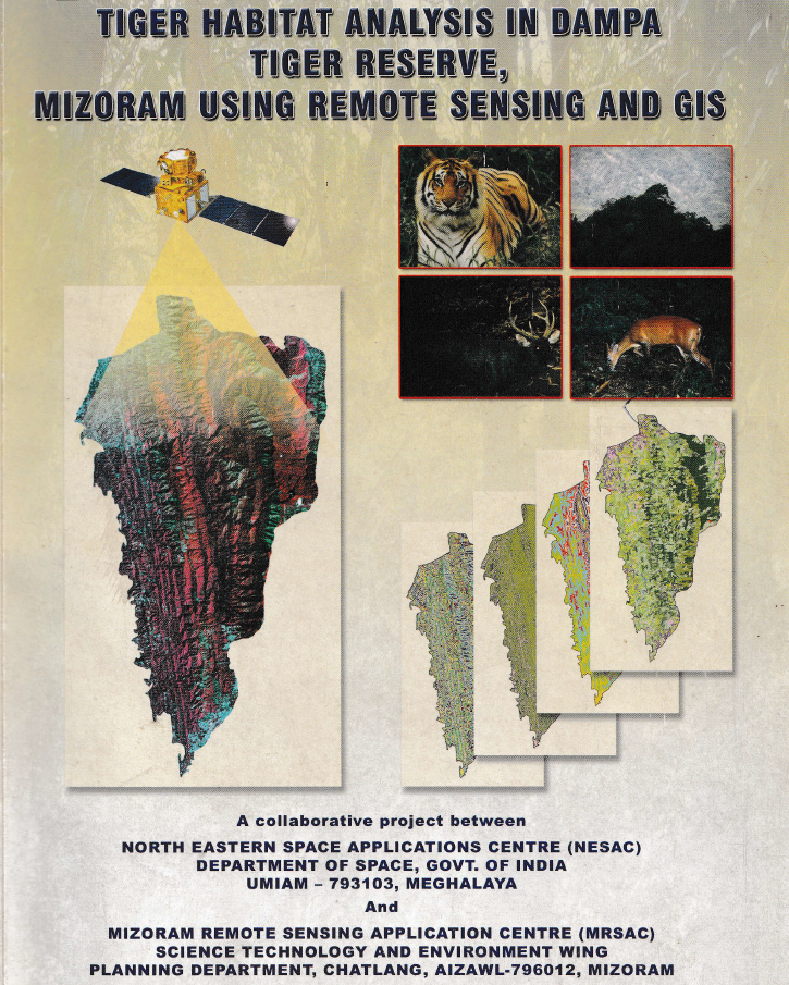
Tiger Habitat Analysis in Dampa Tiger Reserve, Mizoram using Remote Sensing and GIS
The project “Tiger Habitat Analysis in Dampa Tiger Reserve, Mizoram using Remote Sensing and GIS” was undertaken to evaluate the condition, change and suitability of tiger habitat within Dampa Tiger Reserve and its adjoining landscape, and to support scientific conservation and management planning. The study aimed to inventory vegetation types, forest density and water bodies; detect habitat changes between 1978 and 2005; characterize preferred tiger habitat; identify potential habitat and corridors outside the reserve; and develop a digital GIS database for long-term monitoring and management.A multi-temporal remote sensing approach was adopted using Landsat MSS (1978), Landsat TM (1989), IRS-1D LISS-III (1999), IRS-1D PAN (2003) and IRS-P6 LISS-III (2005) imagery, supplemented by reserve boundaries, socio-economic information on surrounding villages and field observations. Vegetation type, forest density, slope, aspect, elevation, proximity to water and tiger pug-mark locations were integrated through GIS-based spatial modelling to derive habitat-suitability classes. Tiger pug marks were treated as indicators of habitat use, and areas associated with higher pug-mark occurrence were interpreted as relatively more suitable habitat.The most significant result was the substantial alteration of forest structure over the 27-year assessment period. Closed evergreen/semi-evergreen forest declined from 36.62% of the reserve in 1978 to 22.88% in 2005, representing a 37.52% reduction. In contrast, bamboo increased by 192.89%, scrub forest by 74.67%, and built-up land by 590%, although the latter remained small in absolute extent. Abandoned jhum declined by 51.52%, while current jhum showed an overall decline of 35.41% between 1978 and 2005 after initially increasing during 1978–1989. The study concludes that much of the original closed forest was replaced by bamboo, scrub and shifting-cultivation landscapes, resulting in increasing fragmentation of tiger habitat.Habitat analysis indicated that closed evergreen/semi-evergreen forests with forest density above 40% were most favourable for tiger use. Areas within 500 m of major rivers were considered highly suitable, while 500–2,000 m distances were moderately suitable. Pug-mark analysis further suggested a strong avoidance of human disturbance: tigers maintained distances of approximately 20 km from the northern inhabited buffer and 25 km from the eastern inhabited buffer, compared with about 10 km from the less-disturbed southern buffer.The surrounding buffer also showed considerable anthropogenic pressure, with current jhum occupying 24.45%, scrub forest 16.32%, abandoned jhum 14.26%, and bamboo 13.14% of the analyzed 5,192.01 ha buffer landscape. Overall, the study identified habitat degradation and shifting cultivation rather than poaching as major constraints on tiger population recovery. The resulting habitat-suitability maps, change-detection products and GIS database provide a valuable scientific basis for habitat restoration, corridor protection, buffer-zone management, monitoring of forest degradation and long-term conservation planning in Dampa Tiger Reserve. Summarized MetadataMapping Scale: 1:50,000 Satellite data & Year: Landsat MSS (1978), Landsat TM (1989), IRS 1D LISS III (1999), IRS 1D PAN (2003), IRS P6 LISS-III (2005).Thematic sub-category: Forestry & EnvironmentCollaborating/Funding Agency: North Eastern Space Applications Centre (NESAC) & Environment & Forest Department, Government of Mizoram.Report Publication Month/Year: October, 2008
Mapping of Forest Administrative Boundary of Mizoram
The project “Mapping of Forest Administrative Boundary of Mizoram using Remote Sensing and GIS” was undertaken by the Mizoram Remote Sensing Application Centre (MRSAC) as an in-house initiative under the Centre’s Annual Plan for 2007–08. The study responded to the need for a standardized and spatially accurate representation of forest administrative jurisdictions in Mizoram, where extensive forest resources, rugged terrain and multiple management authorities make conventional boundary compilation difficult. Its principal objective was to prepare digital forest administrative boundary maps extending from Circle and Division levels down to Forest Ranges, thereby creating a dependable geospatial reference for forest conservation, administration and development planning.The project covered the entire 21,087 sq. km geographical area of Mizoram. Its database incorporated IRS-1D LISS-III satellite imagery, acquired in January 2006, Survey of India topographical sheets at 1:50,000 scale, Forest Department records, field observations and locally obtained information for inaccessible areas. The imagery was geometrically registered and interpreted using ERDAS Imagine, while boundary digitization, integration and analysis were carried out using ARC/INFO GIS. Hand-held GPS instruments supported field verification of selected Forest Division and Range boundaries. The workflow involved pre-field interpretation, ground verification and post-field correction, followed by cross-checking against departmental and ancillary records.A significant finding of the study was that several inconsistencies and anomalies existed in the available administrative records and maps. These were identified, reconciled and corrected through the integration of satellite imagery, GIS analysis, field evidence and institutional inputs. The completed database represented three Territorial Circles comprising 10 Territorial Forest Divisions and 60 Ranges. It also mapped the Wildlife Circle, consisting of the Wildlife Division, Dampa Tiger Reserve and Lawngtlai Wildlife Division, together comprising 10 wildlife ranges or management units. Forest jurisdictions administered by the Lai, Mara and Chakma Autonomous District Councils were separately documented through three Forest Divisions and 13 Ranges. In total, the project spatially organized 16 territorial, wildlife and Autonomous District Council forest divisions and approximately 83 constituent ranges or management units.The principal outputs include detailed administrative maps for individual Forest Divisions, Wildlife Divisions, protected areas, Dampa Tiger Reserve and Autonomous District Council forest jurisdictions, supported by spatial and non-spatial attributes. A consolidated forest administrative boundary map for the whole State was also prepared at 1:250,000 scale.The project established an important digital baseline for the Environment and Forest Department. Its maps and GIS database support working-plan preparation, jurisdictional clarification, forest monitoring, protected-area management, field administration, infrastructure planning and inter-departmental coordination. The data can also be integrated with forest cover, biodiversity, land use, watersheds, roads and settlements, making the report a valuable reference for forest managers, planners, researchers and decision-makers engaged in the sustainable management of Mizoram’s forest resources.Summarized MetadataMapping Scale: 1:50,000 Satellite data & Year: IRS 1D LISS III (2006)Thematic sub-category: Forestry, Administrative boundaryCollaborating/Funding Agency: Mizoram Remote Sensing Application CentreReport Publication Month/Year: March, 2008
Mapping of Agriculture/Horticulture Potential areas within R.Tut Riverine Reserve Forest, Mamit District
The project “Mapping of Agriculture and Horticulture Potential Areas within R. Tut Riverine Reserve Forest, Mamit District, Mizoram using Remote Sensing and GIS” was undertaken by the Mizoram Remote Sensing Application Centre, with sponsorship from the Environment and Forest Department, Government of Mizoram. The study was conceived to identify cultivable land within the legally protected riverine reserve and to provide a scientific basis for evaluating possible agricultural and horticultural development in accordance with the Forest (Conservation) Act, 1980. The study area covered the River Tut Riverine Reserve Forest, extending approximately 800 metres on both sides of the river, with a total mapped area of 141.85 sq. km.The assessment integrated IRS-1D LISS-III satellite data acquired in January 2006, IRS-P5 Cartosat-I stereo data acquired during 2006, Survey of India topographic maps, field observations and departmental information. Image processing and preliminary interpretation were carried out using ERDAS Imagine, while GIS integration, slope generation, thematic overlay and area computation were performed using ARC/INFO. Ground verification included GPS-based observations of wetland rice fields, plantations, forest types and potentially cultivable areas, supplemented by information from Forest, Agriculture and Horticulture authorities and local residents.Land-use analysis showed that bamboo forest was the dominant cover, occupying 76.45 sq. km or 53.90% of the study area. Dense, medium-dense and open forests together accounted for 38.80 sq. km, while current and abandoned shifting cultivation occupied 11.34 sq. km. Existing kharif cropland and agriculture-horticulture plantations covered only 1.97 sq. km and 0.45 sq. km, respectively, indicating that much of the cultivation potential had not yet been developed. Slope assessment revealed that the largest class was the 35–50% slope category, covering 38.79 sq. km or 27.34%, although several low-lying valley and foothill areas suitable for wetland cultivation were also identified.Land-capability analysis classified the area into five capability subclasses. The largest class was IVe, covering 40.59%, representing land suitable for agro-horticulture, sericulture and silvipastoral development with appropriate erosion-control measures. Class IIe and IIIe lands, considered suitable for agriculture and horticulture, together accounted for approximately 28.29% of the study area.The integrated suitability analysis identified 15.18 sq. km or 10.70% as potential agricultural land, mainly for wetland rice and double cropping in valley bottoms and foothills. A substantially larger area of 82.29 sq. km or 58.01% was assessed as suitable for horticulture and agroforestry. The potential areas were further divided into 36 sectors, each mapped at 1:25,000 scale to support site-specific planning.Overall, the project produced a detailed spatial database and sector-wise maps for balancing agricultural development with forest conservation. The outputs provide valuable decision support for evaluating forest-diversion proposals, planning irrigation and crop development, prioritizing field verification and implementing environmentally responsible agriculture and horticulture programmes in Mamit District. Summarized MetadataMapping Scale: 1:50,000 Satellite data & Year: IRS 1D – LISS III (2006); Cartosat-1 (April & December, 2006)Thematic sub-category: Agriculture/Horticulture, ForestryCollaborating/Funding Agency: Environment & Forest Department, Government of MizoramReport Publication Month/Year: March, 2008