Natural Resources Atlas of Mizoram
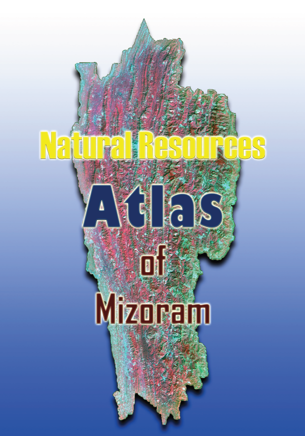
The Atlas of Natural Resources of Mizoram is a comprehensive geospatial reference publication prepared by the Mizoram State Remote Sensing Centre (MSRSC) under the Science, Technology & Environment Wing, Planning Department, Government of Mizoram. Published in 2009, the Atlas represents the culmination of the Natural Resources Mapping of Mizoram project, a state-wide initiative funded by the North Eastern Council (NEC), Shillong, and subsequently supported by the Government of Mizoram for the compilation and publication of this integrated reference volume. Unlike the individual district reports, which present detailed technical analyses, the Atlas consolidates the findings from all districts into a single, visually rich document that provides a comprehensive overview of Mizoram's natural resources through thematic maps, state-wide statistics, and spatial analyses.Prepared using Remote Sensing, Geographic Information System (GIS), GPS-based field verification, and conventional resource surveys, the Atlas integrates information derived from high-resolution IRS satellite imagery with field observations and existing geoscientific data. It presents an extensive collection of standardized maps covering major natural resource themes, including land use land cover, geology, geomorphology, soils, drainage, watersheds, groundwater potential, slope, aspect, elevation, transportation networks, settlements, and integrated land and water resource development action plans. In addition to district-wise thematic maps, the Atlas introduces consolidated state-level resource inventories and statistical summaries, enabling readers to visualize the spatial distribution, extent, and diversity of Mizoram's natural resources at a broader regional scale.One of the principal strengths of the Atlas lies in its ability to transform large volumes of technical geospatial information into an accessible and user-friendly reference. By combining district-level datasets into a unified state-wide perspective, it highlights regional variations in terrain, forest resources, agricultural landscapes, watershed systems, soil characteristics, groundwater prospects, and land capability. The Atlas also provides valuable insights into the distribution of shifting cultivation, forest cover, bamboo resources, and environmentally sensitive areas, thereby serving as an important baseline for monitoring land-use change and supporting evidence-based environmental planning. The standardized thematic maps facilitate comparison across districts and offer an integrated understanding of the interrelationships between natural resources, physiography, and developmental potential.Designed as a multidisciplinary reference, the Atlas serves a wide spectrum of users, including government departments, planners, researchers, academic institutions, engineers, environmental managers, and policymakers. The information compiled within the Atlas supports applications in watershed management, forestry, agriculture, horticulture, infrastructure planning, groundwater exploration, disaster risk reduction, biodiversity conservation, environmental impact assessment, and sustainable regional development. Even years after its publication, the Atlas continues to serve as an invaluable baseline document for geospatial planning and natural resource management in Mizoram.User Advisory: Owing to the inclusion of numerous high-resolution thematic maps covering the entire State of Mizoram, the digital version of this Atlas is large in size (exceeding 300 MB). Users should expect longer download times depending on their internet connection, and opening the document may require considerable system memory and processing resources, particularly on older computers or mobile devices. For users requiring only a quick overview of the state's natural resources, a condensed edition containing the consolidated state-wide maps and statistical summaries is also available upon request, offering a more lightweight and convenient alternative for general reference.Summarized MetadataMapping Scale: 1:50,000Satellite data & Year: IRS 1D PAN & LISS III (2003 & 2004) Thematic sub-category: Land Use/Land Cover, Geology, Water resource, Climate, Action Plan Collaborating/Funding Agency: Science, Technology & Environment Wing, Planning Department, Government of MizoramReport Publication Month/Year: June, 2009
Environmental Studies of Lunglei town using Remote Sensing and GIS
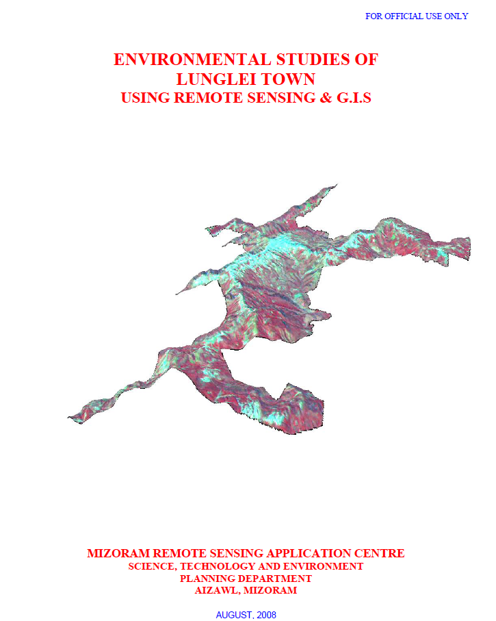
The project “Environmental Studies of Lunglei Town using Remote Sensing & GIS”, undertaken by the Mizoram Remote Sensing Application Centre (MIRSAC), Science, Technology & Environment, Planning Department, Government of Mizoram, and published in August 2008, was designed to develop an integrated environmental database for sustainable urban planning in Lunglei. The study addressed growing concerns associated with heavy rainfall, unstable slopes and rocks, water scarcity during the dry season, vegetation degradation, pollution and expanding human activities. Its objectives covered the assessment of climate, surface-water resources, groundwater potential, water quality, geology, geomorphology, landslide hazards, slope, aspect, altitude, soils and land use/land cover, culminating in recommendations for environmental management and development planning.The study covered 55.08 sq. km of Lunglei Town, the second-largest settlement in Mizoram. It employed Cartosat-I PAN data (2006), Resourcesat LISS-IV data (2007), Survey of India topographic sheets, meteorological and socio-economic information, departmental records and extensive ground observations. Image processing and interpretation were carried out using ERDAS Imagine, while spatial integration and analysis were undertaken in ARC/INFO GIS. Field verification included handheld GPS observations of landslides, springs, wells, geology and vegetation, along with soil sampling and laboratory analysis.The integrated assessment highlighted several environmental constraints. Groundwater potential mapping classified only 11.04% of the town as Very Good and 21.00% as Good, whereas 38.02% fell within the Poor category, indicating significant dependence on surface and harvested rainwater resources. The report notes an annual rainfall of approximately 3,352 mm and demonstrates that a 60 sq. m roof could theoretically harvest about 201,120 litres annually, underscoring the potential of rooftop rainwater harvesting.Landslide susceptibility emerged as another major concern. The study area forms part of the Lunglei anticline, characterized by steep slopes, soft sedimentary rocks, lineaments and faults, with about 45.32 km of mapped structural discontinuities. Landslide zonation incorporated slope, lithology, geomorphology, geological structure, land use, road cutting and known landslides. The Very High Hazard Zone alone covers 1.07 sq. km (1.94%), including parts of Theiriat, Hauruang, Hrangchalkawn, Bazar Veng and western Zotlang.Land-use analysis shows that built-up land occupies 6.77 sq. km (12.29%), while open and dense scrub together cover over 41%, reflecting extensive disturbed vegetation. Land-capability assessment further indicates that 38.44% of the area falls under Class IVe, suitable mainly for agro-horticulture and related uses with erosion-control measures, whereas only 1.70% represents good arable Class IIe land.Overall, the project established a multidisciplinary environmental baseline for Lunglei Town and demonstrated the value of integrating Remote Sensing, GIS and field investigations for urban environmental assessment. Its thematic maps, hazard information and resource databases provide an important scientific foundation for land-use regulation, water-resource development, landslide mitigation, infrastructure planning, vegetation conservation and long-term sustainable urban development. Summarized MetadataMapping Scale: 1:10,000 Satellite data & Year: ResourceSat – LISS IV (2007) & Cartosat-1 (2006)Thematic sub-category: Multi-ThematicCollaborating/Funding Agency: Science & Technology wing, Planning DepartmentReport Publication Month/Year: August, 2008
Natural Resources Mapping of Saiha District using Remote Sensing and GIS
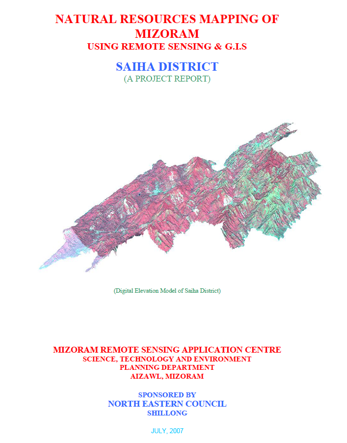
The Natural Resources Mapping of Saiha District using Remote Sensing and GIS was undertaken by the Mizoram State Remote Sensing Centre (MSRSC), Science, Technology & Environment Wing, Planning Department, Government of Mizoram, under the Natural Resources Mapping of Mizoram programme funded by the North Eastern Council (NEC), Shillong. The project formed part of a comprehensive three-year state-wide initiative to develop an integrated geospatial database of Mizoram's natural resources using Remote Sensing (RS), Geographic Information System (GIS), GPS-assisted field surveys, and conventional resource investigations. Its primary objective was to generate reliable thematic information on the district's land, water, forest, and terrain resources to support scientific planning, sustainable development, and long-term natural resource management.The study encompasses the entire Saiha District, covering approximately 1,399.16 sq. km, or about 6.64% of Mizoram's geographical area. High-resolution IRS-1D LISS-III and Panchromatic satellite imagery, together with Survey of India topographic maps, geological data, meteorological records, soil surveys, and extensive field verification, were integrated within a GIS environment to prepare detailed thematic maps on land use/land cover, geology, geomorphology, drainage, watershed boundaries, groundwater potential, soils, slope, aspect, settlements, and transportation networks. The integration of these datasets enabled a comprehensive assessment of the district's natural resources and facilitated the preparation of integrated land and water resource development plans.The analysis shows that Saiha District is characterized by rugged structural hill ranges, deeply incised valleys, and a dense drainage network dominated by the Kolodyne (Chhimtuipui) River and its tributaries. Terrain analysis indicates that steep and moderately steep slopes occupy the majority of the district, significantly influencing land capability, settlement distribution, and agricultural practices. The district remains predominantly forested, with forest and bamboo forest together accounting for nearly 70% of the total geographical area, highlighting its importance as one of Mizoram's ecologically rich landscapes. The land use assessment also identifies current shifting cultivation (approximately 94 sq. km, 6.7%) and young abandoned jhum (around 166 sq. km, 11.9%) as major land-use categories, reflecting the continuing influence of traditional shifting cultivation on the landscape. Permanent agriculture and horticultural plantations occupy comparatively smaller but steadily expanding areas, particularly within valley bottoms and gentle slopes.Groundwater assessment indicates that poor groundwater potential predominates across nearly half of the district, largely due to the steep terrain and rapid runoff, while moderate groundwater potential occupies approximately one-third of the area, mainly along valleys and structurally favourable zones. Soil investigations reveal predominantly acidic hill soils derived from sedimentary rocks of the Surma Group, possessing moderate organic matter but requiring appropriate conservation measures because of their susceptibility to erosion on steep slopes. The watershed analysis further identifies priority areas for rainwater harvesting, soil conservation, and integrated watershed development.A major outcome of the project is the establishment of a district-level natural resources information integrating all thematic datasets within a GIS platform for resource evaluation and spatial planning. Based on the integrated assessment, the report recommends watershed development, afforestation, bamboo resource management, agroforestry, horticultural expansion, groundwater development, and scientific land capability-based planning to optimize resource utilization while conserving the district's fragile hill ecosystem.Overall, the study demonstrates the effectiveness of combining Remote Sensing, GIS, GPS, and field investigations for comprehensive natural resource assessment in mountainous regions. The thematic maps, digital databases, and resource development plans generated under the project provide an invaluable baseline for government agencies, planners, researchers, and development organizations, supporting evidence-based planning, environmental conservation, and sustainable management of Saiha District's diverse natural resources.Summarized MetadataMapping Scale: 1:50,000Satellite data & Year: IRS 1D PAN & LISS III (2003 & 2004) – Digital & Photo printThematic sub-category: Land Use/Land Cover, Geology, Water resource, Climate, Action Plan Collaborating/Funding Agency: North Eastern Council (NEC), ShillongReport Publication Month/Year: July, 2007
Natural Resources Mapping of Lawngtlai District using Remote Sensing and GIS
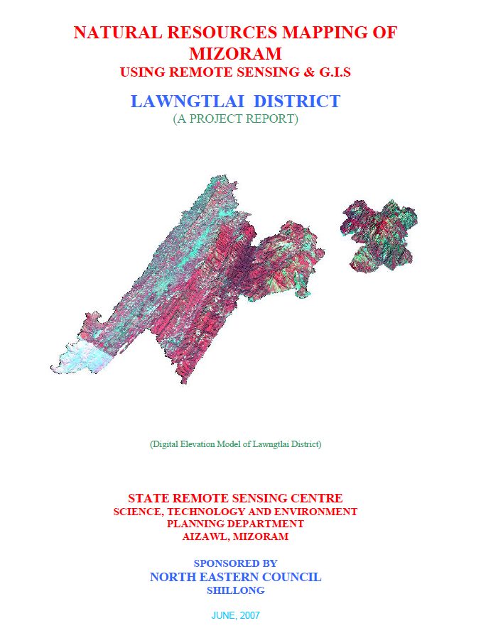
The Natural Resources Mapping of Lawngtlai District using Remote Sensing and GIS was undertaken by the Mizoram State Remote Sensing Centre (MSRSC), Science, Technology & Environment Wing, Planning Department, Government of Mizoram, under the Natural Resources Mapping of Mizoram programme sponsored by the North Eastern Council (NEC), Shillong. Executed as part of a three-year state-wide geospatial resource inventory, the project aimed to develop a comprehensive spatial database of Lawngtlai District by integrating Remote Sensing (RS), Geographic Information System (GIS), GPS-based field surveys, and conventional resource investigations. The principal objective was to generate standardized thematic information on the district's land, water, forest, and terrain resources to support scientific planning, sustainable development, and evidence-based natural resource management.The study covers the entire Lawngtlai District, encompassing approximately 2,557.10 sq. km in the southernmost part of Mizoram. The district is characterized by rugged north-south trending hill ranges, deeply dissected valleys, high rainfall, and extensive forest cover, making it one of the state's ecologically significant landscapes. The project utilized IRS-1D LISS-III and Panchromatic satellite imagery, Survey of India topographic maps, geological and meteorological records, soil surveys, and extensive field verification to prepare detailed thematic layers on land use/land cover, geology, geomorphology, drainage, watershed boundaries, groundwater potential, soils, slope, aspect, settlements, and transportation networks. These datasets were integrated within a GIS environment to create a district-level Natural Resources Information System (NRIS).The assessment indicates that the district is dominated by structural hills and steep slopes, which largely determine land capability, settlement patterns, and agricultural practices. Forest and bamboo forest constitute the predominant land-use categories, reflecting the district's rich biodiversity and relatively intact natural ecosystems. Nevertheless, current and abandoned shifting cultivation (jhum) continue to occupy substantial portions of the landscape, demonstrating the continued dependence of rural communities on traditional farming systems. The report also highlights the gradual expansion of horticultural plantations, wet rice cultivation, and permanent agriculture in suitable valleys and gentle slopes, indicating an ongoing transition towards more sustainable and diversified land-use practices.Groundwater investigations reveal that groundwater occurrence is primarily associated with fractured sandstone formations, valley fills, and gentle slopes, while the extensive hilly terrain generally exhibits poor to moderate groundwater potential because of steep gradients and rapid runoff. Soil investigations identify predominantly acidic hill soils with moderate organic carbon content and varying fertility, emphasizing the need for appropriate soil conservation and watershed management measures. The study also delineates watershed boundaries and drainage characteristics, providing valuable information for integrated water resource planning and rainwater harvesting initiatives.One of the major outcomes of the project is the development of an integrated natural resources information that combines multiple thematic datasets into a GIS platform for resource evaluation and spatial decision-making. Based on the integrated assessment, the report recommends watershed development, afforestation, agroforestry, bamboo resource management, groundwater development, horticultural expansion, soil and water conservation, and land capability-based planning to ensure sustainable utilization of natural resources while minimizing environmental degradation.Overall, the project demonstrates the effectiveness of integrating Remote Sensing, GIS, GPS, and field investigations for comprehensive natural resource assessment in mountainous environments. The thematic maps, digital databases, and resource development plans generated under the study provide a valuable baseline for government departments, planners, researchers, and development agencies, supporting sustainable land and water resource management, environmental conservation, infrastructure planning, and long-term regional development in Lawngtlai District.Summarized MetadataMapping Scale: 1:50,000Satellite data & Year: IRS 1D PAN & LISS III (2003 & 2004) – Digital & Photo printThematic sub-category: Land Use/Land Cover, Geology, Water resource, Climate, Action Plan Collaborating/Funding Agency: North Eastern Council (NEC), ShillongReport Publication Month/Year: June, 2007
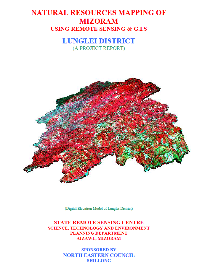
Natural Resources Mapping of Lunglei District using Remote Sensing and GIS
The Natural Resources Mapping of Lunglei District using Remote Sensing and GIS was undertaken by the Mizoram State Remote Sensing Centre (MSRSC), Science, Technology & Environment Wing, Planning Department, Government of Mizoram, under the Natural Resources Mapping of Mizoram programme sponsored by the North Eastern Council (NEC), Shillong. Implemented as part of a three-year state-wide geospatial resource inventory project, the study aimed to develop a comprehensive spatial database of Lunglei District through the integration of Remote Sensing (RS), Geographic Information System (GIS), GPS-assisted field surveys, and conventional resource investigations. The project sought to generate standardized thematic information for sustainable management of land, water, forests, and other natural resources while providing scientific inputs for district-level planning and long-term environmental management.The study covers the entire Lunglei District, one of the largest districts in Mizoram, extending over approximately 4,538 sq. km and accounting for nearly 21.5% of the state's geographical area. The project utilized IRS-1D LISS-III and Panchromatic satellite imagery, Survey of India topographic sheets, geological and meteorological records, soil investigations, and extensive ground verification to prepare a suite of thematic maps comprising land use/land cover, geology, geomorphology, drainage, watershed boundaries, groundwater prospects, soils, slope, aspect, settlements, and transportation networks. These datasets were integrated within a GIS environment to develop a district-level Natural Resources Information System capable of supporting multi-sectoral planning and resource evaluation.The assessment reveals that Lunglei District is characterized by rugged structural hill ranges, steep slopes, deeply dissected valleys, and an extensive drainage network dominated by the Tlawng, Mat, Tuichawng, Tuipui, and Kolodyne river systems. Terrain conditions strongly influence land capability, agricultural suitability, and settlement patterns. Forests remain the dominant land cover, with bamboo forests constituting the largest single vegetation category, followed by medium and dense forests, reflecting the district's rich biodiversity and ecological importance. The report also identifies current and abandoned shifting cultivation (jhum) as significant components of the landscape, indicating the continued dependence of rural communities on traditional agricultural practices. At the same time, the expansion of horticultural plantations, wet rice cultivation, and permanent agriculture in suitable valleys demonstrates a gradual shift towards more sustainable land-use systems.Groundwater assessment indicates that groundwater occurrence is largely controlled by fractured sandstone formations, valley fills, and topographic conditions, with moderate groundwater potential confined mainly to valley areas and gently sloping terrain, while the extensive hill regions generally exhibit limited groundwater prospects because of steep slopes and rapid surface runoff. Soil investigations reveal predominantly acidic hill soils with moderate organic matter content and varying fertility, emphasizing the importance of soil conservation and appropriate land capability-based planning.A major outcome of the project is the preparation of an integrated natural resources information that combines all thematic datasets within a GIS platform for spatial analysis and decision support. Based on the integrated resource assessment, the report recommends watershed development, rainwater harvesting, afforestation, agroforestry, horticultural expansion, groundwater development, bamboo resource management, and scientific land capability planning to ensure sustainable utilization of the district's natural resources while minimizing environmental degradation.Overall, the project demonstrates the effectiveness of integrating Remote Sensing, GIS, GPS, and field investigations for comprehensive natural resource assessment in mountainous environments. The thematic maps, digital databases, and resource development plans generated under the study provide an invaluable reference for government departments, planners, researchers, and development agencies, supporting evidence-based planning and the sustainable management of Lunglei District's diverse natural resources.Summarized MetadataMapping Scale: 1:50,000Satellite data & Year: IRS 1D PAN & LISS III (2003 & 2004) – Digital & Photo printThematic sub-category: Land Use/Land Cover, Geology, Water resource, Climate, Action Plan Collaborating/Funding Agency: North Eastern Council (NEC), ShillongReport Publication Month/Year: March, 2007