Urban sprawl study of Aizawl city
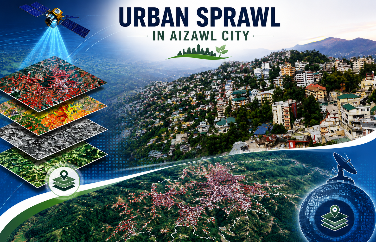
The Urban Sprawl Study of Aizawl City represents a pivotal collaboration between the North Eastern Space Applications Centre (NESAC), Department of Space, Government of India, Umiam, Meghalaya, and the Mizoram Remote Sensing Application Centre (MSRSC), Aizawl, Mizoram. Completed in October 2004 under the supervision of NESAC Director Shri K.C. Bhattacharyya, the project leveraged expertise from principal investigators like Shri ASRKV Murali Mohan (NESAC) and Dr. R.K. Lallianthanga (MIRSAC), alongside a multidisciplinary team of scientists specializing in remote sensing and GIS applications. The core technology employed integrated multi-temporal satellite remote sensing data including Landsat MSS, IRS-1C LISS-III/PAN merged products, and Resourcesat-1 LISS-III with advanced GIS tools for spatial analysis. Data were geometrically registered to 1:25,000 scale Survey of India topographical sheets, processed via visual/digital interpretation techniques, and enhanced with ground truth verification. This enabled precise thematic mapping of land use/land cover, slope (from DEM), transport networks, and surface water bodies, culminating in a comprehensive GIS database linking spatial layers with non-spatial socio-economic attributes from census records and household surveys. The main objective was to monitor Aizawl's urban expansion patterns, evaluate compliance with the 2002 Aizawl Master Plan, and delineate site suitability zones for future growth. Nestled in northern Mizoram's rugged terrain, Aizawl – the capital of Mizoram, faces acute topographic challenges like steep north-south aligned ridges, deep valleys, erosional landforms, acidic loamy soils, and moderate climate (208 cm annual rainfall). Rapid, unplanned sprawl along highways risks exacerbating congestion, water scarcity, erosion, and infrastructure deficits, making this study critically important for sustainable urban management in a hill-station context. The generated outputs such as urban sprawl maps, land use classifications, suitability zonations (prioritizing low-slope, road-proximate wastelands), and integrated databases are invaluable for city and town planning. Planners can use these to decongest the core, direct fringe development, enforce vertical limits, harness springs, and mitigate environmental risks. Aligned partially with the Master Plan, the data supports evidence-based zoning, infrastructure prioritization (e.g., roads, drainage), and policy formulation, fostering controlled growth that balances population pressures with ecological stability. This geospatial framework empowers local authorities, TCP departments, and policymakers to optimize land resources, enhance access to amenities, and promote resilient urbanism amid Aizawl's fragile geology. Summarize Metadata Mapping Scale: 1:25,000 Satellite data & Year: Landsat MSS (1981), IRS-1C (1998-2022), Resourcesat-1 (2003) Study area: Aizawl city (Urban). Collaborating/Funding Agency: North Eastern Space Applications Centre (NESAC), Umiam No. of Report(s) published: 1 Project Period: 2003 – 2004
Road Network Mapping of Mizoram
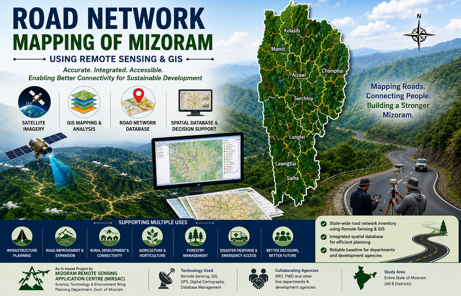
The Road Network Mapping of Mizoram using Remote Sensing and GIS was an in-house geospatial mapping project undertaken by the Mizoram Remote Sensing Application Centre (MSRSC) under the Science, Technology & Environment Wing, Planning Department, Government of Mizoram. Executed during 2003 and subsequently compiled into a comprehensive report, the project was initiated in recognition of the importance of an accurate and systematic inventory of the existing road infrastructure for transportation planning, infrastructure development, and the overall socio-economic growth of Mizoram. The study was undertaken at a time when reliable, spatially referenced information on the state's road network was essential for planning the improvement, expansion, and construction of roads across its challenging mountainous terrain. The principal objective of the project was to map and classify the existing road network of Mizoram, convert the mapped information into a digital GIS database, and make the resulting spatial information readily available to user departments. The project covered the entire geographical area of Mizoram, encompassing all eight districts—Kolasib, Mamit, Aizawl, Champhai, Serchhip, Lunglei, Lawngtlai, and Saiha. The state's rugged topography, narrow ridges, steep slopes, deeply dissected valleys, and international borders with Bangladesh and Myanmar make transportation infrastructure a particularly important component of regional development and connectivity planning. The project employed IRS-1D LISS-III and Panchromatic satellite imagery acquired in 2003, procured from the NRSA Data Centre, Hyderabad, as the primary source for identifying and mapping the road network. Satellite-derived information was supplemented by Survey of India topographic sheets, Census data, administrative and other collateral information, as well as ground verification and field observations undertaken to assess the accuracy of mapped road features. Standard Remote Sensing and GIS techniques were applied to interpret satellite imagery, delineate and classify road categories, digitize the mapped features, and integrate them into a spatial database. This approach provided a systematic and consistent means of generating road network information for the state, complementing conventional ground-based mapping methods. The project involved and provided information relevant to several agencies responsible for transportation and developmental infrastructure in Mizoram. These included the Border Roads Organisation (BRO), responsible for major strategic roads and National Highway infrastructure, the Public Works Department (PWD) for State Highways and district roads, and departments and agencies such as Rural Development, DRDA, Agriculture, Horticulture, and Forest, which are also involved in the development of minor roads and link roads. By providing a common spatial representation of the existing road network, the project helps establish a shared baseline for inter-departmental planning and coordination. The resulting road network maps and GIS database provide valuable baseline information for road improvement, expansion, connectivity assessment, infrastructure planning, and identification of areas requiring better transportation access. The datasets can also support planning in agriculture, horticulture, forestry, rural development, emergency response, and other sectors where accessibility and transportation connectivity are critical. Overall, the project demonstrated the practical application of satellite remote sensing and GIS for infrastructure inventory and planning and established an important geospatial reference for understanding Mizoram's transportation network and supporting future road development initiatives. Summarize Metadata Mapping Scale: 1:50,000 Satellite data & Year: IRS 1D LISS III & PAN (2003) Study area: Mizoram Collaborating/Funding Agency: Mizoram Remote Sensing Application Centre No. of Report(s) published: 1 Project Period: 2003 – 2006

Wastelands of Mizoram
The “Wastelands of Mizoram” project was undertaken as part of a nationwide initiative of the Department of Space, Government of India, coordinated through the National Remote Sensing Agency (NRSA), Hyderabad, to develop an updated and scientifically reliable inventory of wastelands across the country. In Mizoram, the project was implemented by the Mizoram State Remote Sensing Application Centre (MIRSAC) in close collaboration with NRSA, utilizing standardized methodologies and geospatial technologies to map, classify, and assess wastelands across all eight districts of the state. The primary objective of the project was to generate a comprehensive spatial database of wastelands and degraded land resources using satellite remote sensing and Geographic Information System (GIS) techniques. The study aimed to identify the extent, distribution, and characteristics of wasteland categories prevalent in Mizoram’s unique mountainous environment and to provide a scientific basis for land reclamation, restoration planning, and sustainable resource management. The project recognized the growing need for reliable geospatial information to support informed decision-making in a state where land-use dynamics are strongly influenced by shifting cultivation, forest resource utilization, and challenging terrain conditions. The project employed satellite imagery acquired from Indian Remote Sensing (IRS) satellites, supported by image interpretation, cartographic analysis, GIS integration, and field verification. These technologies enabled the systematic mapping of degraded lands at a uniform scale and facilitated the creation of district-wise and state-level spatial databases. The study covered the entire geographical extent of Mizoram, encompassing diverse physiographic regions ranging from densely forested hill ranges and river valleys to areas affected by land degradation arising from human and natural processes. A key outcome of the project is the generation of a standardized geospatial repository on wastelands that serves as an important reference for planners, policymakers, researchers, and development agencies. The thematic maps, spatial datasets, and accompanying reports provide valuable baseline information for identifying priority areas requiring intervention and for formulating land management strategies suited to local environmental conditions. The project also contributes to a better understanding of the relationship between land-use practices and landscape degradation, thereby supporting long-term planning for ecological restoration and sustainable development. The information generated through this project has significant practical value for a wide range of sectors, including forestry, agriculture, horticulture, watershed development, rural development, and environmental conservation. By providing accurate and spatially referenced information on degraded lands, the project supports the design of targeted reclamation programmes, afforestation initiatives, agroforestry interventions, and watershed management activities. As one of the earliest state-wide geospatial assessments of land degradation in Mizoram, the “Wastelands of Mizoram” project remains an important resource for evidence-based planning and sustainable management of the state’s land resources. Summarize Metadata Mapping Scale: 1:50,000 Satellite data & Year: IRS 1D LISS III (2003) Study area: Mizoram Collaborating/Funding Agency: National Remote Sensing Centre (NRSC), Hyderabad No. of Report(s) published: 8 Project Period: 2003 - 2004
Village level passion fruit site suitability maps of Champhai and Kolasib horticultural circles, Mizoram state
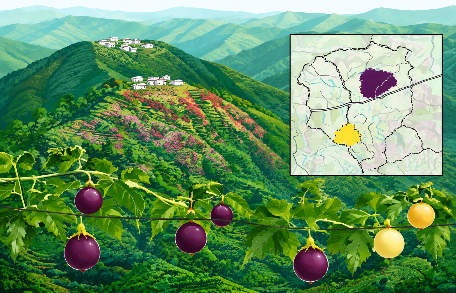
The “Village Level Passion Fruit Site Suitability Maps of Champhai and Kolasib Horticultural Circles, Mizoram State” project is a collaborative effort under the Technology Mission for Integrated Development of Horticulture in North Eastern States, funded by the Ministry of Agriculture, Government of India. It brings together the Space Applications Centre (ISRO), Mizoram State Remote Sensing Centre, and the Mizoram State Department of Horticulture, combining national remote sensing expertise with state-level GIS capabilities and field-based horticultural knowledge. The project’s core objective is to translate earlier passion fruit suitability analysis into operational village-level maps that clearly show where purple and yellow passion fruit orchards can be expanded within existing jhum (shifting cultivation) areas in Champhai and Kolasib circles. Building on prior work that identified suitable jhum patches using a passion fruit site suitability index, this report prepares detailed village maps and categorizes sites into Priority I and Priority II to guide phased orchard expansion under the Technology Mission. Technologically, the study relies on Indian Remote Sensing (IRS) satellite data, mainly IRS-1D LISS-III multispectral imagery, combined with digital elevation models and GIS-based spatial analysis. Village and settlement boundaries, road networks, drainage and soil maps are integrated with remote-sensing-derived current jhum layers to generate fine-scale suitability maps. The passion fruit suitability index uses key terrain parameters (elevation, slope, aspect) and agronomic requirements, while ancillary factors such as cluster size and proximity to roads, settlements and water sources are used for prioritization. The study area - Champhai and Kolasib horticultural circles within Mizoram’s hilly, high-rainfall landscape is of high strategic importance for horticulture-based livelihood diversification. Champhai already supports extensive purple passion fruit orchards and is envisaged as a major passion fruit belt, whereas Kolasib’s lower elevation and gentle slopes make it promising for yellow passion fruit, whose fruiting season complements the purple variety and supports year-round supply. The outputs including village-level maps for each settlement showing Priority I and II sites, backed by tabulated village statistics, provide practical tools not only for horticulture planning but also for broader city and town planning. Planners can use these geospatial products to- align road improvements and market infrastructure with high-potential orchard clusters; integrate horticulture zones into land-use plans; support jhum-to-orchard transition in peri-urban and rural belts; and identify areas where water supply, processing units or storage facilities will have maximum impact. By linking remotely sensed data with village boundaries and accessibility networks, the project delivers an actionable spatial decision support base that helps Mizoram move toward economically viable, ecologically sustainable, and spatially coherent horticulture and urban–rural development. Summarize Metadata Mapping Scale: 1:50,000 Satellite data & Year: IRS LISS III & WIFS (2002) Study area: Champhai & Kolasib Horticulture Circles Collaborating/Funding Agency: Ministry of Agriculture, Government of India; Space Applications Centre (SAC), Ahmedabad; Department of Horticulture, Govt. of Mizoram No. of Reports published: 1 Project Period: 2002 – 2003
Identification and prioritization of suitable sites for passion fruit using Remote Sensing and GIS technique in Aizawl district, Mizoram state
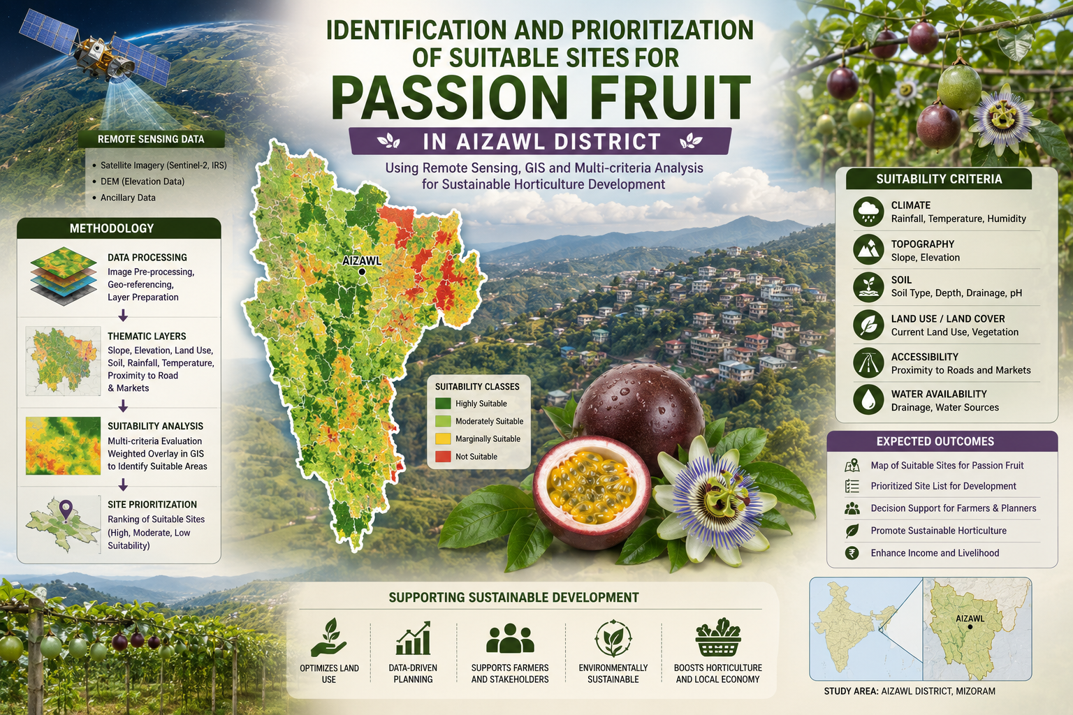
The Identification and Prioritization of Suitable Sites for Passion Fruit using Remote Sensing and GIS Techniques in Aizawl District, Mizoram State was a pilot project under the Technology Mission on the Integrated Development of Horticulture in North Eastern States (including Sikkim), funded by the Ministry of Agriculture, Government of India, and completed in March 2003. It involved key collaboration among Space Applications Centre (SAC)-ISRO, Ahmedabad; Mizoram State Remote Sensing Centre (MSRSC), Aizawl; and Mizoram State Department of Horticulture, Aizawl, pooling expertise in agro-ecology, geospatial analysis, and local horticulture extension. The project harnessed IRS LISS-III (23 m) and IRS WIFS (188 m) satellite data, processed via digital classification/visual interpretation. Ancillary inputs included SOI topographical sheets, village/road/drainage/soil maps, Census data, and ground truth. GIS (ArcInfo) integrated terrain parameters such as elevation, slope, aspect were used for enabling jhum delineation, crop suitability indexing, prioritization, and village-level mapping/statistics. The main objective was to map current jhum (shifting cultivation) areas and prioritize sites within them for passion fruit expansion, transitioning unsustainable slash-and-burn practices to viable horticulture amid jhum's dominance (~6–8% annual area in pilot circles). Aizawl district exemplifies NER's horticulture potential (e.g., mandarin orange/passion fruit/banana dominant), yet faces jhum degradation, low settled cultivation (24.4% culturable), and export needs. The study targets the passionfruit production boost in the horticulture circles, promoting year-round fruiting complementarity for processing/juice markets. The project outputs include village atlases, suitability maps, terrain databases, statistics which offer transformative geospatial intelligence for city/town planning. They guide land-use zoning in jhum hotspots, incentivize farmer transitions, integrate with Technology Mission schemes (orchard expansion/afforestation), and optimize infrastructure (roads/water to clusters). Planners can leverage for sustainable diversification, reducing erosion/soil loss, boosting rural incomes, ensuring nutritional security, and aligning with eco-friendly settled systems in the fragile hills. Summarize Metadata Mapping Scale: 1:50,000 Satellite data & Year: IRS LISS III & WIFS (2002) Study area: Aizawl district Collaborating/Funding Agency: Ministry of Agriculture, Government of India No. of Reports published: 1 Project Period: 2002 – 2003