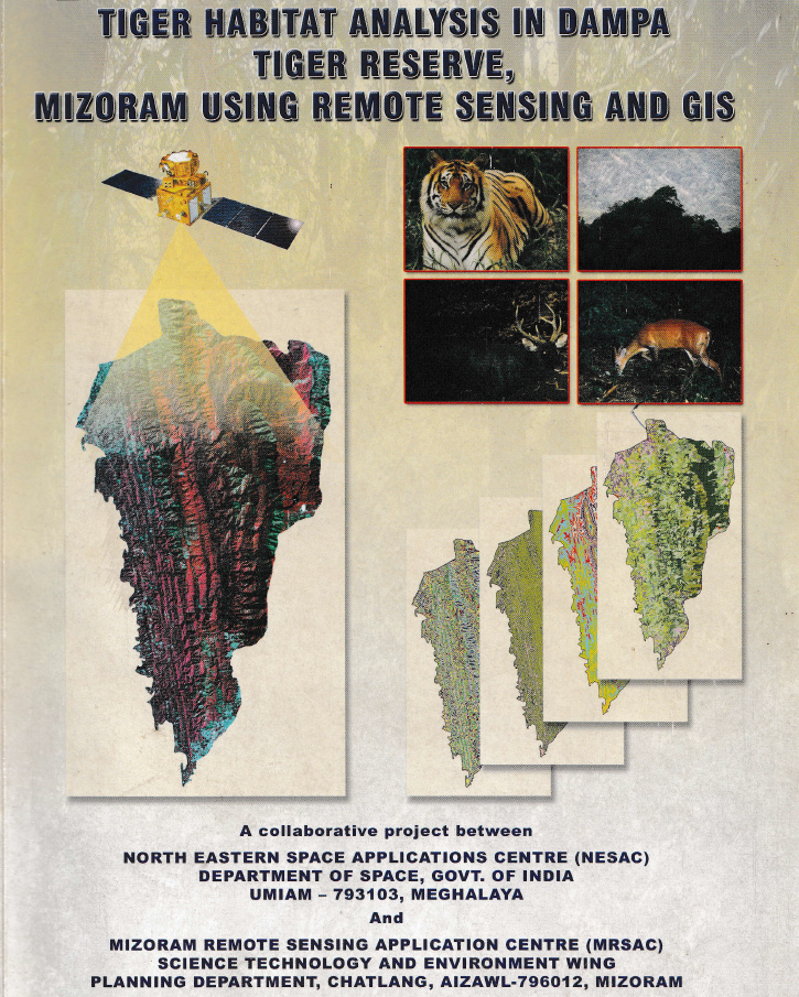
Tiger Habitat Analysis in Dampa Tiger Reserve, Mizoram using Remote Sensing and GIS
The project “Tiger Habitat Analysis in Dampa Tiger Reserve, Mizoram using Remote Sensing and GIS” was undertaken to evaluate the condition, change and suitability of tiger habitat within Dampa Tiger Reserve and its adjoining landscape, and to support scientific conservation and management planning. The study aimed to inventory vegetation types, forest density and water bodies; detect habitat changes between 1978 and 2005; characterize preferred tiger habitat; identify potential habitat and corridors outside the reserve; and develop a digital GIS database for long-term monitoring and management.A multi-temporal remote sensing approach was adopted using Landsat MSS (1978), Landsat TM (1989), IRS-1D LISS-III (1999), IRS-1D PAN (2003) and IRS-P6 LISS-III (2005) imagery, supplemented by reserve boundaries, socio-economic information on surrounding villages and field observations. Vegetation type, forest density, slope, aspect, elevation, proximity to water and tiger pug-mark locations were integrated through GIS-based spatial modelling to derive habitat-suitability classes. Tiger pug marks were treated as indicators of habitat use, and areas associated with higher pug-mark occurrence were interpreted as relatively more suitable habitat.The most significant result was the substantial alteration of forest structure over the 27-year assessment period. Closed evergreen/semi-evergreen forest declined from 36.62% of the reserve in 1978 to 22.88% in 2005, representing a 37.52% reduction. In contrast, bamboo increased by 192.89%, scrub forest by 74.67%, and built-up land by 590%, although the latter remained small in absolute extent. Abandoned jhum declined by 51.52%, while current jhum showed an overall decline of 35.41% between 1978 and 2005 after initially increasing during 1978–1989. The study concludes that much of the original closed forest was replaced by bamboo, scrub and shifting-cultivation landscapes, resulting in increasing fragmentation of tiger habitat.Habitat analysis indicated that closed evergreen/semi-evergreen forests with forest density above 40% were most favourable for tiger use. Areas within 500 m of major rivers were considered highly suitable, while 500–2,000 m distances were moderately suitable. Pug-mark analysis further suggested a strong avoidance of human disturbance: tigers maintained distances of approximately 20 km from the northern inhabited buffer and 25 km from the eastern inhabited buffer, compared with about 10 km from the less-disturbed southern buffer.The surrounding buffer also showed considerable anthropogenic pressure, with current jhum occupying 24.45%, scrub forest 16.32%, abandoned jhum 14.26%, and bamboo 13.14% of the analyzed 5,192.01 ha buffer landscape. Overall, the study identified habitat degradation and shifting cultivation rather than poaching as major constraints on tiger population recovery. The resulting habitat-suitability maps, change-detection products and GIS database provide a valuable scientific basis for habitat restoration, corridor protection, buffer-zone management, monitoring of forest degradation and long-term conservation planning in Dampa Tiger Reserve. Summarized MetadataMapping Scale: 1:50,000 Satellite data & Year: Landsat MSS (1978), Landsat TM (1989), IRS 1D LISS III (1999), IRS 1D PAN (2003), IRS P6 LISS-III (2005).Thematic sub-category: Forestry & EnvironmentCollaborating/Funding Agency: North Eastern Space Applications Centre (NESAC) & Environment & Forest Department, Government of Mizoram.Report Publication Month/Year: October, 2008
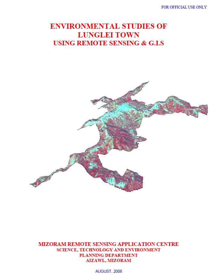
Environmental Studies of Lunglei town using Remote Sensing and GIS
The project “Environmental Studies of Lunglei Town using Remote Sensing & GIS”, undertaken by the Mizoram Remote Sensing Application Centre (MIRSAC), Science, Technology & Environment, Planning Department, Government of Mizoram, and published in August 2008, was designed to develop an integrated environmental database for sustainable urban planning in Lunglei. The study addressed growing concerns associated with heavy rainfall, unstable slopes and rocks, water scarcity during the dry season, vegetation degradation, pollution and expanding human activities. Its objectives covered the assessment of climate, surface-water resources, groundwater potential, water quality, geology, geomorphology, landslide hazards, slope, aspect, altitude, soils and land use/land cover, culminating in recommendations for environmental management and development planning.The study covered 55.08 sq. km of Lunglei Town, the second-largest settlement in Mizoram. It employed Cartosat-I PAN data (2006), Resourcesat LISS-IV data (2007), Survey of India topographic sheets, meteorological and socio-economic information, departmental records and extensive ground observations. Image processing and interpretation were carried out using ERDAS Imagine, while spatial integration and analysis were undertaken in ARC/INFO GIS. Field verification included handheld GPS observations of landslides, springs, wells, geology and vegetation, along with soil sampling and laboratory analysis.The integrated assessment highlighted several environmental constraints. Groundwater potential mapping classified only 11.04% of the town as Very Good and 21.00% as Good, whereas 38.02% fell within the Poor category, indicating significant dependence on surface and harvested rainwater resources. The report notes an annual rainfall of approximately 3,352 mm and demonstrates that a 60 sq. m roof could theoretically harvest about 201,120 litres annually, underscoring the potential of rooftop rainwater harvesting.Landslide susceptibility emerged as another major concern. The study area forms part of the Lunglei anticline, characterized by steep slopes, soft sedimentary rocks, lineaments and faults, with about 45.32 km of mapped structural discontinuities. Landslide zonation incorporated slope, lithology, geomorphology, geological structure, land use, road cutting and known landslides. The Very High Hazard Zone alone covers 1.07 sq. km (1.94%), including parts of Theiriat, Hauruang, Hrangchalkawn, Bazar Veng and western Zotlang.Land-use analysis shows that built-up land occupies 6.77 sq. km (12.29%), while open and dense scrub together cover over 41%, reflecting extensive disturbed vegetation. Land-capability assessment further indicates that 38.44% of the area falls under Class IVe, suitable mainly for agro-horticulture and related uses with erosion-control measures, whereas only 1.70% represents good arable Class IIe land.Overall, the project established a multidisciplinary environmental baseline for Lunglei Town and demonstrated the value of integrating Remote Sensing, GIS and field investigations for urban environmental assessment. Its thematic maps, hazard information and resource databases provide an important scientific foundation for land-use regulation, water-resource development, landslide mitigation, infrastructure planning, vegetation conservation and long-term sustainable urban development. Summarized MetadataMapping Scale: 1:10,000 Satellite data & Year: ResourceSat – LISS IV (2007) & Cartosat-1 (2006)Thematic sub-category: Multi-ThematicCollaborating/Funding Agency: Science & Technology wing, Planning DepartmentReport Publication Month/Year: August, 2008
Mapping of Potential Areas for Wet Rice Cultivation in Mizoram using Remote Sensing and GIS
The project “Mapping of Potential Areas for Wet Rice Cultivation in Mizoram using Remote Sensing and Geographic Information System” was undertaken by the Mizoram Remote Sensing Application Centre (MRSAC), Science & Technology, Planning Department, Government of Mizoram, as an in-house study completed in July 2008. The project was initiated in response to Mizoram’s limited availability of level and gently sloping land, which constrains the expansion of wet rice cultivation in the State’s predominantly rugged and mountainous terrain. Its principal objective was to identify, delineate and quantify potential areas for wet rice cultivation across all eight districts and to generate supporting thematic maps on slope and land use/land cover for agricultural planning.The assessment used IRS-1D LISS-III satellite imagery with a spatial resolution of 23.5 metres, Survey of India topographic maps at 1:50,000 scale, ancillary departmental information and extensive field verification. Image registration and interpretation were undertaken using ERDAS Imagine, while digitization, spatial integration, analysis and map preparation were carried out in ARC/INFO GIS. Handheld GPS observations and information from Village Councils and local residents were used to verify uncertain or inaccessible locations. Areas with slopes between 0 and 25% were primarily classified as wet rice cultivation potential, while terrace cultivation was considered feasible up to approximately 33% slope, following ICAR recommendations. Most potential areas were associated with heavy soils having good water-retention capacity and pH values generally ranging from 4.5 to 5.8.The study identified a total of 746.44 sq. km of potential wet rice cultivation land, representing only 3.54% of Mizoram’s total geographical area of 21,087 sq. km. This confirms that suitable land is scarce and largely confined to river valleys, flood plains, foothills and narrow low-lying basins. Mamit District recorded the largest potential area at 201.82 sq. km, followed by Lunglei (127.97 sq. km) and Lawngtlai (114.05 sq. km). Kolasib contained the highest proportional availability, with 6.82% of its district area classified as potential, closely followed by Mamit at 6.67%. Aizawl District had the lowest potential, covering about 41.4 sq. km or 1.16% of its area. Important concentrations included the Teirei and Langkaih valleys in Mamit, Serlui and Chemlui valleys in Kolasib, Champhai Zawl and the Tiau–Tuipui systems in Champhai, Mat Zawlpui in Serchhip, and the Tuichawng–Chamdur region in Lawngtlai.The project produced district-wise and statewide maps, spatial databases and area statistics that provide a scientific baseline for irrigation development, land improvement, accessibility assessment and prioritization of field-level agricultural interventions. Overall, the study demonstrated the effectiveness of Remote Sensing, GIS and GPS-supported verification for identifying scarce cultivable valleys and supporting evidence-based strategies to improve rice production and food security in Mizoram. Summarized MetadataMapping Scale: 1:50,000 Satellite data & Year: IRS 1D – LISS III (2006)Thematic sub-category: AgricultureCollaborating/Funding Agency: Mizoram Remote Sensing Application CentreReport Publication Month/Year: July, 2008
Mapping of Forest Administrative Boundary of Mizoram
The project “Mapping of Forest Administrative Boundary of Mizoram using Remote Sensing and GIS” was undertaken by the Mizoram Remote Sensing Application Centre (MRSAC) as an in-house initiative under the Centre’s Annual Plan for 2007–08. The study responded to the need for a standardized and spatially accurate representation of forest administrative jurisdictions in Mizoram, where extensive forest resources, rugged terrain and multiple management authorities make conventional boundary compilation difficult. Its principal objective was to prepare digital forest administrative boundary maps extending from Circle and Division levels down to Forest Ranges, thereby creating a dependable geospatial reference for forest conservation, administration and development planning.The project covered the entire 21,087 sq. km geographical area of Mizoram. Its database incorporated IRS-1D LISS-III satellite imagery, acquired in January 2006, Survey of India topographical sheets at 1:50,000 scale, Forest Department records, field observations and locally obtained information for inaccessible areas. The imagery was geometrically registered and interpreted using ERDAS Imagine, while boundary digitization, integration and analysis were carried out using ARC/INFO GIS. Hand-held GPS instruments supported field verification of selected Forest Division and Range boundaries. The workflow involved pre-field interpretation, ground verification and post-field correction, followed by cross-checking against departmental and ancillary records.A significant finding of the study was that several inconsistencies and anomalies existed in the available administrative records and maps. These were identified, reconciled and corrected through the integration of satellite imagery, GIS analysis, field evidence and institutional inputs. The completed database represented three Territorial Circles comprising 10 Territorial Forest Divisions and 60 Ranges. It also mapped the Wildlife Circle, consisting of the Wildlife Division, Dampa Tiger Reserve and Lawngtlai Wildlife Division, together comprising 10 wildlife ranges or management units. Forest jurisdictions administered by the Lai, Mara and Chakma Autonomous District Councils were separately documented through three Forest Divisions and 13 Ranges. In total, the project spatially organized 16 territorial, wildlife and Autonomous District Council forest divisions and approximately 83 constituent ranges or management units.The principal outputs include detailed administrative maps for individual Forest Divisions, Wildlife Divisions, protected areas, Dampa Tiger Reserve and Autonomous District Council forest jurisdictions, supported by spatial and non-spatial attributes. A consolidated forest administrative boundary map for the whole State was also prepared at 1:250,000 scale.The project established an important digital baseline for the Environment and Forest Department. Its maps and GIS database support working-plan preparation, jurisdictional clarification, forest monitoring, protected-area management, field administration, infrastructure planning and inter-departmental coordination. The data can also be integrated with forest cover, biodiversity, land use, watersheds, roads and settlements, making the report a valuable reference for forest managers, planners, researchers and decision-makers engaged in the sustainable management of Mizoram’s forest resources.Summarized MetadataMapping Scale: 1:50,000 Satellite data & Year: IRS 1D LISS III (2006)Thematic sub-category: Forestry, Administrative boundaryCollaborating/Funding Agency: Mizoram Remote Sensing Application CentreReport Publication Month/Year: March, 2008
Digital Mapping of Village Boundary of Mizoram using Remote Sensing and GIS
The project “Digital Mapping of Village Boundary of Mizoram using Remote Sensing and GIS” was undertaken by the Mizoram Remote Sensing Application Centre as an in-house initiative to establish a standardized, spatially referenced database of village administrative boundaries across the State. The study recognized that clearly defined village jurisdictions are fundamental to decentralized planning, infrastructure development, resource allocation and implementation of area-specific government programmes. Its principal objective was to prepare accurate village-boundary maps using satellite imagery, Survey of India topographic sheets and departmental land records, and to preserve the resulting spatial and attribute information in digital form for future use by MRSAC and other government agencies.The project covered the entire 21,087 sq. km geographical area of Mizoram, comprising the eight districts of Mamit, Kolasib, Aizawl, Champhai, Serchhip, Lunglei, Lawngtlai and Saiha, including areas administered by the Lai, Mara and Chakma Autonomous District Councils. The primary remote-sensing input was IRS-1D LISS-III imagery with 23.5 m spatial resolution, acquired in January 2006. This was supplemented by Survey of India topographic maps at 1:50,000 scale, records supplied by the Land Revenue and Settlement Department, collateral administrative information and field observations. Image registration and interpretation were carried out using ERDAS Imagine, while boundary digitization, database preparation and spatial integration were undertaken in ARC/INFO GIS.The methodology consisted of pre-field, field and post-field stages. Existing maps and departmental records were initially compiled and compared with geometrically corrected satellite imagery. Doubtful boundary sections and village locations were subsequently verified through field surveys using handheld GPS instruments. In inaccessible areas, information was obtained through consultations with Village Council members and local residents. Following field verification, the boundaries were corrected, cross-checked and incorporated into district-wise and statewide digital maps.The completed assessment documented 709 villages, 23 notified towns and 158 urban wards across the eight districts. Lunglei District recorded the largest number of villages at 159, closely followed by Lawngtlai with 158, while Serchhip had the fewest at 34. Aizawl District contained the highest number of urban wards, reflecting the concentration of population and administrative functions around the State capital. A consolidated village-boundary map for the whole of Mizoram was also prepared at 1:250,000 scale, supported by detailed district and town maps.A major outcome of the project was the identification and correction of inconsistencies in earlier village-boundary records through the integration of departmental information, satellite data and ground evidence. The resulting GIS database provides an important baseline for village-level administration, rural development, census analysis, infrastructure planning, land and natural-resource management, watershed programmes and equitable allocation of development schemes. Overall, the project demonstrated the effectiveness of Remote Sensing, GIS and participatory field verification for establishing reliable administrative boundaries and supporting evidence-based micro-level planning in Mizoram. Summarized MetadataMapping Scale: 1:50,000 Satellite data & Year: IRS 1D – LISS III (2006)Thematic sub-category: Administrative, Village boundaryCollaborating/Funding Agency: Mizoram Remote Sensing Application CentreReport Publication Month/Year: March, 2008