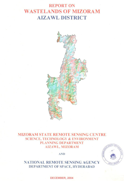
Wastelands of Mizoram - Aizawl district
The “Report on Wastelands of Mizoram – Aizawl District” was prepared under the National Wastelands Atlas Updation Programme, coordinated by the National Remote Sensing Agency (NRSA), Department of Space, Government of India, and implemented by the Mizoram State Remote Sensing Centre (MSRSC). The project aimed to update the spatial inventory of wastelands using advanced Remote Sensing and Geographic Information System (GIS) techniques, evaluate changes in land degradation since the previous national assessment, and develop a comprehensive geospatial database to support sustainable land-use planning, watershed management, and ecological restoration. The study forms an integral part of the state-wide initiative to monitor degraded lands and provide scientific information for resource conservation and development planning.The study encompasses the entire Aizawl District, located in the north-central part of Mizoram, with a geographical area of approximately 3,557.36 sq. km, representing about 16.86% of the total geographical area of the state. The district is characterized by rugged hill ranges, steep slopes, narrow valleys, and extensive forest cover. The humid tropical climate, with an average annual rainfall exceeding 2,500 mm, supports luxuriant vegetation but also accelerates soil erosion and land degradation in areas disturbed by anthropogenic activities. Agriculture, particularly shifting cultivation (jhum), remains the principal land-use practice influencing the district's landscape dynamics.The primary objective of the project was to identify, classify, and quantify various wasteland categories using interpretation of IRS satellite imagery integrated with GIS analysis, and to assess temporal changes in wasteland distribution between 1995 and 2003. The assessment focused on major wasteland classes including current shifting cultivation, abandoned shifting cultivation, degraded forests, and current jhum within notified forest areas. Spatial analysis was carried out at both district and watershed levels to identify areas experiencing severe land degradation and requiring priority management interventions.The study reveals that the total wasteland area in Aizawl District increased from 756.26 sq. km (21.25% of the geographical area) in 1995 to 792.61 sq. km (22.28%) in 2003, representing a net increase of 36.35 sq. km (1.03% of the district area) during the eight-year period. Abandoned shifting cultivation emerged as the dominant wasteland category, increasing from 465.01 sq. km (13.07%) to 483.24 sq. km (13.58%), while degraded forest expanded from 67.19 sq. km (1.89%) to 73.70 sq. km (2.08%). Conversely, current shifting cultivation declined slightly from 196.04 sq. km (5.51%) to 184.10 sq. km (5.18%), suggesting localized conversion of active jhum fields into abandoned fallows and secondary vegetation. The study also identified 51.56 sq. km (1.45%) of current shifting cultivation occurring within notified forest areas, indicating continued pressure on protected forest ecosystems.Watershed-level analysis demonstrated considerable spatial variability in wasteland distribution, with several watersheds exhibiting wasteland proportions exceeding 30% of their geographical area, reflecting the combined influence of steep terrain, repeated shifting cultivation, and shortened fallow cycles. The report further documents localized reductions in wasteland extent resulting from afforestation programmes, horticultural plantations, and conversion of degraded lands into permanent agricultural systems, illustrating the effectiveness of targeted reclamation initiatives.Overall, the project provides a robust geospatial assessment of land degradation in Aizawl District and establishes an important baseline for future environmental monitoring. The findings offer valuable guidance for planners, policymakers, and resource managers in prioritizing interventions related to afforestation, watershed development, agroforestry, soil and water conservation, and sustainable agricultural practices. Furthermore, the study demonstrates the effectiveness of Remote Sensing and GIS technologies in supporting evidence-based land resource management and promoting environmentally sustainable development in the fragile hill ecosystems of Mizoram.Summarized MetadataMapping Scale: 1:50,000Satellite data & Year: IRS 1D LISS III, February 2003Thematic sub-category: Wasteland, Spatial Planning Collaborating/Funding Agency: National Remote Sensing Centre (NRSC), HyderabadReport Publication Month/Year: December, 2004
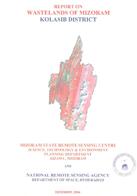
Wastelands of Mizoram - Kolasib district
The Wasteland Mapping of Kolasib District, Mizoram was carried out by the Mizoram State Remote Sensing Centre (MSRSC) under the National Wasteland Mapping Project sponsored by the National Remote Sensing Agency (NRSA), Department of Space, Government of India. The primary objective of the study was to identify, classify, quantify and spatially map wastelands of Kolasib district using satellite remote sensing and Geographic Information System (GIS) techniques. The resulting spatial database provides a scientific basis for sustainable land-use planning, watershed development, afforestation programmes, and reclamation of degraded lands.Kolasib district occupies the north-western part of Mizoram and serves as the gateway to the state, sharing its northern boundary with Assam. The district is characterized by rugged hill ranges interspersed with narrow valleys and low-lying plains. Elevation varies from the alluvial plains adjoining Assam to moderately high hill ranges in the southern part of the district. Compared with the central and southern districts of Mizoram, Kolasib possesses relatively gentler terrain and larger areas suitable for agriculture and settlements.The district experiences a humid tropical monsoon climate with abundant rainfall concentrated during the southwest monsoon season. The annual rainfall exceeds 2,000 mm, supporting luxuriant vegetation and rich biodiversity. Numerous perennial and seasonal streams drain the district, eventually joining the Barak River system. While the heavy rainfall sustains dense forest cover, it also accelerates soil erosion on exposed slopes affected by deforestation and shifting cultivation.Geologically, Kolasib district is composed predominantly of sedimentary rocks belonging to the Surma Group, consisting mainly of sandstone, shale and siltstone. These formations have undergone folding and faulting, producing the characteristic north–south trending hill ranges of Mizoram. The soils are generally acidic, moderately deep on hill slopes, and comparatively deeper in valley bottoms. Although rich in organic matter under forest cover, the soils become highly vulnerable to erosion when protective vegetation is removed.The natural vegetation consists mainly of tropical evergreen and semi-evergreen forests with extensive bamboo brakes. Economically important species include Michelia champaca, Schima wallichii, Gmelina arborea, Castanopsis spp., Terminalia spp., Albizia spp., Duabanga grandiflora, Macaranga denticulata, Trema orientalis, and several bamboo species. However, repeated anthropogenic disturbances, particularly shifting cultivation (jhum), extraction of forest resources and localized encroachments, have contributed to forest degradation and the formation of wastelands in several parts of the district.The study follows the standardized wasteland classification adopted under the National Wasteland Mapping Programme. Based on satellite image interpretation supported by extensive field verification, three major wasteland categories were identified in Kolasib district:Shifting Cultivation Areas – This represents the dominant wasteland category in the district. These lands comprise hill slopes subjected to the traditional slash-and-burn cultivation system. Vegetation is cleared and burned before cultivation, followed by abandonment to allow natural regeneration. However, the shortening of fallow periods due to increasing population pressure has reduced forest recovery, resulting in soil degradation, declining productivity and expansion of degraded landscapes. The report identifies shifting cultivation as the principal driver of wasteland formation in Kolasib district. Current Jhum Areas (Current Shifting Cultivation) – These include areas actively under cultivation during the period of satellite image acquisition. They are characterized by freshly cleared vegetation, exposed soil surfaces, seasonal agricultural crops and sparse regenerating vegetation. The report notes that current jhum areas are concentrated on moderate hill slopes surrounding rural settlements where traditional agricultural practices continue to dominate. Degraded Notified Forest Land – This category includes reserved and protected forest areas where the original forest vegetation has deteriorated due to repeated burning, fuelwood extraction, illicit felling, grazing and other anthropogenic disturbances. Although legally designated as forest land, these areas have experienced significant reduction in canopy density and ecological quality, necessitating restoration measures. The assessment reveals that shifting cultivation constitutes the largest proportion of wastelands in Kolasib district, while degraded notified forest occupies a comparatively smaller area. The report further indicates that the overall extent of wasteland has declined compared with the previous mapping cycle, reflecting positive impacts of natural forest regeneration, plantation programmes, watershed development initiatives and increasing adoption of horticulture and permanent agricultural practices. Large areas of abandoned jhum have gradually regenerated into secondary forests dominated by pioneer tree species and bamboo, demonstrating the ecological resilience of the landscape when adequate fallow periods are maintained.The report documents several successful examples of land restoration where abandoned jhum lands have been converted into orchards, plantations and agroforestry systems. Expansion of horticultural crops, soil conservation measures and community participation in resource management have contributed to improved land productivity and reduced land degradation in several localities. These examples illustrate the potential for sustainable land-use transformation while maintaining ecological stability.The study emphasizes that long-term management of Kolasib's wastelands requires an integrated strategy combining scientific watershed management, contour-based soil and water conservation, afforestation with indigenous species, promotion of agroforestry, regulated shifting cultivation practices, and expansion of sustainable horticultural development. Strengthening community participation through village institutions is considered essential for the successful implementation of conservation programmes because land-use decisions in Mizoram are closely linked to customary land tenure systems.Overall, the report demonstrates the effectiveness of remote sensing and GIS as powerful tools for systematic inventory and monitoring of wastelands in mountainous regions. The spatial database generated through the study provides valuable baseline information for government agencies, planners, forest managers and watershed development authorities involved in natural resource management. The findings indicate that although shifting cultivation continues to be the principal factor responsible for land degradation in Kolasib district, ongoing conservation initiatives and improved land management practices have resulted in measurable reduction of wastelands and enhanced prospects for sustainable landscape restoration.Summarized MetadataMapping Scale: 1:50,000Satellite data & Year: IRS 1D LISS III, February 2003Thematic sub-category: Wasteland, Spatial Planning Collaborating/Funding Agency: National Remote Sensing Centre (NRSC), HyderabadReport Publication Month/Year: December, 2004
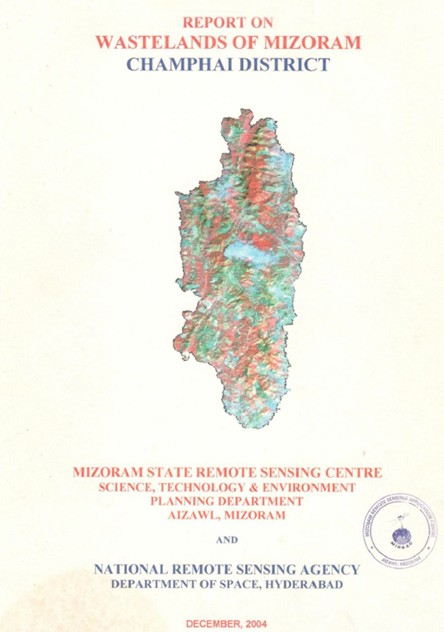
Wastelands of Mizoram - Champhai district
The Wasteland Mapping of Champhai District, Mizoram was undertaken by the Mizoram State Remote Sensing Centre (MSRSC) under the National Wasteland Mapping Project sponsored by the National Remote Sensing Agency (NRSA), Department of Space, Government of India. The study aims to identify, classify, quantify and spatially map wastelands in Champhai district using satellite remote sensing and GIS techniques, thereby providing a scientific database for sustainable land-use planning, watershed development, afforestation and ecological restoration.Champhai district occupies the eastern part of Mizoram and shares an international boundary with Myanmar. The district is characterized by rugged mountainous terrain, narrow valleys, steep hill slopes and extensive forest cover. Elevation varies considerably from the valley floors to mountain ridges exceeding 2,000 m, resulting in diverse physiographic conditions. The region experiences a humid tropical monsoon climate with high annual rainfall, which supports luxuriant vegetation but also accelerates soil erosion on exposed hill slopes.The geology of the district is dominated by sedimentary formations belonging to the Surma Group, consisting mainly of sandstone, siltstone and shale. These rocks have undergone intense folding and faulting, giving rise to the characteristic north-south trending hill ranges of Mizoram. The soils are generally shallow to moderately deep on hill slopes, acidic in nature, rich in organic matter in the surface horizons, but susceptible to erosion due to steep gradients and shifting cultivation practices.Natural vegetation comprises tropical evergreen and semi-evergreen forests interspersed with bamboo brakes and secondary forests. However, human interventions, particularly shifting cultivation (jhum), have significantly altered the original forest cover in many parts of the district. The shortening of jhum cycles has reduced the regenerative capacity of forests, resulting in increasing areas of degraded land.The study adopts the standardized wasteland classification developed under the National Wasteland Mapping Programme. Based on visual interpretation of satellite imagery supported by field verification, three major categories of wasteland were identified in Champhai district:Shifting Cultivation Areas – These constitute the largest share of wastelands in the district. Large tracts of hill slopes are subjected to rotational cultivation involving clearing, burning and temporary cultivation followed by abandonment. While traditional jhum is ecologically sustainable under long fallow periods, increasing population pressure has shortened the fallow cycle, leading to inadequate vegetation regeneration, soil degradation and declining agricultural productivity. During the survey period, this category accounted for approximately 804.46 km², representing about 25.25% of the district's geographical area, making it the dominant wasteland class. Current Jhum Areas (Current Jhum Land) – These include lands presently under cultivation after recent clearing and burning. Such areas are characterized by exposed soil surfaces, temporary crops and early successional vegetation. The spatial distribution reflects active shifting cultivation predominantly on moderate to steep hill slopes. Degraded Notified Forest Land – These are portions of reserved and protected forests where the natural vegetation has deteriorated due to repeated biotic disturbances, frequent burning, encroachment and unsustainable extraction of forest resources. Although these lands continue to retain legal forest status, their ecological condition has been substantially impaired. The report highlights that the overwhelming dominance of shifting cultivation in the district strongly influences land degradation patterns. Nevertheless, comparison with previous assessments indicates a decline in the overall extent of wastelands, suggesting gradual improvement in land management. The report records that the total wasteland area decreased from approximately 959.63 km² (30.09%) in the earlier assessment to 804.46 km² (25.25%), reflecting a reduction of about 155.17 km². This positive change has largely been attributed to natural forest regeneration during longer fallow periods in certain locations, successful plantation programmes, horticultural development, improved watershed management and conversion of abandoned jhum lands into permanent agricultural and horticultural plantations.Field observations documented several encouraging examples of ecological recovery. Previously abandoned jhum areas have regenerated into secondary forests dominated by pioneer species such as Macaranga denticulata, Trema orientalis, Albizia spp., and various bamboo species. In several locations, degraded slopes have been successfully converted into fruit orchards and plantations, demonstrating the potential for sustainable land-use transitions. Photographic evidence included in the report illustrates abandoned jhum fields undergoing natural succession as well as areas where horticultural development has stabilized formerly degraded landscapes.The report emphasizes that effective management of Champhai's wastelands requires an integrated approach combining soil and water conservation measures, scientific watershed management, afforestation using suitable indigenous species, promotion of agroforestry, improvement of shifting cultivation practices, and expansion of sustainable horticulture. Community participation is considered essential because most land-use decisions are closely linked with traditional village institutions and customary practices.Overall, the study demonstrates the effectiveness of remote sensing and GIS technologies for systematic monitoring of land degradation in mountainous regions. The generated spatial database provides valuable baseline information for planners, forest managers, watershed development agencies and policy makers engaged in sustainable natural resource management. The findings indicate that although shifting cultivation remains the principal driver of land degradation in Champhai district, ongoing conservation interventions and improved land-use practices have contributed to measurable reductions in wasteland extent, highlighting the potential for ecological restoration and sustainable landscape management in the district.Summarized MetadataMapping Scale: 1:50,000Satellite data & Year: IRS 1D LISS III, February 2003Thematic sub-category: Wasteland, Spatial Planning Collaborating/Funding Agency: National Remote Sensing Centre (NRSC), HyderabadReport Publication Month/Year: December, 2004
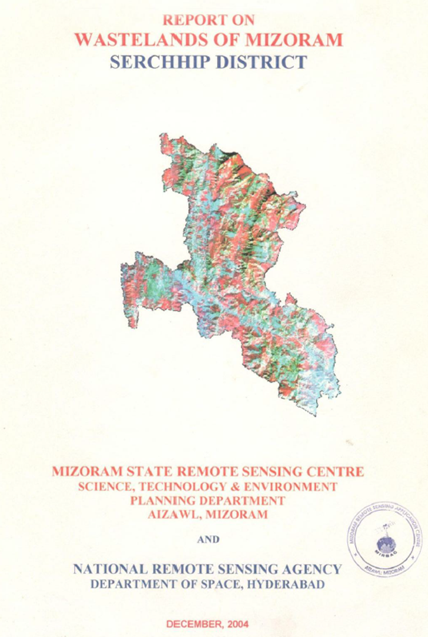
Wastelands of Mizoram - Serchhip district
The “Report on Wastelands of Mizoram – Serchhip District” was prepared under the National Wastelands Atlas Updation Programme, coordinated by the National Remote Sensing Agency (NRSA), Department of Space, Government of India, and implemented in Mizoram by the Mizoram State Remote Sensing Application Centre (MSRSC). The project aimed to update the spatial inventory of wastelands using satellite remote sensing and Geographic Information System (GIS) techniques, evaluate changes in land degradation over time, and develop a reliable geospatial database to support sustainable land-use planning, watershed management, and ecological restoration. The study contributes to the state-wide assessment of degraded lands and provides a scientific basis for prioritizing reclamation and conservation measures.The study encompasses the entire Serchhip District, located in the central part of Mizoram and characterized by rugged hill terrain, steep slopes, dense forest cover, and a predominantly agrarian population. The district experiences a humid tropical climate with high annual rainfall, which promotes luxuriant vegetation but also increases the susceptibility of disturbed slopes to soil erosion and land degradation. Traditional land-use systems, particularly shifting cultivation (jhum), continue to exert significant influence on the district’s landscape dynamics and ecological stability.The principal objective of the project was to identify, classify, and quantify different categories of wastelands through interpretation of multi-temporal IRS satellite imagery and GIS analysis, while also assessing the changes that occurred between the previous wasteland inventory and the updated assessment. Mapping was carried out at both district and watershed levels to evaluate the spatial distribution of degraded lands and identify areas requiring priority intervention. Particular emphasis was placed on wasteland categories associated with current shifting cultivation, abandoned jhum lands, degraded forest areas, and shifting cultivation occurring within notified forest lands, which constitute the dominant forms of land degradation in the district.The assessment indicates that shifting cultivation remains the principal driver of wasteland formation in Serchhip District. Expansion of current jhum cultivation, coupled with shortened fallow cycles, has resulted in the gradual conversion of mature forests into secondary bamboo-dominated vegetation and degraded landscapes. The study highlights a net increase in wasteland extent compared with the previous assessment, reflecting continued pressure on land resources due to repeated forest clearing, biomass removal, and unsustainable cultivation practices. Watershed-level analysis reveals considerable spatial variation in wasteland distribution, with higher concentrations occurring in areas where shifting cultivation is more intensive and terrain conditions favour accelerated soil erosion.The study also documents localized improvements in land condition resulting from plantation programmes, horticultural development, and conversion of degraded lands into permanent agricultural systems, demonstrating the potential for successful reclamation through appropriate land management practices. These observations emphasize the importance of integrating scientific land-use planning with community-based resource management to reduce further land degradation.Overall, the project provides a comprehensive geospatial assessment of wastelands in Serchhip District and establishes an important baseline for long-term environmental monitoring. The findings serve as a valuable resource for planners, policymakers, and development agencies by identifying priority areas for afforestation, agroforestry, watershed development, soil and water conservation, and sustainable agricultural interventions. Furthermore, the study demonstrates the effectiveness of remote sensing and GIS technologies in supporting evidence-based decision-making for sustainable land resource management in the hill ecosystems of Mizoram.Summarized MetadataMapping Scale: 1:50,000Satellite data & Year: IRS 1D LISS III, February 2003Thematic sub-category: Wasteland, Spatial Planning Collaborating/Funding Agency: National Remote Sensing Centre (NRSC), HyderabadReport Publication Month/Year: December, 2004
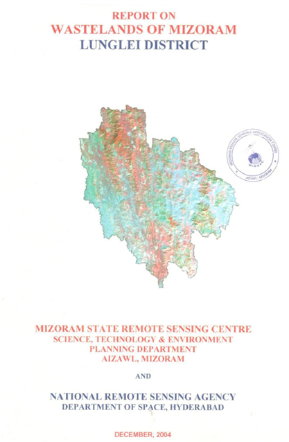
Wastelands of Mizoram - Lunglei district
The “Report on Wastelands of Mizoram – Lunglei District” was prepared under the National Wastelands Atlas Updation Programme, a nationwide initiative coordinated by the National Remote Sensing Agency (NRSA), Department of Space, Government of India, and implemented in Mizoram by the Mizoram State Remote Sensing Centre (MSRSC). The project aimed to update the inventory of wastelands using satellite remote sensing and GIS technologies, evaluate changes in land degradation patterns over time, and generate a reliable geospatial database to support land reclamation, environmental management, and sustainable development planning. The study forms part of a broader state-wide effort to monitor the status of degraded lands and assess the impacts of prevailing land-use practices on Mizoram’s fragile hill ecosystems.The study covers the entire Lunglei District, occupying approximately 4,538 sq. km, which constitutes about 21.52% of the total geographical area of Mizoram, making it one of the largest districts in the state. Characterized by rugged hill ranges, steep slopes, high rainfall, and extensive forest cover, the district experiences significant pressure from traditional shifting cultivation practices. The region receives an average annual rainfall of approximately 2,817 mm, and its terrain is dominated by deeply dissected hill systems separated by narrow valleys and perennial river networks.The primary objective of the project was to identify, classify, and quantify wasteland categories using satellite imagery and GIS-based interpretation and to assess changes in wasteland extent between 1995 and 2003. Particular emphasis was placed on land degradation associated with current shifting cultivation (current jhum), abandoned shifting cultivation areas, degraded notified forest lands, and current jhum occurring within notified forest areas. These categories were mapped and analyzed at both district and watershed levels to understand the spatial dynamics of land degradation.The findings indicate that wastelands accounted for approximately 21.26% of the district’s geographical area in 2003, representing a substantial increase from 16.19% recorded in 1995. The total wasteland extent increased from about 734.80 sq. km to 964.85 sq. km, reflecting a net increase of 5.07% of the district area over the eight-year period. Shifting cultivation emerged as the dominant driver of land degradation, with current jhum covering approximately 300.03 sq. km (6.61%) and abandoned jhum occupying about 596.64 sq. km (13.15%) of the district area. The study also identified 48.20 sq. km (1.06%) of degraded notified forest land and 19.99 sq. km (0.44%) of current jhum cultivation occurring within notified forest areas, highlighting continued pressure on protected forest resources.A notable observation of the study is the strong correlation between increasing wasteland extent and the persistence of shifting cultivation, particularly in watersheds experiencing shortened fallow cycles. The report documents how repeated clearing of forest vegetation has transformed large tracts of primary forest into secondary bamboo-dominated vegetation and degraded landscapes. Consequences include increased soil erosion, nutrient depletion, sedimentation of rivers, and declining ecological productivity. At the same time, the study identifies localized success stories where wasteland areas have decreased due to forest plantation programmes and the conversion of degraded lands into permanent horticultural and agricultural systems.Overall, the project provides a comprehensive geospatial assessment of land degradation in Lunglei District and establishes an important baseline for future monitoring and planning. The findings offer valuable guidance for policymakers, planners, and development agencies in prioritizing interventions related to afforestation, agroforestry, watershed management, sustainable agriculture, and ecological restoration, while also demonstrating the effectiveness of remote sensing and GIS technologies in supporting evidence-based land resource management in Mizoram.Summarized MetadataMapping Scale: 1:50,000Satellite data & Year: IRS 1D LISS III, February 2003Thematic sub-category: Wasteland, Spatial Planning Collaborating/Funding Agency: National Remote Sensing Centre (NRSC), HyderabadReport Publication Month/Year: December, 2004