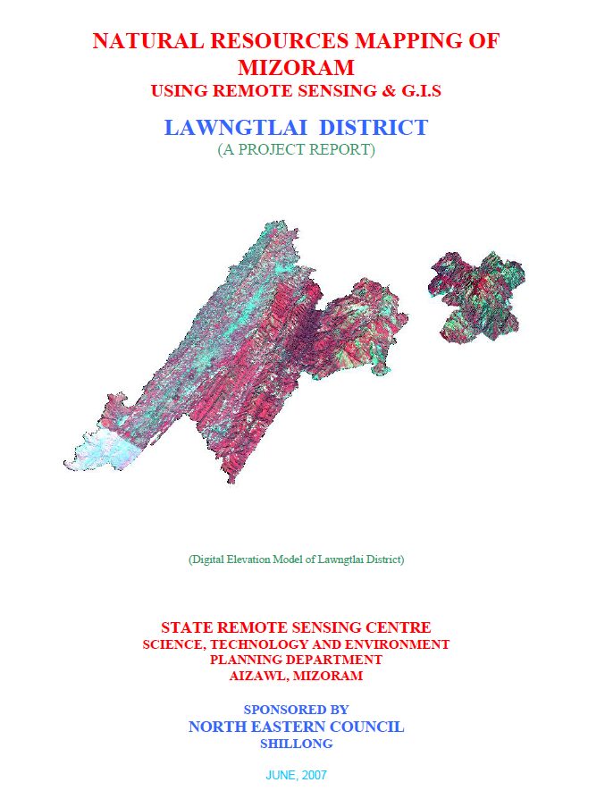
Natural Resources Mapping of Lawngtlai District using Remote Sensing and GIS
The Natural Resources Mapping of Lawngtlai District using Remote Sensing and GIS was undertaken by the Mizoram State Remote Sensing Centre (MSRSC), Science, Technology & Environment Wing, Planning Department, Government of Mizoram, under the Natural Resources Mapping of Mizoram programme sponsored by the North Eastern Council (NEC), Shillong. Executed as part of a three-year state-wide geospatial resource inventory, the project aimed to develop a comprehensive spatial database of Lawngtlai District by integrating Remote Sensing (RS), Geographic Information System (GIS), GPS-based field surveys, and conventional resource investigations. The principal objective was to generate standardized thematic information on the district's land, water, forest, and terrain resources to support scientific planning, sustainable development, and evidence-based natural resource management.The study covers the entire Lawngtlai District, encompassing approximately 2,557.10 sq. km in the southernmost part of Mizoram. The district is characterized by rugged north-south trending hill ranges, deeply dissected valleys, high rainfall, and extensive forest cover, making it one of the state's ecologically significant landscapes. The project utilized IRS-1D LISS-III and Panchromatic satellite imagery, Survey of India topographic maps, geological and meteorological records, soil surveys, and extensive field verification to prepare detailed thematic layers on land use/land cover, geology, geomorphology, drainage, watershed boundaries, groundwater potential, soils, slope, aspect, settlements, and transportation networks. These datasets were integrated within a GIS environment to create a district-level Natural Resources Information System (NRIS).The assessment indicates that the district is dominated by structural hills and steep slopes, which largely determine land capability, settlement patterns, and agricultural practices. Forest and bamboo forest constitute the predominant land-use categories, reflecting the district's rich biodiversity and relatively intact natural ecosystems. Nevertheless, current and abandoned shifting cultivation (jhum) continue to occupy substantial portions of the landscape, demonstrating the continued dependence of rural communities on traditional farming systems. The report also highlights the gradual expansion of horticultural plantations, wet rice cultivation, and permanent agriculture in suitable valleys and gentle slopes, indicating an ongoing transition towards more sustainable and diversified land-use practices.Groundwater investigations reveal that groundwater occurrence is primarily associated with fractured sandstone formations, valley fills, and gentle slopes, while the extensive hilly terrain generally exhibits poor to moderate groundwater potential because of steep gradients and rapid runoff. Soil investigations identify predominantly acidic hill soils with moderate organic carbon content and varying fertility, emphasizing the need for appropriate soil conservation and watershed management measures. The study also delineates watershed boundaries and drainage characteristics, providing valuable information for integrated water resource planning and rainwater harvesting initiatives.One of the major outcomes of the project is the development of an integrated natural resources information that combines multiple thematic datasets into a GIS platform for resource evaluation and spatial decision-making. Based on the integrated assessment, the report recommends watershed development, afforestation, agroforestry, bamboo resource management, groundwater development, horticultural expansion, soil and water conservation, and land capability-based planning to ensure sustainable utilization of natural resources while minimizing environmental degradation.Overall, the project demonstrates the effectiveness of integrating Remote Sensing, GIS, GPS, and field investigations for comprehensive natural resource assessment in mountainous environments. The thematic maps, digital databases, and resource development plans generated under the study provide a valuable baseline for government departments, planners, researchers, and development agencies, supporting sustainable land and water resource management, environmental conservation, infrastructure planning, and long-term regional development in Lawngtlai District.Summarized MetadataMapping Scale: 1:50,000Satellite data & Year: IRS 1D PAN & LISS III (2003 & 2004) – Digital & Photo printThematic sub-category: Land Use/Land Cover, Geology, Water resource, Climate, Action Plan Collaborating/Funding Agency: North Eastern Council (NEC), ShillongReport Publication Month/Year: June, 2007
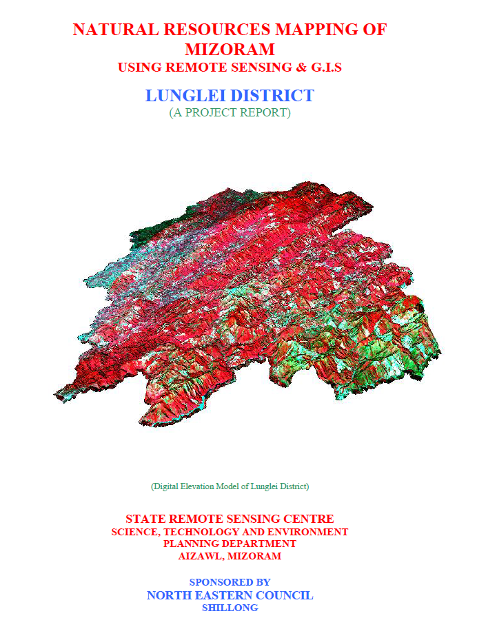
Natural Resources Mapping of Lunglei District using Remote Sensing and GIS
The Natural Resources Mapping of Lunglei District using Remote Sensing and GIS was undertaken by the Mizoram State Remote Sensing Centre (MSRSC), Science, Technology & Environment Wing, Planning Department, Government of Mizoram, under the Natural Resources Mapping of Mizoram programme sponsored by the North Eastern Council (NEC), Shillong. Implemented as part of a three-year state-wide geospatial resource inventory project, the study aimed to develop a comprehensive spatial database of Lunglei District through the integration of Remote Sensing (RS), Geographic Information System (GIS), GPS-assisted field surveys, and conventional resource investigations. The project sought to generate standardized thematic information for sustainable management of land, water, forests, and other natural resources while providing scientific inputs for district-level planning and long-term environmental management.The study covers the entire Lunglei District, one of the largest districts in Mizoram, extending over approximately 4,538 sq. km and accounting for nearly 21.5% of the state's geographical area. The project utilized IRS-1D LISS-III and Panchromatic satellite imagery, Survey of India topographic sheets, geological and meteorological records, soil investigations, and extensive ground verification to prepare a suite of thematic maps comprising land use/land cover, geology, geomorphology, drainage, watershed boundaries, groundwater prospects, soils, slope, aspect, settlements, and transportation networks. These datasets were integrated within a GIS environment to develop a district-level Natural Resources Information System capable of supporting multi-sectoral planning and resource evaluation.The assessment reveals that Lunglei District is characterized by rugged structural hill ranges, steep slopes, deeply dissected valleys, and an extensive drainage network dominated by the Tlawng, Mat, Tuichawng, Tuipui, and Kolodyne river systems. Terrain conditions strongly influence land capability, agricultural suitability, and settlement patterns. Forests remain the dominant land cover, with bamboo forests constituting the largest single vegetation category, followed by medium and dense forests, reflecting the district's rich biodiversity and ecological importance. The report also identifies current and abandoned shifting cultivation (jhum) as significant components of the landscape, indicating the continued dependence of rural communities on traditional agricultural practices. At the same time, the expansion of horticultural plantations, wet rice cultivation, and permanent agriculture in suitable valleys demonstrates a gradual shift towards more sustainable land-use systems.Groundwater assessment indicates that groundwater occurrence is largely controlled by fractured sandstone formations, valley fills, and topographic conditions, with moderate groundwater potential confined mainly to valley areas and gently sloping terrain, while the extensive hill regions generally exhibit limited groundwater prospects because of steep slopes and rapid surface runoff. Soil investigations reveal predominantly acidic hill soils with moderate organic matter content and varying fertility, emphasizing the importance of soil conservation and appropriate land capability-based planning.A major outcome of the project is the preparation of an integrated natural resources information that combines all thematic datasets within a GIS platform for spatial analysis and decision support. Based on the integrated resource assessment, the report recommends watershed development, rainwater harvesting, afforestation, agroforestry, horticultural expansion, groundwater development, bamboo resource management, and scientific land capability planning to ensure sustainable utilization of the district's natural resources while minimizing environmental degradation.Overall, the project demonstrates the effectiveness of integrating Remote Sensing, GIS, GPS, and field investigations for comprehensive natural resource assessment in mountainous environments. The thematic maps, digital databases, and resource development plans generated under the study provide an invaluable reference for government departments, planners, researchers, and development agencies, supporting evidence-based planning and the sustainable management of Lunglei District's diverse natural resources.Summarized MetadataMapping Scale: 1:50,000Satellite data & Year: IRS 1D PAN & LISS III (2003 & 2004) – Digital & Photo printThematic sub-category: Land Use/Land Cover, Geology, Water resource, Climate, Action Plan Collaborating/Funding Agency: North Eastern Council (NEC), ShillongReport Publication Month/Year: March, 2007
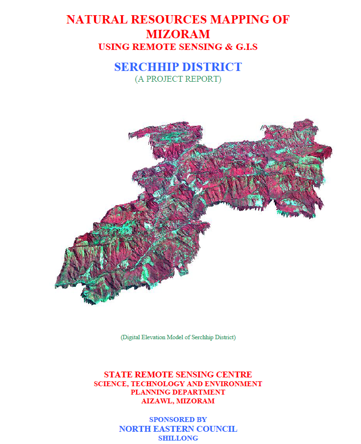
Natural Resources Mapping of Serchhip District using Remote Sensing and GIS
The Natural Resources Mapping of Serchhip District using Remote Sensing and GIS was undertaken by the Mizoram State Remote Sensing Centre (MSRSC), Science, Technology & Environment Wing, Planning Department, Government of Mizoram, under the Natural Resources Mapping of Mizoram programme sponsored by the North Eastern Council (NEC), Shillong. Implemented as part of a three-year state-wide geospatial resource inventory project, the study aimed to develop a comprehensive spatial database of Serchhip District through the integration of Remote Sensing (RS), Geographic Information System (GIS), GPS-based field surveys, and conventional resource investigations. The project sought to generate reliable thematic information for sustainable management of land, water, forests, and other natural resources while supporting scientific planning across multiple development sectors.The study covers the entire Serchhip District, occupying approximately 1,421.60 sq. km, or about 6.75% of the geographical area of Mizoram. Multi-date IRS-1D LISS-III and Panchromatic satellite imagery, Survey of India topographic maps, geological and meteorological records, soil surveys, and extensive field verification were integrated within a GIS environment to prepare detailed thematic layers on land use/land cover, geology, geomorphology, drainage, watershed boundaries, groundwater potential, soils, slope, aspect, settlements, and transport networks. These datasets were subsequently synthesized to formulate integrated land and water resource development plans for the district.The assessment reveals that Serchhip District is characterized by rugged structural hill ranges, deeply dissected valleys, and a well-developed drainage network that strongly influences land capability and resource utilization. Forests continue to dominate the landscape, with bamboo forests representing the largest single land-use category, reflecting the district's rich forest resources and ecological significance. The report also documents the widespread occurrence of young abandoned shifting cultivation (jhum) lands, which form one of the major land-use categories, indicating the continued influence of traditional shifting cultivation on the landscape. Current shifting cultivation occupies about 66.60 sq. km (4.68%) of the district area, while permanent agriculture and horticultural plantations are gradually expanding in suitable valleys and gentle hill slopes, demonstrating an ongoing transition towards more sustainable land-use systems.Groundwater investigations indicate that moderate groundwater potential covers approximately 459.54 sq. km (32.33%) of the district, whereas the remaining higher hill regions generally possess poor groundwater prospects because of steep terrain, rapid surface runoff, and limited infiltration. Soil investigations identified predominantly acidic hill soils with moderate to high organic matter content but varying fertility and erosion susceptibility depending on slope and land use. The watershed-based analysis further identifies priority areas requiring soil and water conservation, rainwater harvesting, and integrated watershed management.A major outcome of the project is the establishment of a district-level natural resources information integrating all thematic datasets within a GIS platform for spatial analysis and planning. Based on the integrated assessment, the report recommends watershed development, afforestation, bamboo resource management, agroforestry, horticultural expansion, groundwater development, and land capability-based planning to promote sustainable utilization of natural resources while minimizing environmental degradation. The study also highlights the importance of scientific management of bamboo resources in view of the impending gregarious bamboo flowering (Mautam), emphasizing opportunities for value addition, conservation, and rural livelihood enhancement.Overall, the project demonstrates the effectiveness of integrating Remote Sensing, GIS, GPS, and field investigations for comprehensive natural resource assessment in mountainous environments. The thematic maps, digital databases, and development plans generated under the study provide an invaluable reference for government departments, planners, researchers, and development agencies, supporting evidence-based planning and the long-term sustainable management of Serchhip District's natural resources.Summarized MetadataMapping Scale: 1:50,000Satellite data & Year: IRS 1D PAN & LISS III (2003 & 2004) – Digital & Photo printThematic sub-category: Land Use/Land Cover, Geology, Water resource, Climate, Action Plan Collaborating/Funding Agency: North Eastern Council (NEC), ShillongReport Publication Month/Year: March, 2007
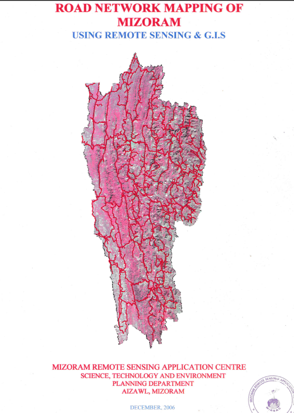
Road Network Mapping of Mizoram
The Road Network Mapping of Mizoram using Remote Sensing and GIS was an in-house geospatial mapping project undertaken by the Mizoram Remote Sensing Application Centre (MSRSC) under the Science, Technology & Environment Wing, Planning Department, Government of Mizoram, with funding support from the State Government. The project was initiated to establish a systematic, spatially referenced inventory of Mizoram's road infrastructure and to demonstrate the application of satellite remote sensing and Geographic Information System (GIS) technologies for transportation and developmental planning. The project covered the entire State of Mizoram, encompassing all eight districts and its extensive network of inter-state, inter-district, district, village, agricultural, horticultural, and other link roads. The final report was compiled and published in December 2006, based primarily on satellite data acquired during 2003.The principal objective was to map and classify different categories of roads using satellite data, digitize the mapped information, and prepare a comprehensive road network map and GIS database for use by government departments. The study employed IRS-1D LISS-III and Panchromatic satellite imagery, procured from the NRSA Data Centre, Hyderabad, supported by Survey of India topographic sheets, Census data, administrative information, departmental reports, and ground verification of major roads. The GIS database was structured to incorporate road types along with associated information on settlements and drainage, providing a spatial framework for analysing road connectivity in relation to other geographical features.The project mapped the road infrastructure within a State covering approximately 21,087 sq. km, extending between 21°58′20″ N and 24°35′00″ N latitude and 92°15′–93°20′ E longitude. Mizoram's challenging mountainous landscape and its 585-km international boundary with Bangladesh and Myanmar make road connectivity particularly important from economic, social, administrative, and strategic perspectives. The resulting maps provide a detailed spatial representation of the State's transportation infrastructure. The project mapped the principal inter-state corridors, including National Highway 54, National Highway 44A, National Highway 150, and National Highway 54B, which connect Mizoram with neighbouring states and form important routes for trade, administration, and movement of people and goods.The study recognizes the important roles of multiple agencies in developing Mizoram's road infrastructure. The Border Roads Organisation (BRO) is primarily responsible for major strategic and National Highway corridors, while the Public Works Department (PWD) undertakes State Highways and district roads. Other departments and agencies, including Rural Development, DRDA, Agriculture, Horticulture, and Forest, contribute to the development of minor, agricultural, horticultural, and village link roads. The mapping therefore provides a common spatial reference that can facilitate coordination among these institutions and support more integrated infrastructure planning.A key observation emerging from the mapping is the importance of agricultural and horticultural link roads, which provide connectivity between interior production areas and markets. However, the report also identifies areas where villages remain dependent on footpaths, unmetalled jeepable roads, or seasonally functional routes, with poor maintenance limiting accessibility during the rainy season. These findings highlight the value of the mapped database for identifying connectivity gaps and prioritizing road improvement and expansion.The resulting maps, digital spatial information, and report provide valuable baseline resources for transportation planning, road construction and maintenance, infrastructure prioritization, rural connectivity, agricultural and horticultural development, emergency response, disaster management, and regional planning. The road network data can also be integrated with other GIS layers such as settlements, terrain, land use, forests, and natural resources to support multi-sectoral decision-making. Overall, the project represents an important early application of Remote Sensing and GIS for statewide infrastructure inventory, establishing a standardized geospatial reference that can assist government departments, planners, researchers, and development agencies in understanding and improving road connectivity across Mizoram. Summarized MetadataMapping Scale: 1:50,000 Satellite data & Year: IRS 1D LISS III & PAN (2003) Thematic sub-category: Infrastructure, RoadCollaborating/Funding Agency: Mizoram Remote Sensing Application CentreReport Publication Month/Year: December, 2006
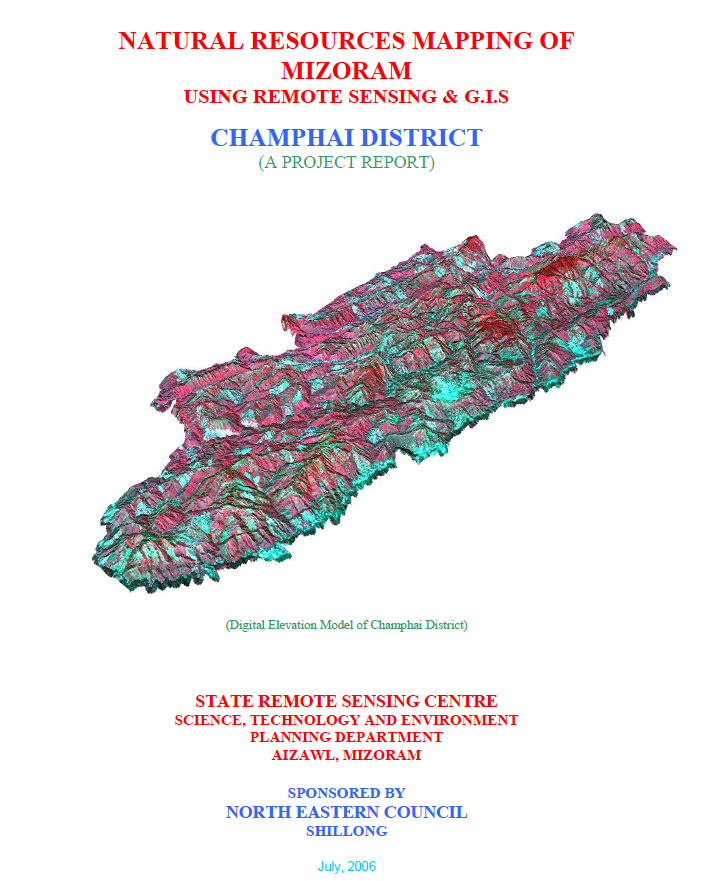
Natural Resources Mapping of Champhai District using Remote Sensing and GIS
The Natural Resources Mapping of Champhai District using Remote Sensing and GIS was undertaken by the Mizoram State Remote Sensing Centre (MSRSC), Science, Technology & Environment Wing, Planning Department, Government of Mizoram, under the Natural Resources Mapping of Mizoram programme sponsored by the North Eastern Council (NEC), Shillong. The study forms part of a three-year state-wide initiative to develop an integrated geospatial database of Mizoram's natural resources using Remote Sensing (RS), Geographic Information System (GIS), GPS-assisted field surveys, and conventional resource mapping techniques. The primary objective was to generate standardized thematic maps and digital spatial datasets for sustainable management of land, water, forests, and other natural resources while supporting scientific planning and policy formulation.The study covers the entire Champhai District, extending over 3,185.83 sq. km, accounting for approximately 15.11% of the geographical area of Mizoram. The project utilized IRS-1D LISS-III and Panchromatic satellite imagery (2003–2004), Survey of India topographic maps, meteorological records, geological information, and extensive field verification to prepare thematic layers on land use/land cover, geology, geomorphology, soils, drainage, watershed boundaries, groundwater potential, slope, aspect, elevation, settlements, and transportation networks. These datasets were integrated within a GIS environment to facilitate resource assessment and formulate district-specific action plans.The analysis reveals that Champhai District is characterized by rugged hill ranges interspersed with broad intermontane valleys, particularly the fertile Champhai Valley, making it one of Mizoram's most important agricultural regions. Terrain analysis indicates that the district is predominantly mountainous, with land capability and agricultural suitability closely controlled by slope and elevation. Geological mapping identifies sedimentary formations of the Surma Group as the dominant lithology, while geomorphological analysis highlights structural hills, valleys, flood plains, and denudational features that govern drainage and land-use patterns.Land use and land cover assessment indicates that forest and bamboo forest remain the dominant land cover, reflecting the district's rich ecological resources. However, current shifting cultivation (jhum) occupies approximately 164.48 sq. km (5.16%), while young abandoned jhum lands cover about 561.44 sq. km (17.62%), emphasizing the continued influence of traditional shifting cultivation on the landscape. The report also documents the expansion of horticultural plantations, wet rice cultivation in valley floors, and permanent agriculture, indicating a gradual transition towards more sustainable land-use systems in suitable areas.The study further evaluates soil characteristics, groundwater prospects, and watershed conditions to identify areas suitable for agricultural intensification and water resource development. Soil investigations reveal predominantly acidic hill soils with moderate fertility and high susceptibility to erosion on steep slopes, underscoring the need for integrated soil and water conservation measures. Watershed-based analysis provides a scientific framework for rainwater harvesting, groundwater recharge, and sustainable watershed management.A major outcome of the project is the development of a comprehensive natural resources information for Champhai District, integrating multiple thematic datasets into a GIS platform for resource planning and spatial decision-making. Based on the integrated assessment, the report recommends watershed development, afforestation, agroforestry, horticultural expansion, sustainable agricultural practices, groundwater development, and land capability-based planning to optimize resource utilization while conserving the district's fragile mountain ecosystem.Overall, the project demonstrates the effectiveness of integrating Remote Sensing, GIS, GPS, and field investigations for comprehensive natural resource assessment in mountainous regions. The thematic maps, digital databases, and development plans generated under the study provide an invaluable reference for planners, researchers, government agencies, and development organizations, supporting evidence-based planning and the sustainable management of Champhai District's natural resources.Summarized MetadataMapping Scale: 1:50,000Satellite data & Year: IRS 1D PAN & LISS III (2003 & 2004) – Digital & Photo printThematic sub-category: Land Use/Land Cover, Geology, Water resource, Climate, Action Plan Collaborating/Funding Agency: North Eastern Council (NEC), ShillongReport Publication Month/Year: July, 2006