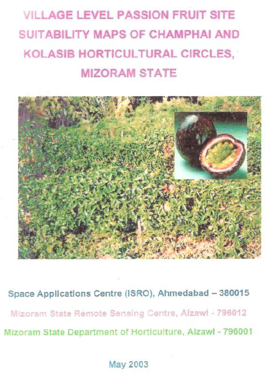
Village Level Passion Fruit Site Suitability Maps of Champhai and Kolasib Horticultural Circles, Mizoram State
The project “Village Level Passion Fruit Site Suitability Maps of Champhai and Kolasib Horticultural Circles, Mizoram State” was undertaken under the Technology Mission for Integrated Development of Horticulture in North Eastern States to operationalize earlier passion fruit suitability analysis at village scale. Its main objective was to generate detailed, village-level maps showing sites suitable for purple and yellow passion fruit within current jhum areas, and to prioritize these sites for phased orchard expansion based on biophysical and accessibility criteria.Focusing on Champhai (Khawzawl division) and Kolasib (Aizawl division) horticultural circles, the study translates remote sensing– and GIS-based suitability analysis into practical decision-support products for field implementation. Champhai, a high-elevation circle with 19 villages, already accounts for more than 80% of Mizoram’s passion fruit and grape area and is targeted for expansion of the indigenous purple variety. Kolasib, with 12 villages at comparatively lower elevation and gentler slopes, is earmarked for introducing the yellow variety, whose fruiting season complements that of the purple variety to enable near year-round supply.Methodologically, the project builds on IRS-1D LISS-III imagery and DEM-derived terrain layers (elevation, slope, aspect) used earlier to map current jhum and compute a passion fruit site suitability index. Current jhum areas were delineated using their distinct spectral signatures, and each jhum patch was characterized in terms of terrain parameters. The passion fruit suitability index, derived from agronomic package of practices and calibrated using existing orchards, was applied to identify suitable patches, which were then further stratified as Priority I and Priority II based on cluster size and proximity to settlements, roads, and drainage. All results were compiled into village-level maps and tables for both circles.Key outcomes show that in Champhai circle, a subset of the mapped current jhum (previously quantified at about 4,900–6,700 ha) is highly suitable for purple passion fruit, with approximately 600–630 ha identified as suitable and subdivided into higher-priority and secondary-priority clusters across villages such as Champhai–Tuipui, Selam–Lungphunlian, Hnahlan, and Mualkawi. In Kolasib circle, about 4,000 ha of current jhum were analyzed, and roughly one-third to half of this area was found suitable for yellow passion fruit, with prominent potential in villages such as Phainuam–Saiphai, Saikhawthlir–Bungthuam, Bairabi, Bilkhawthlir, and N. Thingdawl. These metrics confirm a significant, spatially clustered resource base for passion fruit-based horticultural expansion without further forest clearing.The project demonstrates that combining IRS LISS-III data, DEM-based terrain analysis, and GIS at village boundary level can produce actionable maps for crop-specific land-use planning in complex hill environments. The resulting village atlases of Priority I and II sites provide a concrete framework for targeting orchard expansion, extension, and infrastructure investments (roads, water, processing) under the Technology Mission. In doing so, the work offers a replicable model for using remote sensing and GIS to guide the transition of jhum lands into sustainable, high-value horticulture in Mizoram and similar regions.Summarized MetadataMapping Scale: 1:50,000Satellite data & Year: IRS 1D - LISS III & IRS WiFS (2002)Thematic sub-category: Horticulture Collaborating/Funding Agency: Ministry of Agriculture, Government of India; Space Application Centre (SAC), Ahmedabad; Horticulture Department, Govt. of MizoramReport Publication Month/Year: May, 2003
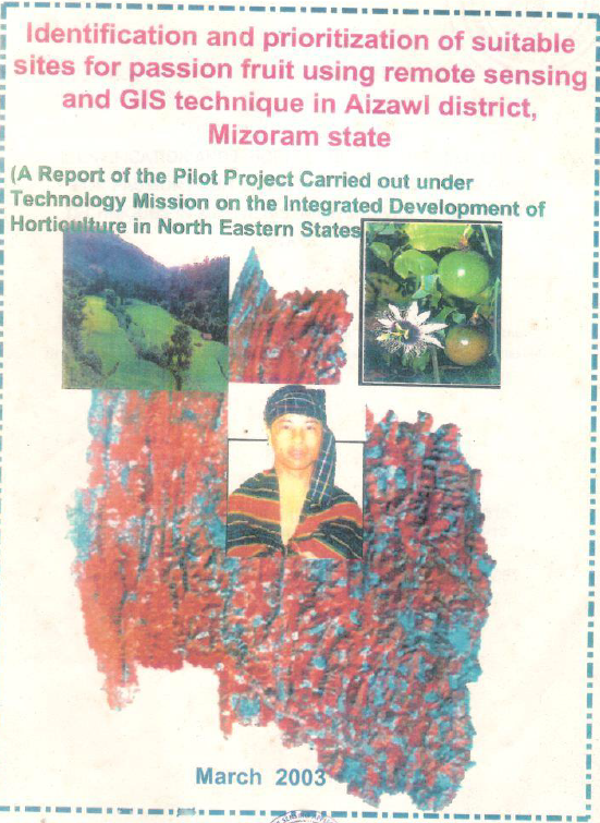
Identification and prioritization of suitable sites for passion fruit using Remote Sensing and GIS technique in Aizawl district, Mizoram state
The project “Identification and Prioritization of Suitable Sites for Passion Fruit using Remote Sensing and GIS Techniques in Aizawl District, Mizoram” was undertaken as a pilot initiative under the Technology Mission for Integrated Development of Horticulture in the North Eastern States, with the goal of transforming current jhum lands into sustainable, high-value horticulture. The main objectives were to (i) map current jhum areas in the undivided Aizawl district, (ii) characterize them using terrain and accessibility parameters, (iii) develop site suitability indices for purple and yellow passion fruit, and (iv) prioritize suitable sites for phased horticultural development at village level.The study focused on two contrasting horticultural circles. Champhai, in Khawzawl division, is a higher-elevation, steep terrain zone that already hosts most of Mizoram’s purple passion fruit and grape orchards. Kolasib, in Aizawl division, is relatively low-lying and gently sloping, dominated by arecanut and citrus, and was hypothesized to be suitable for yellow passion fruit. The wider context is a humid tropical hill state where about 70% of the population depends on agriculture, shifting cultivation remains widespread, and horticulture is a key strategy for livelihood enhancement and land degradation control.Methodologically, the project integrated multi-temporal satellite remote sensing with terrain modelling and GIS-based spatial analysis. Multi-date IRS WiFS imagery (December–May) was used to identify the optimal seasonal “window” for detecting current jhum, while IRS-1D LISS-III data (23 m, green/red/NIR bands) from April–May 2002 supported detailed mapping of fresh jhum clearings, which appear as distinctive low-vegetation spectral classes. Digital elevation models generated from topographic contours and spot heights were used to derive elevation, slope and aspect layers, which were then combined with village, road, drainage and soil information in a GIS. Ground truth data from ~15 existing passion fruit orchards in Champhai were used to calibrate and validate a passion fruit growing index.Key quantitative findings demonstrate both the scale of opportunity and the power of the methodology. Current jhum was mapped at about 6.29% of the district area, with circle-level values of roughly 5–8%, indicating substantial convertible land without further forest clearance. In Champhai, about 6,756 ha of current jhum were mapped. Terrain analysis showed that 77% of this area lies between ~900–1,500 m with slopes mostly below 20°. Applying the purple passion fruit suitability index identified roughly 634 ha (~9.4% of current jhum) as suitable, of which 234 ha were classed as Priority I (larger, contiguous clusters close to roads/settlements/water) and 400 ha as Priority II. In Kolasib, approximately 4,062 ha of current jhum were mapped, around 70% of which lies below 200 m with gentle slopes (<10°). Using a separate index for yellow passion fruit, about 1,951 ha (~48% of current jhum) were identified as suitable, with several villages showing individual suitable extents of 90–370 ha.The study provides three important insights. First, remote sensing and GIS can robustly capture the highly dynamic jhumscape at appropriate spatial and temporal scales, allowing frequent updates critical for planning. Second, site-specific suitability indices that combine terrain and management knowledge can distinguish realistic horticulture expansion zones within jhum, avoiding overly steep or inaccessible patches. Third, the village-level suitability maps and statistics create an operational decision-support tool. They allow horticulture departments and planners to target extension, credit, infrastructure and processing investments to identified clusters, support gradual transition from shifting to settled cultivation, and dovetail with broader land use and town planning. In particular, the identified passion fruit belts in Champhai (purple variety) and Kolasib (yellow variety) support the concept of a near year-round passion fruit supply chain, with implications for local agro-processing, road prioritization and market infrastructure in and around Aizawl and secondary towns.Summarized MetadataMapping Scale: 1:50,000Satellite data & Year: IRS 1D - LISS III & IRS WiFS (2002)Thematic sub-category: Horticulture Collaborating/Funding Agency: Ministry of Agriculture, Government of India; Space Application Centre (SAC), Ahmedabad; Horticulture Department, Govt. of MizoramReport Publication Month/Year: March, 2003
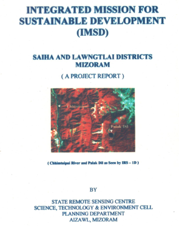
Integrated Mission for Sustainable Development (IMSD) – Saiha & Lawngtlai District, Mizoram
The report “Integrated Mission for Sustainable Development (IMSD) – Saiha and Lawngtlai Districts” presents a comprehensive geospatial assessment of natural resources and land-use conditions in the southern districts of Mizoram, undertaken to support integrated planning and sustainable development through the application of remote sensing and Geographic Information System (GIS) techniques. The study forms part of the IMSD programme framework, adapted and implemented at the state level to generate spatially explicit, multi-thematic datasets for decentralized planning. The project was executed by the Mizoram State Remote Sensing Application Centre (MIRSAC) with the objective of developing scientifically informed, location-specific action plans for resource management and livelihood enhancement.The primary objective of the study was to assess the spatial distribution and condition of natural resources across Saiha and Lawngtlai districts and to integrate these datasets with socio-economic information to guide sectoral development interventions. Satellite imagery was interpreted and analysed within a GIS environment to generate key thematic layers including land use and land cover, slope, soil characteristics, hydrogeomorphology, drainage network, groundwater potential zones, transportation network, and settlement distribution. These layers were subsequently integrated to evaluate land capability and identify constraints affecting agricultural productivity, soil stability, water availability, and overall environmental sustainability.The analysis reveals that a significant proportion of the study area is under forest cover and secondary vegetation associated with shifting cultivation practices, which remain the dominant land-use system in the region. Extensive areas of fallow land and degraded forest were identified, reflecting the impact of repeated jhum cycles and shortened fallow periods. Agricultural land occupies a relatively smaller proportion of the total area and is primarily confined to valley bottoms and gentle slopes where soil fertility and moisture availability are more favourable. The slope analysis indicates that much of the terrain falls within moderate to steep slope categories, highlighting the inherent vulnerability of the landscape to soil erosion and land degradation.Hydrogeomorphological assessment suggests that groundwater potential in the districts is generally low to moderate due to steep terrain and high surface runoff; however, localized zones such as valley fills, weathered rock formations, and structural depressions were identified as suitable for groundwater recharge and water resource development. The integration of thematic layers enabled the delineation of erosion-prone areas and resource-deficient zones requiring priority intervention.Based on the integrated analysis, the study proposes a set of targeted action plans aimed at improving land productivity and environmental sustainability. Recommended interventions include afforestation and regeneration of degraded forest lands, promotion of horticulture and agroforestry in suitable upland areas, soil and water conservation measures such as contour trenching and vegetative barriers, development of fodder resources, and construction of water harvesting structures to enhance groundwater recharge and support irrigation. These interventions were prioritized based on land capability, slope stability, and proximity to settlements to ensure practical implementation and maximum socio-economic benefit.Overall, the study demonstrates the effectiveness of integrating Remote sensing, GIS, and field-based information in developing actionable, watershed-based development plans for ecologically fragile hill regions. The project provides a comprehensive spatial database and decision-support framework that can guide sustainable management of land, water, and forest resources in Saiha and Lawngtlai districts. Summarized MetadataMapping Scale: 1:50,000Satellite data & Year: IRS 1D, 1994-1995Thematic sub-category: Land & Water, Geology, Spatial PlanningCollaborating/Funding Agency: Government of MizoramReport Publication Month/Year: November, 2002
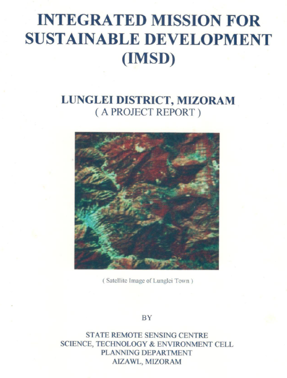
Integrated Mission for Sustainable Development (IMSD) –Lunglei District, Mizoram
The report “Integrated Mission for Sustainable Development (IMSD) – Lunglei District” represents a continuation and expansion of the Integrated Mission for Sustainable Development initiative within Lunglei District, Mizoram, undertaken to support systematic natural resource planning through the integration of remote sensing, GIS analysis, and field-based surveys. Unlike earlier phases of the IMSD programme that were implemented under the Department of Space with technical support from national remote sensing institutions, this phase of the project was undertaken with funding support from the Government of Mizoram, reflecting the state government’s recognition of the importance of geospatial information for decentralized planning and sustainable resource management. The study was implemented by the Mizoram State Remote Sensing Application Centre (MIRSAC) as part of its mandate to develop spatial databases and decision-support tools for district-level planning. The principal objective of the project was to generate an updated and integrated assessment of natural resources in Lunglei District and to develop actionable development plans based on scientific evaluation of land capability and environmental constraints. The study sought to build upon earlier IMSD datasets by refining thematic information and extending the analysis to additional areas within the district. To achieve this objective, satellite remote sensing data were interpreted and processed within a GIS environment to generate a comprehensive suite of thematic layers describing the physical and environmental characteristics of the landscape. These included land use and land cover, slope and terrain characteristics, soil resources, hydrogeomorphology, drainage patterns, groundwater prospects, transportation networks, and settlement distribution. These spatial datasets were subsequently integrated with socio-economic and meteorological information to support multi-sectoral planning and to identify priority zones for development interventions. Analysis of the land use and land cover data indicates that forest vegetation and secondary regrowth associated with shifting cultivation continue to dominate the landscape of Lunglei District. Large tracts of land are occupied by regenerating fallow areas reflecting the prevalence of jhum cultivation practices in the region. Agricultural land occupies a relatively small proportion of the district and is mainly confined to valley floors and gently sloping terrain where soil depth, moisture availability, and accessibility are more favourable for cultivation. The spatial distribution of degraded forest and fallow lands identified in the study highlights the ecological pressures associated with shortened jhum cycles and increasing land-use intensity.Slope and terrain analysis reveal that the district is characterized predominantly by moderate to steep slopes, a geomorphological condition typical of the hill ranges of Mizoram. Such terrain conditions increase vulnerability to soil erosion and land degradation, particularly where vegetation cover has been removed for cultivation. Hydrogeomorphological assessment indicates that groundwater potential across much of the district remains generally low to moderate because of steep slopes and rapid runoff characteristics. However, certain geomorphic features such as valley fills, structural depressions, and weathered zones were identified as favourable locations for groundwater recharge and localized water resource development. Based on the integrated evaluation of natural resource parameters, the project developed a series of location-specific action plans aimed at improving environmental sustainability and enhancing rural livelihoods. Recommended interventions include afforestation and regeneration of degraded forest lands, promotion of horticultural and agroforestry practices on suitable slopes, soil and water conservation measures such as contour bunding and vegetative barriers, development of fodder resources, and the construction of water harvesting structures to enhance groundwater recharge and support irrigation in agricultural areas. The prioritization of these interventions was guided by land capability, slope stability, soil characteristics, and proximity to settlements in order to maximize both ecological benefits and socio-economic impact.Overall, the study demonstrates the continued relevance of the IMSD framework as a practical approach for integrated watershed and land resource planning in mountainous regions. By updating spatial datasets and refining development strategies for Lunglei District, the project provides a valuable decision-support tool for government departments and local planning authorities engaged in sustainable land, water, and forest resource management in Mizoram.Summarized MetadataMapping Scale: 1:50,000Satellite data & Year: IRS 1D, 1994-1995Thematic sub-category: Land & Water, Spatial Planning Collaborating/Funding Agency: Government of MizoramReport Publication Month/Year: March, 2002
Wasteland Mapping of Aizawl District, Mizoram
The Wasteland Mapping Project for Aizawl district was undertaken as part of the nationwide Phase V programme initiated by the National Remote Sensing Agency (NRSA), Department of Space, Government of India, during 1997–99. The project aimed to generate a systematic spatial database on wasteland distribution to support scientific planning for land resource development and ecological restoration. In Mizoram, the study was carried out by the Mizoram Remote Sensing Application Centre under the Science, Technology & Environment Cell, Planning Department, in coordination with NRSA, Hyderabad.The primary objective of this district-level study was to identify, delineate, and quantify wasteland categories within Aizawl district using satellite remote sensing techniques. The analysis was based on visual interpretation of IRS-1B LISS-II geocoded False Colour Composites (FCCs) acquired in 1995 at a scale of 1:50,000, supplemented by ground truth verification, Survey of India topographical sheets, and ancillary data. This approach enabled accurate mapping of degradation amid steep slopes (>50° dominant), high rainfall (2,802 mm annual average), and Surma Group geology prone to erosion.The study identified shifting cultivation (jhum) as the dominant wasteland category, comprising current jhum (743.52 sq km; 5.91% of district area) and abandoned jhum/scrub (1,684.37 sq km; 13.38%) alongside degraded notified forest land (193.05 sq km; 1.53%; e.g., Dampa Wildlife Sanctuary). Total wastelands spanned 2,620.94 sq km (20.82%), with hotspots in topo sheets 84E8 (33.48%), 84A5 (26.64%), and watersheds like 3D1B6b (36.65%). These reflect jhum-driven erosion, nutrient depletion, and forest conversion in hilly terrain.The project generated detailed thematic maps, watershed-wise statistics, and a digital vector database, providing a baseline for land degradation dynamics and priority interventions.A key component was site-specific reclamation strategies tailored to slope, soil (pH 4-6.5, loamy skeletal), and location: silvipasture (e.g., Ficus hirta, Stylosanthes spp.) on hilltops; sericulture (Morus indica); silviculture (Tectona grandis); horticulture (Citrus spp., Musa spp.); agro-horticulture with Sloping Agricultural Land Technology (SALT); and wetland rice via irrigation. The findings offer policymakers and agencies a geospatial framework for sustainable development, optimizing resources and mitigating jhum impacts in Aizawl district.Summarized MetadataMapping Scale: 1:50,000Satellite data & Year: IRS 1B (1995)Thematic sub-category: Wasteland, Spatial Planning Collaborating/Funding Agency: National Remote Sensing Centre (NRSC), HyderabadReport Publication Month/Year: July, 1999